Utilisation information in public transport: Timely and reliable data enables more efficient use of public transport.
Promoting sustainable mobility: less overcrowding leads to more pleasant journeys.
Focal points: User acceptance, digital passenger guidance, integration into existing systems
Local public transport plays a crucial role in sustainable mobility. However, overcrowding can occur, especially at peak times, which can affect the comfort and safety of passengers. In the SAFIRA project (Safety and Distance through Passenger Guidance based on Information and Occupancy Data), which was completed at the end of February, the German Aerospace Center (DLR) developed digital technologies that enable travellers to plan better. SAFIRA used real-time and forecast data on vehicle utilisation to optimise passenger routing and make public transport more attractive. The project was concluded with a three-month pilot test in the Berlin-Brandenburg area.
How did the SAFIRA pilot test work?
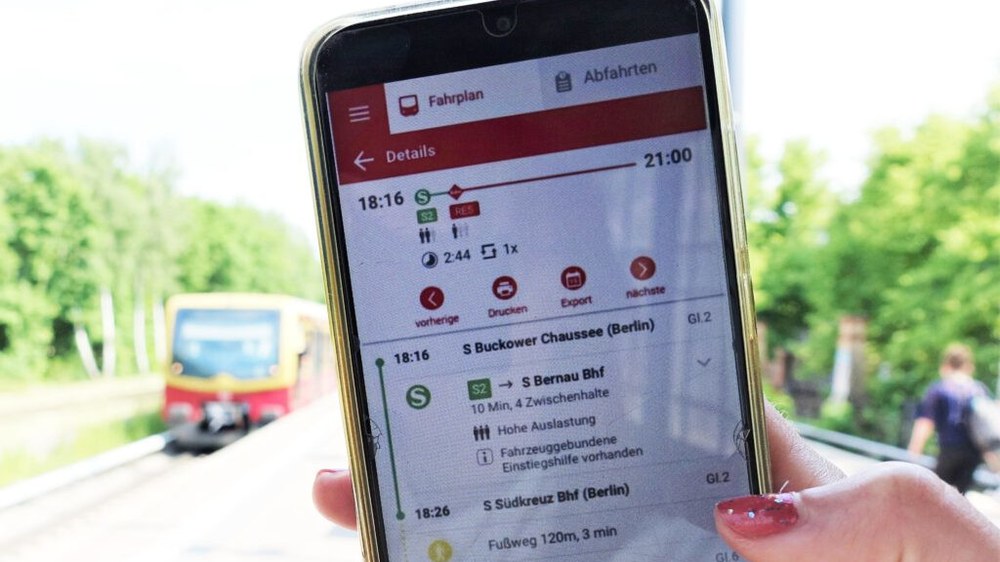
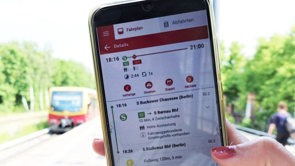
To test the effectiveness of the digital capacity utilisation information, 38 test subjects used a specially developed app to plan their public transport journeys. The app displayed the predicted capacity utilisation of the means of transport before the start of the journey so that users could consciously choose less frequented connections.
As part of the pilot test, the project team analysed the following:
How the provision of capacity utilisation information in advance of the journey influences route selection
How useful the capacity utilisation information is perceived to be
Which type of utilisation information (utilisation at the time of boarding vs. utilisation averaged over the entire journey) is preferred
How capacity utilisation information affects travel satisfaction
The insights gained were incorporated into the further development of the technology. The aim was to create a reliable and human-centred solution that can be integrated into existing information apps in the future.
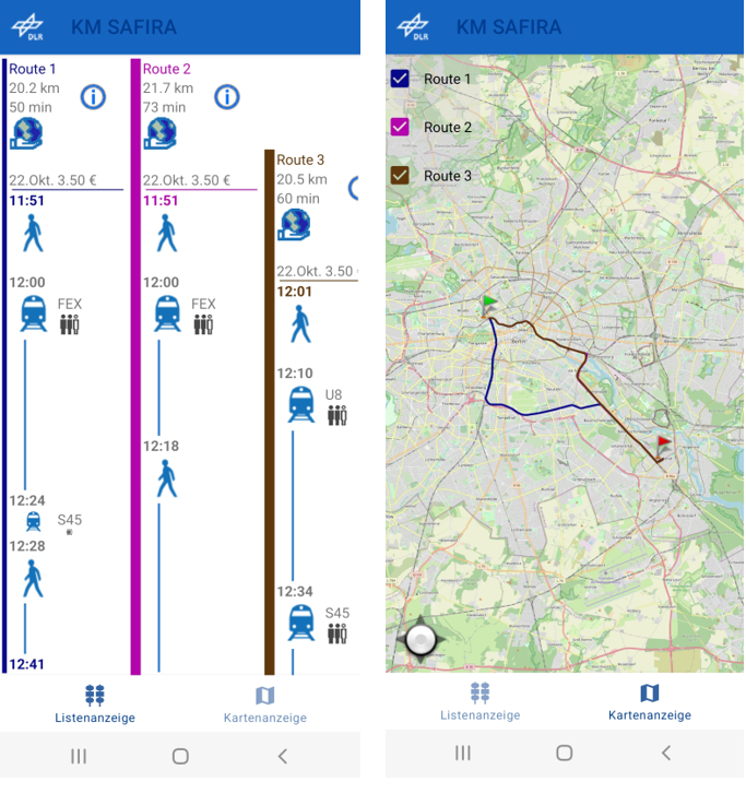
Insight into the SAFIRA app and the travel options presented.
In total, test users completed over 800 journeys with the app during the test period. It was found that the load information at the time of boarding was particularly useful. The influence of capacity utilisation on individual route selection was rated as moderate. Interestingly, the researchers found that the general assessment of the usefulness of the load factor information increased over the course of the test operation. This indicates that passengers are adapting to the information and that it is better accepted over time. The extent to which this has an effect on the route selection of the test persons still needs to be analysed in the future.
Potential of the project: More transparency, better user experience
The introduction of intelligent passenger information systems, such as those developed in SAFIRA, could sustainably optimise public transport. Precise capacity utilisation forecasts enable informed travel planning, reduce overcrowding and increase comfort and safety. Transport companies benefit from a more even distribution of passengers, allowing existing capacities to be utilised more efficiently.
Outlook
The completion of the pilot phase also marks the end of the SAFIRA project. The knowledge gained should help to integrate reliable and user-tailored capacity utilisation information into existing passenger information systems. The next step will be taken by the Berlin-Brandenburg Transport Association (VBB), which plans to include capacity utilisation information in its passenger app from summer 2025. In the long term, the knowledge gained in SAFIRA could help to make public transport more flexible. A nationwide introduction or adaptation in other regions are realistic options.


