Test Bed Lower Saxony – basic service
Research into automated driving systems requires a wide variety of components within a test field – from digital maps to traffic management interfaces.
The central components of the Test Bed Lower Saxony
The Test Bed Lower Saxony enables high-precision data acquisition and processing as well as evaluation of traffic situations, which are used in a targeted manner to improve road safety and develop new driver assistance systems.
The main focus of the test field is the recording technology with almost 300 camera systems on selected stretches of road and the testing of Car2X communication via integrated communications technologies.
In addition, other core components play an important role:
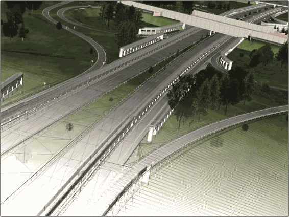
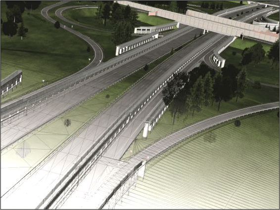
HD Maps – highly accurate maps
High-precision digital maps (HD Maps – High-Definition Maps) are an essential component for testing automated vehicles that communicate with each other. They contain important topographical information on traffic infrastructure, buildings or roads and serve as a reference for the research vehicles in the test field.
General data
- Areas of application: motorway and rural road sections A2, A39, A391, L295
- Recorded elements: road layouts, lane alignments, lane markings, crash barriers, posts, traffic signs, etc.
- Accuracy: max. relative deviation of five centimetres, max. absolute deviation of 20 centimetres
- Available formats: OpenDRIVE, Road2Simulation


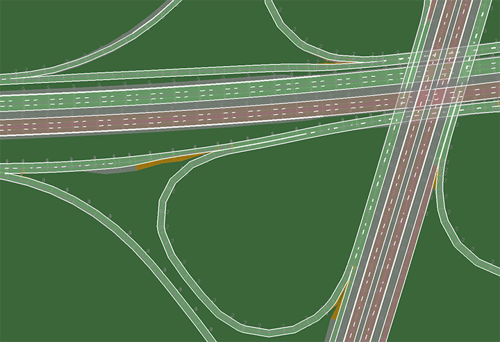
Scenarios and models
A wide variety of relevant scenarios and models serve as a basis for simulation-based investigations of vehicles or vehicle components. Among other things, these scenarios consist of special traffic densities and driving situations. Route guidance and environment models that describe the behaviour of road users in the test field are also available for simulations.
General data
- Recorded elements: 3D route based on HD Maps
- Modelled landmarks: Motorway bridges, test field masts, solar park near Schandelah, etc.
- Scenario database: typical events, including road works, accidents, traffic jams, deer crossings, heavy goods transport, overtaking, on and off-ramp manoeuvres
- Available formats: OpenDRIVE, openSCENARIO
- Users can comprehensively simulate traffic situations for the open-source software platform SUMO
- FMI interface (functional mock-up interface) for integration of external sensor models
- Idealised sensors (error-free, neglecting physical properties)
VMZ – interface to the Traffic Management Centre
For optimal testing of automated and networked vehicles, we have an additional interface to the Lower Saxony Traffic Management Centre (Verkehrsmanagementzentrale Niedersachsen; VMZ). The VMZ processes a large amount of traffic data and makes it available to the public. This data processing includes current traffic situations and an overview of existing and future roadworks.
The services provided or additional information on the traffic situation can be transmitted to the research vehicles. This is done via the communications technologies in the test field.
General data
- Recorded elements: Construction site data, incident information (for example, accidents)
- Transmission of data: Car2X or V2X communication
- Display of live data:
- of the route control system Hanover-Braunschweig-Salzgitter
- network control with dynamic route guidance and integrated congestion information (dWiSta)
- lane-related measurement loops in large areas of the test field

Property registry data
The property registry of the Test Bed Lower Saxony maintains important status information on the traffic infrastructure and surroundings. This includes data on:
- Construction sites
- Weather conditions
- Variable message signs
- Road and crash barrier condition
Any anomalies and errors can thus be included in the planning and evaluation of the tests.
General data
- Area of application: throughout the test field
- Elements recorded: general weather data, traffic infrastructure, road and crash barrier condition
- Stationary weather station with measurement technology on the A39 to record:
- Surface temperature
- Water film thickness on the road surface
- Current visibility
- Mobile sensor with a detection rate of 40 Hz (non-contact measurement of road surface temperature and data on road surface wetness)
- Access to traffic inventory and live data from the Test Bed Lower Saxony

Funding and cooperation
Operation of the test field involves close cooperation with the state of Lower Saxony and various partners from industry. The construction was financed with funds from the European Regional Development Fund (ERDF), among others. In addition, we have an interface with the Lower Saxony Traffic Management Centre (VMZ).
FAQ – Frequently asked questions about basic services in the Test Bed Lower Saxony
Can the collected and provided data be used for our own tests?
We make all DLR data and systems available to external partners and customers for their own tests. Please contact us for further information or send us a booking request.
Is personal data from the test field stored?
Data protection is very important to us. Our sensor and camera systems do not store any personal data (number plates, faces).