Road2Simulation

Digital and highly accurate map data has become indispensable for the development and evaluation of modern driver assistance and automation systems. They are used both as input in the simulation for acceptance and safety tests and as additional knowledge on board the vehicles.
Special description formats are used in the simulation, which enable very precise modelling of the environment. However, collecting real data and converting it into the simulation formats can quickly become very time-consuming. Digital cadastral data that has already been collected usually contains little information that simplifies conversion into the simulator formats.
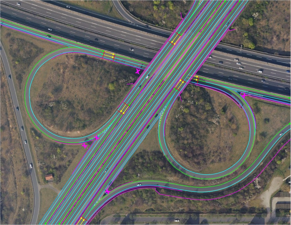
In order to reduce the effort involved in surveying routes and converting cadastral data into simulation formats, a guideline for the standardised collection of road and surface data was created in the "Road2Simulation" project. The basic idea of the guideline is a simplified survey by an external service provider and an automated data transformation by the end user. Data conversion is to be made possible with the help of a defined but simple intermediate format, as this format contains all the essential detailed information. The intermediate format was aligned with the OpenDRIVE® road description format and the OpenCRG® surface description format, but does not require any knowledge of the description formats.

The guidelines are based on so-called polylines with a heterogeneous point density of the measuring points in order to model the course of the road. Lanes, markings, boundaries and other linear objects form the main framework. In addition, there are point coordinates that describe road infrastructure elements such as signage, traffic lights, special road markings and street furniture. The elements are provided with attribute information. Important information is their logical affiliation to the other elements, but information about their type and appearance is also stored.
The guideline will be used for emerging test fields and corresponding projects in which highly accurate data in different formats is required for testing automated driving functions. The guide will therefore be expanded to include requirements for other formats such as the Navigation Data Standard. The guideline is freely available.
The work is based on the DLR research project "Virtual World" in connection with the Application Platform for Intelligent Mobility (AIM). The creation of the guide was made possible by Audi, BMW, Daimler, Porsche, Volkswagen and DLR.

Project title:
Road2Simulation
Duration:
04/2015 to 12/2016
Contracting authority:
Audi, BMW, Daimler, Porsche, Volkswagen
Project participants:
DLR
HLRS (High Performance Computing Center Stuttgart)
