
Real-World Marine Radar Datasets for Target Tracking
Dataset 1: Raw Radar & AIS Data in Port Scenario
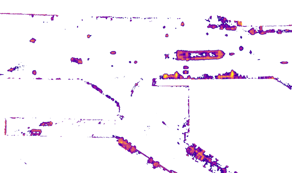
Selected multi-station X-band radar dataset recorded in a challenging port environment. The data contain the radar backscatter observations in polar coordinates from 13 partially overlapping maritime radar stations, stored as hourly UTC chunks, together with anonymized AIS-derived vessel position reports aligned to the same chunking scheme. The dataset is accompanied by the companion software, which provides a local-cache-based access layer and utilities for working with the data files. Radar measurements are stored in HDF5 files. Each file contains polar-coordinate radar cells defined by their corner coordinates and an associated amplitude value. Time is recorded as UTC time-of-day (TOD) timestamps, and rotation segmentation is provided via cycle groupings. AIS data is provided per station and per hour as anonymized vessel position reports in the same station-local polar coordinate convention. Station positions are provided as relative (x, y)-coordinates, rounded to 10 m accuracy.
The data with the links to the accompanying software and the details of usage can be found here.

Related Publications
Moreira, L.P., Romanovas, M. and Meinert, N. (2026) “On Background Subtraction for Target Tracking in Complex Multi-Radar Marine Data Set”. 6th European Workshop on Maritime Systems Resilience and Security (MARESEC 2026), Bremerhaven, Germany.
Dataset 2: Radar Images & AIS Data
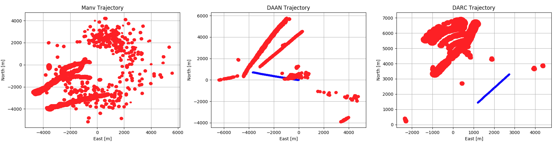
Selected datasets for extended and multiple extended target tracking from our measurement campaigns can be now downloaded. The measurements, in form of point clouds, are results of running a blob detection algorithm on radar images captured through the campaign. Together with the radar images, AIS (Automatic Identification System) data has also been provided as reference (ground truth) for each target where available.

The datasets are a result of an intensive cooperation with Prof. Marcus Baum, leader of the Data Fusion Group at the Institute of Computer Science, Georg-August Universität Göttingen (https://www.fusion.informatik.uni-goettingen.de).
The three datasets are available as zip-files, each file contains
- the extracted measurements (detections) in both polar and (ENU) Cartesian coordinates in JSON format,
- the post-processed radar images used to extract the measurements,
- a sample demonstration code (in Python) loading the measurements, and
- an AIS-based ground truth.
If you want to obtain access, please do not hesitate to send a request via our contact form - select category "Download Marine Radar Datasets"
As the data-set is under export control: To be able to decide on the data-transmission we would be grateful if you could tell us what will be done with the dataset and who will be the final recipient (in which country). For taking a decision the respective department at DLR probably needs to know the final aim of your work, whether it produces dual goods or similar research / technology. Also, it also needs to know the final recipients of the any possible products of your work.
If you are enrolled with a university please also send your enrolment certificate.
License and data protection agreements as per DLR’s provision
Related Publications
Fowdur, Jaya Shradha and Baum, Marcus and Heymann, Frank (2019) A Marine Radar Dataset for Multiple Extended Target Tracking. 1st Maritime Situational Awareness Workshop (MSAW 2019), 08 Oct - 10 Oct 2019, Lerici (La Spezia), Italy.
Fowdur, Jaya Shradha and Baum, Marcus and Heymann, Frank (2019) Tracking Targets with Known Spatial Extent using Experimental Marine Radar Data. 22nd International Conference on Information Fusion (FUSION 2019), Ottawa, Canada.