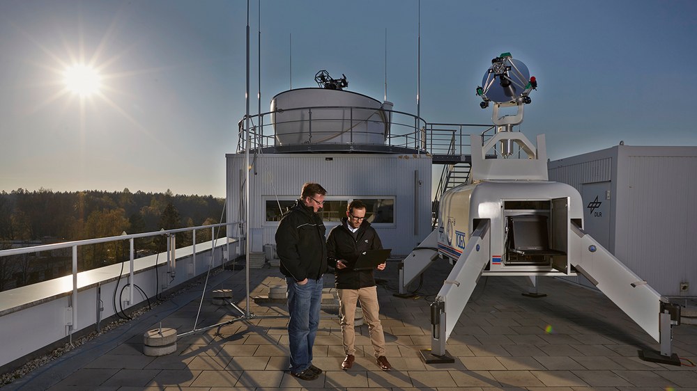
Transportable Optical Ground Station TOGS
The transportable optical ground station is a versatile and modular instrument that can be used for a variety of experimental optical uplink and downlink scenarios as well as for measuring the atmospheric optical channel. It was developed and built at the Institute in 2010 and 2011. A key goal was to have a lightweight but stable construction that could be easily transported on the one hand, but on the other hand offered the necessary rigidity to meet the precision requirements of free-space optical communication.
The heart of the TOGS is a 60cm Ritchie-Chrétien telescope made of aluminium, which can be extended to a height of 3.5m on a fold-out mast construction. A special requirement for the design of the telescope was to maximise the diameter of the primary mirror while minimising the overall length. A special Ritchie-Chrétien design was developed for this purpose. To protect the telescope from dirt and shocks, it can be stowed in a carbon fibre housing that is mounted in a vibration-decoupled manner.
A key requirement for the operation of the TOGS is rapid commissioning and thus the rapid determination of position and attitude, as required for alignment with a known target. A system of satellite navigation receivers and attitude sensors is used for this purpose. In addition, a laser reflector with GPS position determination was developed, with the help of which the TOGS can be quickly and precisely calibrated.
Application scenarios for the transportable optical ground station include data links with aircraft, UAVs and satellites as communication partners. For example, the station was successfully used in the DoD-fast project for a downlink from a fast-flying aircraft at Mach 0.7.
Another concrete application is its use as a receiving station for data links from flying surveillance platforms, such as those used in disaster situations. In this way, images from reconnaissance aircraft can be transmitted directly to the area of operation of rescue forces by means of optical links. Such real-time information provides an essential basis for the coordination of emergency forces.
The system can also be used to identify and characterise possible installation sites for fixed ground stations.

