Location and Landscape Structure
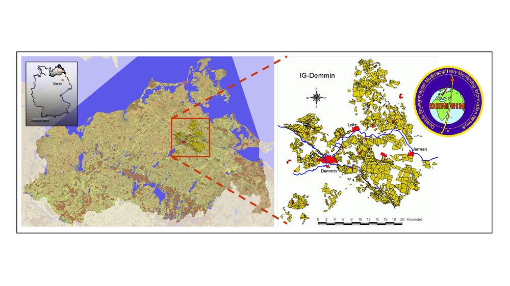
The DEMMIN test site is biologically, geologically, physically and geographically heterogeneous. Intensively used for agriculture, the area is located some 180 km north of Berlin in the north-eastern German state of Mecklenburg-Western Pomerania. It extends from 54°2′54.29″ north, 12°52′17.98″ east to 53°45′40.42″ north, 13°27′49.45″ east. The Demmin Network, an association of farmers in the region, cultivates about 30,000 ha of this land (Fig. 1).
The current surface features of the Mecklenburg-Western Pomeranian Young Drift landscape is in most cases the result of glacial transformation (Bülow, 1952; Hurtig, 1957). While Bülow (1952) still subdivides Mecklenburg-Western Pomerania into three landscape zones (1. northern coast, 2. ridges and lake district, 3. outwash plains), Hurtig (1957) takes weather climatology and the geological origins of Mecklenburg-Western Pomerania into account, thereby distinguishing six landscape zones. By additionally considering the landscape structure, Rabius and Holz (1993) break down these subdivisions even further.
According to Hurtig’s coarse subdivisions (1957), the test site is in the gently rolling northern Mecklenburg clay plains with their marshy lowlands. Billwitz (1997) assigns the test site area to the zone of north-eastern plains and valley networks. The DEMMIN test site extends biogeophysically over two landscape zones. The border can be imagined by drawing a diagonal line from Deyelsdorf (northwest) toward Friedland (southeast) along the Trebel und Tollense tributaries of the Peene river (cf. Grundlagendaten-IWU, 1995; Müller, Karl, 2002).
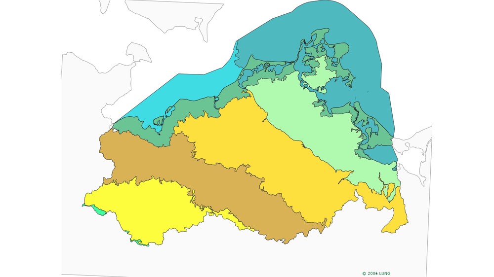
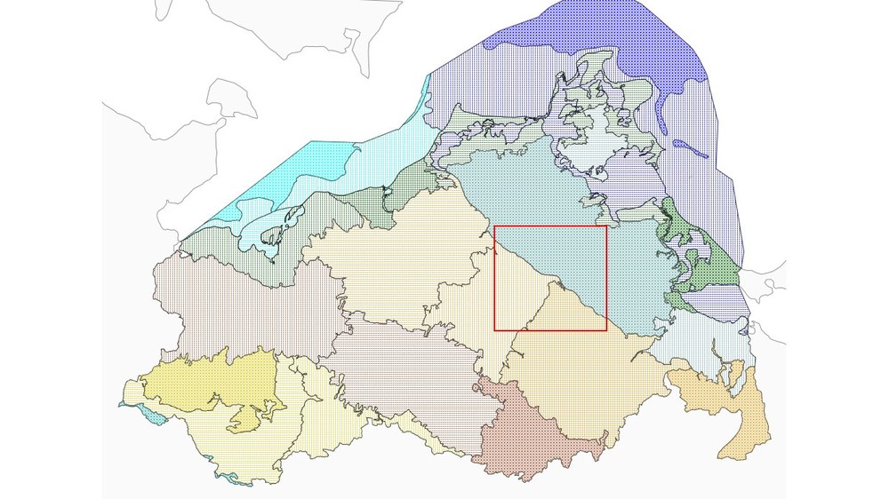
The north-eastern part of the test site is in the “Western Pomeranian Lowlands” landscape zone (Fig. 2), in its “Western Pomeranian Clay Plains” subzone. The Western Pomeranian Clay Plains comprise the landscape units “Clay Plains North of the Peene”, “Clay Plains South of the Peene”, and thirdly the meltwater valley marking the historic border between Mecklenburg and Western Pomerania, along with the Peene valley (Fig. 3).
The south-western part of the test site is in the “Hilly Region of the Mecklenburg Lake District” landscape zone, which is divided into the subzones “Upper Peene Area” in the northwest and the “Upper Tollense Area” in the southeast (Fig. 2). The “Upper Peene Area” subzone is further subdivided into the landscape units “Hilly Peene Area and Mecklenburg Switzerland” and “Teterow and Malchin Basins”. The subzone “Upper Tollense Area is comprised of the landscape unit “Hilly Tollense Area with River Islands (Fig. 3).
Literature
Billwitz, K. (1997). Die Naturraumausstattung von Mecklenburg-Vorpommern vor dem Hintergrund der LAUTENSACHschen Formwandellehre.- Greifswalder Geographische Arbeiten (14).- S. 7-18.
Bülow von, K. (1952): Abriss der Geologie von Mecklenburg.- VEB Verlag Volk und Wissen, Berlin.
Hurtig, T. (1957): Physische Geographie von Mecklenburg.- VEB Deutscher Verlag der Wissenschaften, Berlin.
IWU / Ingenieurbüro Wasser und Umwelt (1995): Landesweite Analyse und Bewertung der Landschaftspotentiale in Mecklenburg Vorpommern (Gutachten im Auftrag des Ministeriums für Landwirtschaft und Naturschutz; 1995)
Müller, D., Karl, H. (2002): Naturräumliche Gliederung von Mecklenburg-Vorpommern im Maßstab 1 : 250.000 (Gutachten im Auftrag des Ministeriums für Landwirtschaft und Naturschutz, 1996).- Aktualisierung.- S. 3.-
Rabius, E.W., Holz, R. (1993): Naturschutz in Mecklenburg-Vorpommern.- Demmler, Schwerin.


