
HydroSHEDS-X

HydroSHEDS-X is an international collaborative project between the German Aerospace Center (DLR), McGill University in Montreal, Confluvio Consulting, and World Wildlife Fund (WWF). It is also the name of a new version of the HydroSHEDS database. It provides digital hydrographic information that can be applied in Geographic Information Systems (GIS) or hydrological models at multiple scales, from local to global. Its various data layers form the basis for applications in a wide range of disciplines including environmental, conservation, socioeconomic, human health, and sustainability studies.
The first version of HydroSHEDS was introduced in 2008 by the Conservation Science Program of the WWF, the McGill University Montreal and other partners. It was derived from the Shuttle Radar Topography Mission (SRTM) and filled with elevation data of lower quality and at a coarser resolution above 60° north to achieve a final pixel resolution of 1x1 arcseconds (~30 m).
The new version HydroSHEDS-X is currently derived from the TanDEM-X data set (TerraSAR-X add-on for Digital Elevation Measurement). TanDEM-X offers a homogeneous global DEM at 0.4 arc-second resolution (~12 m grid cell size). This high-resolution DEM is used to create a pre-processed hydrologically conditioned DEM at 1 arc-second resolution. In a second step, refined hydrological optimization procedures are applied to derive drainage pathways with the same format and resolution as the established HydroSHEDS product, but with improved quality and full global coverage including the Arctic region.

The hydrologically pre-conditioned elevation data set at 1 arc-second resolution is created from the original 12 m resolution DEM and comprises
- void and gap filling,
- smoothing of noisy areas,
- provision of an open water mask,
- reduction of distortions caused by vegetation cover and settlement areas,
- coastline delineation and
- replacement of frozen and open sea areas with geoidal undulations.
Duration: 2020 - ongoing
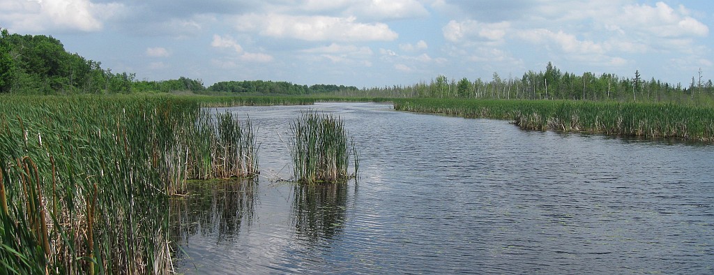
The photo of the Mer Bleu wetland in Ontario, Canada was kindly provided by Achim Roth, DLR-DFD