
New DFD Land Use and Land Cover Map for Germany

The physical and biological surface cover of the ground and the way people use the land are important for many other land surface related parameters. Scientists at the DFD work on methods for the automated derivation of land use and land cover information from multispectral satellite image time series. A detailed depiction of the land use and land cover distribution in Germany has now been created. In future this kind of information should be derived at regular intervals to answer important questions about long-term land use trend in the context of global environmental change.
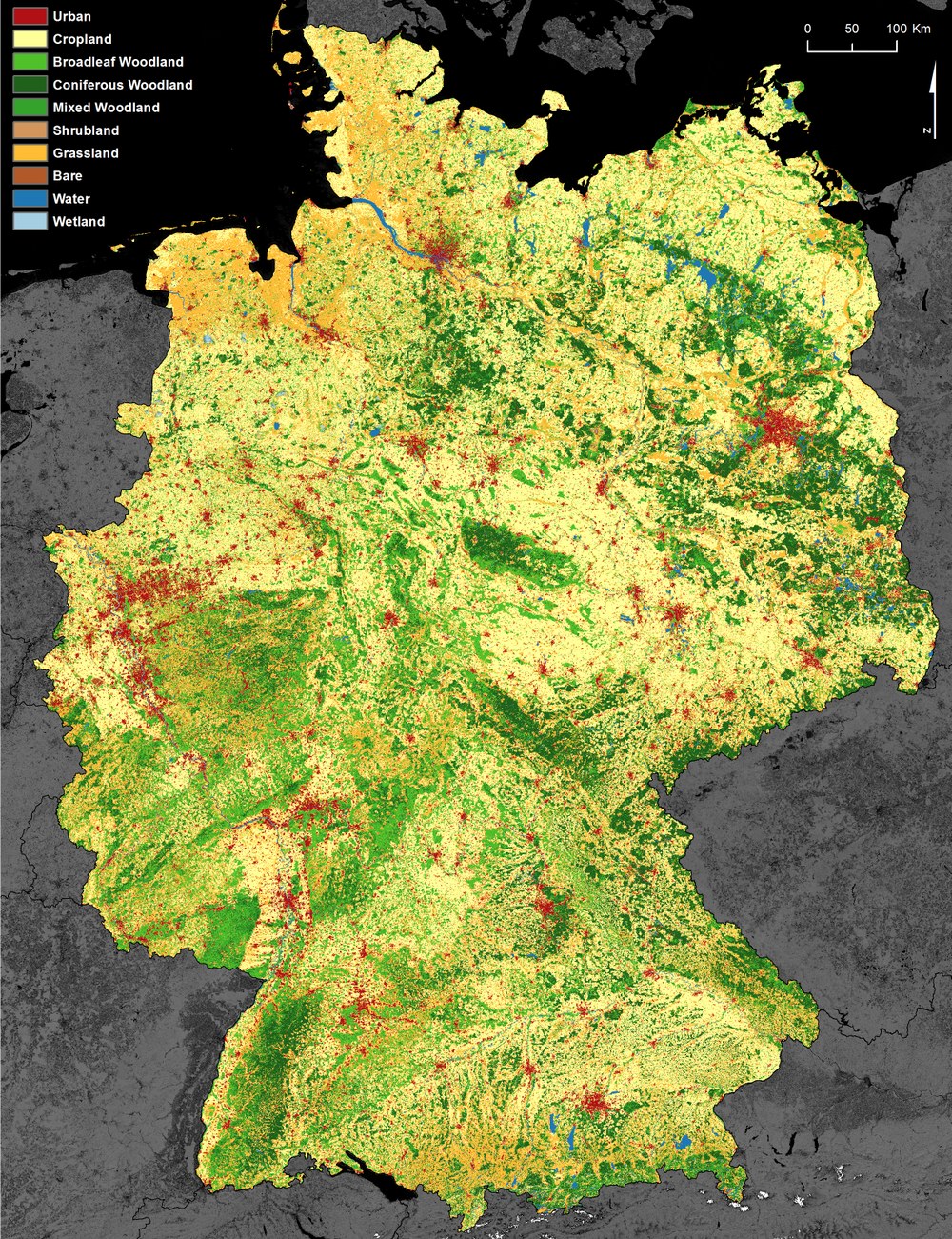
Scientists have developed a new land use and land cover map for Germany at high spatial resolution, forming the initial basis for a long year serial of such maps. The product was generated from all available Landsat-7 and Landat-8 observations acquired within the year 2014. The usage of time series not only solves the problem of data gabs related to clouds, but also allows exploiting specific temporal pattern in the data that can be attributed for example to seasonal vegetation dynamics or different land use types. To cover the federal territory of Germany a total of 768 Landsat acquisitions were obtained. On the basis of these acquisitions a total of 54 multi-temporal features were generated for each pixel as input for the classification.
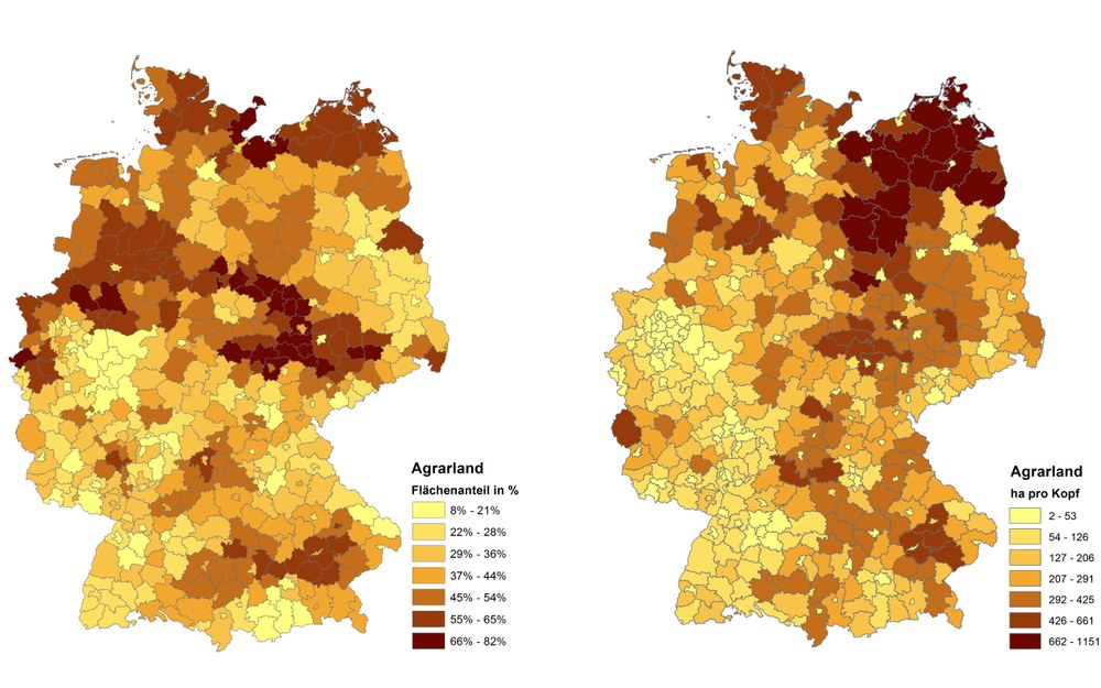
The land use and land cover map, DFD-LULC_DE 2014, builds the basis for the derivation of detailed statistics, for example on the proportion of cropland at district level that can be further combined with other statistical parameters. The largest proportions of cropland reaching maximum values of up to 80% of the total district area can be found in the fertile regions of the Magdeburger Börde, Thüringer Becken, or Leipziger Tiefland, as well as in the old federal states, especially Schleswig Holstein, Lower Saxony and North Rhine-Westphalia. However, when taking the population distribution into account the cropland distribution shows a rather different pattern. The largest cropland shares of up to 1000 ha per capita are particularly concentrated in the sparsely populated districts of Mecklenburg-Vorpommern and the northern districts of Saxony-Anhalt and Brandenburg.
To make valid statements about the spatiotemporal patterns of land use and land cover in Germany and other regions of the world, it is envisaged to derive this kind of land cover and land use information also for past and future years. Only the use of time series information over several decades allows us to answer the most pressing questions in the context of global environmental change, such as on important land use and land cover trends as a result from changes in climate or our society.