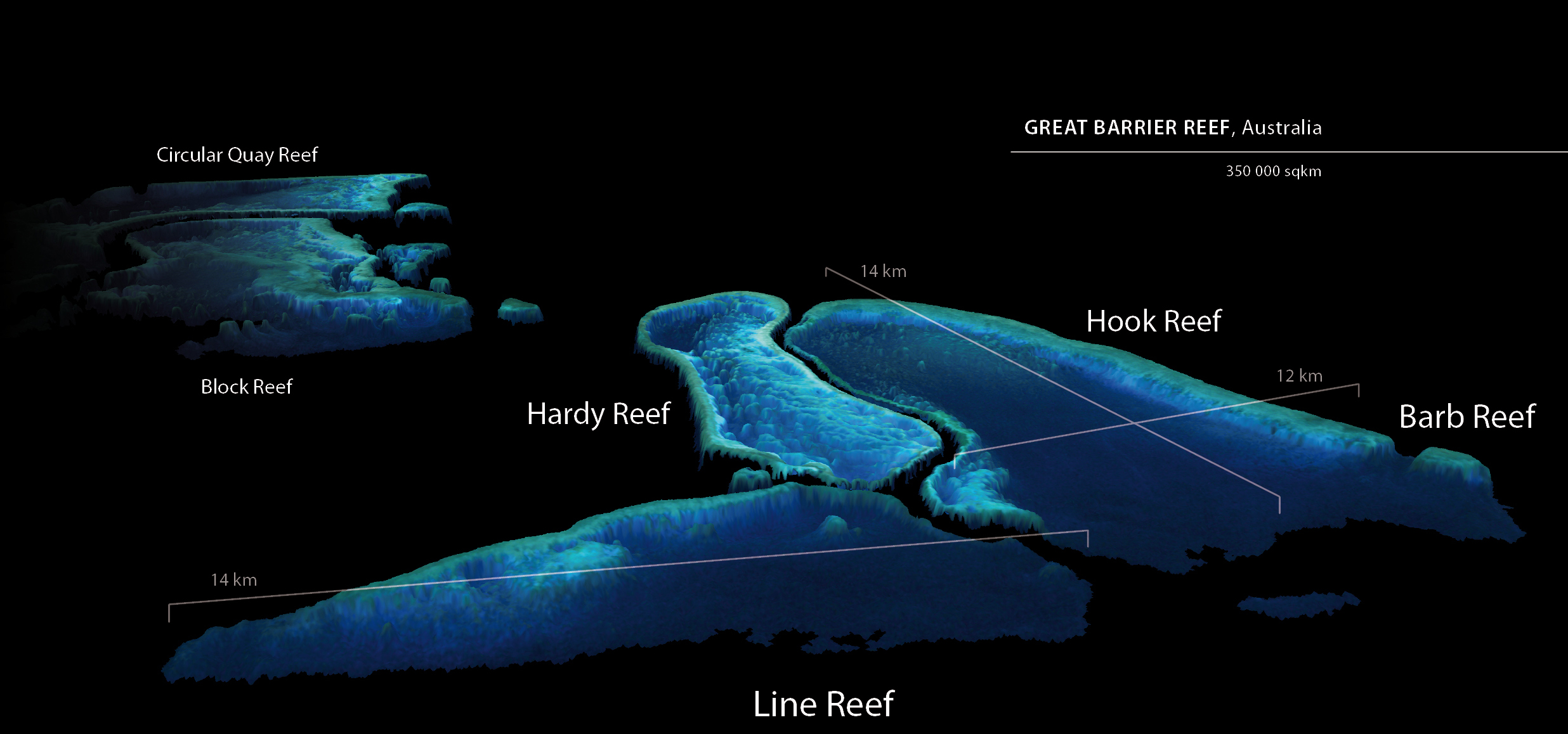
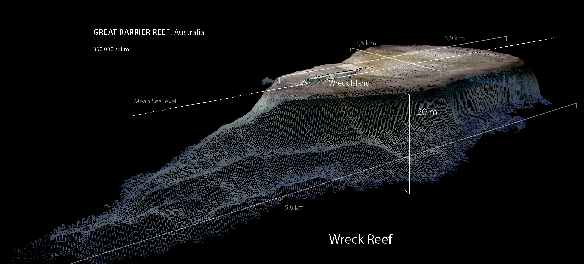
For the first time the Great Barrier Reef has been completely mapped in high resolution. Earth’s largest coral reef extends for more than 2000 kilometres along the east coast of Australia and covers an area of ca. 350,000 square kilometres. The initial high resolution bathymetric measurements of this enormous area were made by EOMAP with the help of satellite data. The groundwork for this technology was laid at EOC. EOMAP is an EOC spin-off fostered by DLR.
The relevant research at DLR began in 1998 as part of German Research Foundation’s Collaborative Research Centre 454: ‘Lake Constance Shallow Water Zone’. In the first few years, efforts focused on mapping the lake bed with multispectral and hyperspectral sensors mounted on aircraft. Mapping water depth was originally only a by-product of this work. After EOMAP was founded as a DLR spin-off in 2006, the company further developed and optimized the optical methodology for mapping water depth, partly in cooperation with EOC. These methods are being employed today in diverse commercial projects related to coastal mapping.
For the Great Barrier Reef project, EOMAP employed the technology for the first time for routine mapping of very large areas. Data from the upcoming Sentinel satellite will provide a basis for worldwide mapping of water depth. EOC is currently establishing a satellite data infrastructure and processing environment to produce such geoinformation products. This will mean rapid access to data and their efficient processing for both the industrial and science sectors.
EOC cooperates toward this end with EOMAP in the context of tests with pilot processors integrated in the ground segment. The concept of operational data processing in a cloud environment for worldwide mapping of water depth was awarded a prize in the Copernicus Masters competition in November 2013.


