
Young Researchers Group: AI4BuildingModeling
The DLR Young Investigators Group “AI4BuildingModeling - Artificial Intelligence for 3D Building Modeling” focuses on bringing powerful computer vision methods to the field of 3D remote sensing. The main objective is to enable detailed building information extraction and reconstruction from satellite imagery applicable to a wide range of applications including improvement of OpenStreetMap (OSM) and CityGML data, update of cadastral data, and fast generation of reliable 3D city models. The integration of detailed information about cities in many different areas of urban management gives an opportunity to create a valuable contribution to the future of smart city planning. It can allow controlling the impact of urbanization, improving the practices of urban environmental planning, buildings energy consumption analysis, and many others. Currently the DLR Young Investigators Group AI4BuildingModeling focuses on the following topics:
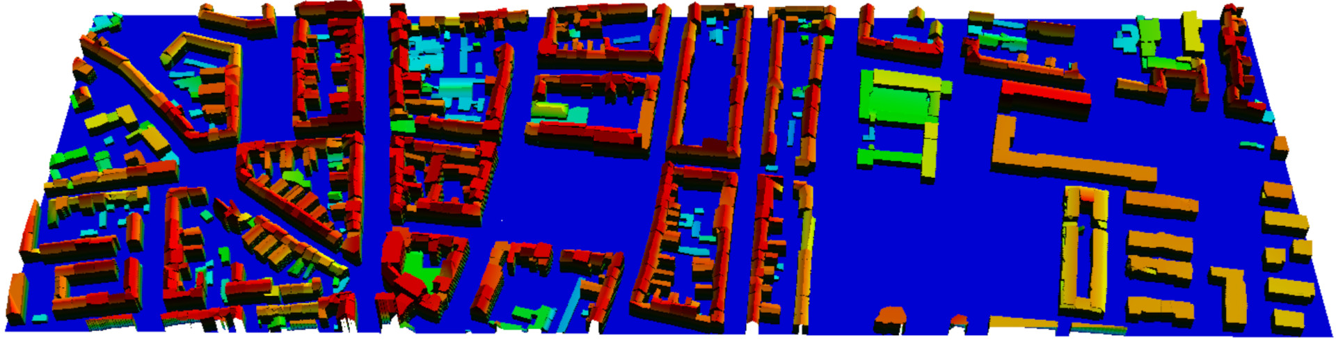
Towards LoD2 reconstruction
In densely urbanized areas, our team uses advanced deep learning to identify fundamental building primitives and their roof planes within complex structures. We predict comprehensive outlines of entire building structures, the boundaries between these primitives, and roof planes using data from Digital Surface Models and RGB imagery. These semantic outputs are then transformed into instances using the watershed transform and morphological operations. Our innovative approach converts these instances into polygonal representations, allowing us to generate detailed building models at both Level of Detail 1 and 2 for the urban landscape under examination. To overcome the challenge of limited high-quality labeled data, we employ cutting-edge unsupervised and self-supervised techniques for classifying various types of building rooftops. These classifications play a pivotal role in the 3D reconstruction process, as we strive to produce digital twins with a Level of Detail of 2 or greater, even in the most complex urban scenarios.

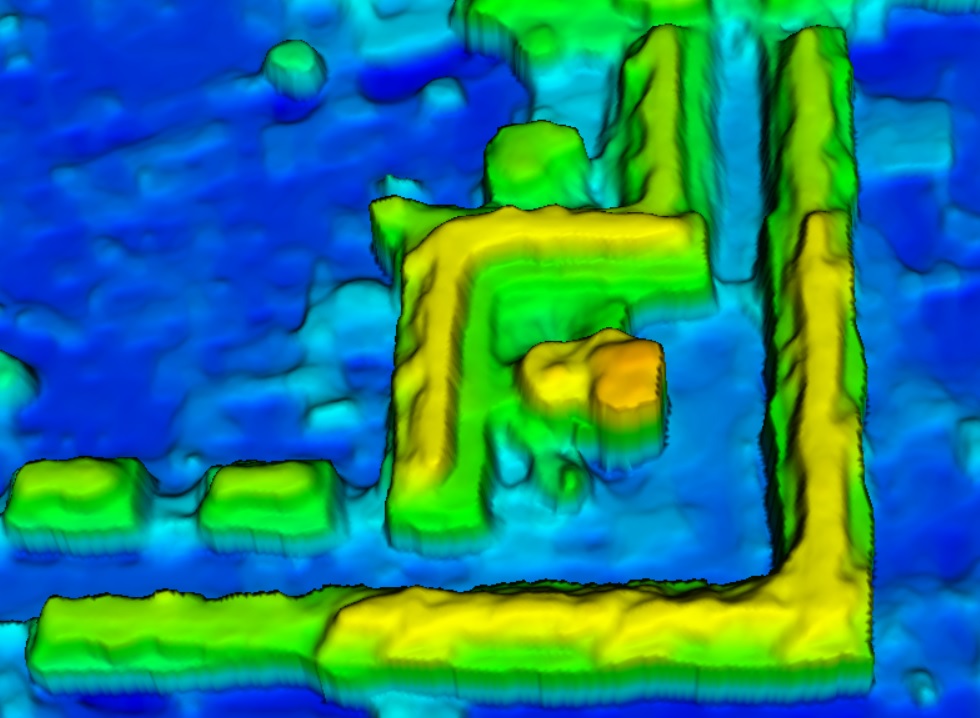
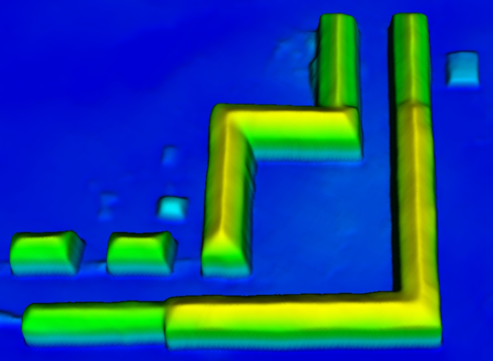
Building geometries optimization in DSMs


Photogrammetric DSMs derived from stereo imagery often produce low-quality results due to issues such as matching errors in homogeneous areas and limited information capture due to varying viewing angles. This makes the tasks related to building reconstruction very challenging since in most cases it is difficult to recognize the types of roofs, especially if overlaid with trees. Our team is currently developing an enhanced Generative Adversarial Network (GAN) architecture designed to reconstruct complete and detailed building structures. Initial results indicate that our proposed strategy can accomplish two key objectives without any manual intervention: it enhances roof surfaces by making them more planar and efficiently identifies and optimizes small residential buildings that are normally hard to detect.
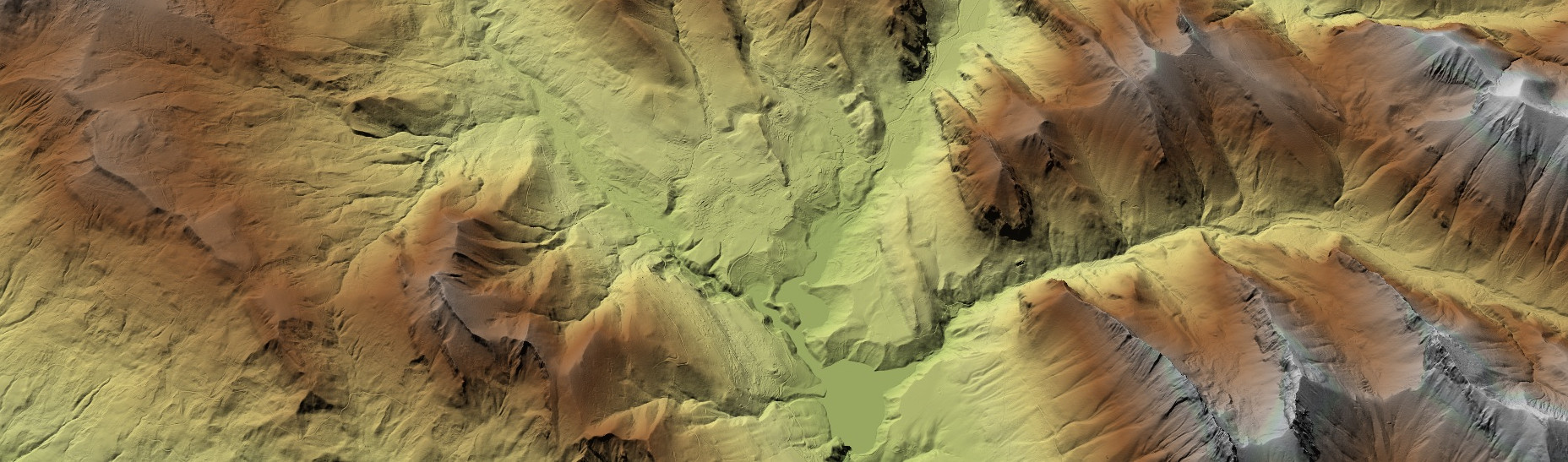
DSM-to-DTM generation from space- and airborne imagery
Inspired by recent successes in deep learning methodologies, our team is actively researching the application of deep learning models for Digital Terrain Model (DTM) extraction from Digital Surface Models (DSMs). Our approach focuses on developing simple yet efficient network architectures with a smaller number of parameters compared to widely-used models. These architectures are designed to generate detailed DTMs from DSMs. What sets our method apart is its ability to operate independently of predefined thresholds and generalize well across challenging terrain types, including steep slopes, vegetated areas, and terrain with discontinuous features. Our team's primary goal is to enhance DTM generation through deep learning by creating a single, versatile model capable of generalizing across data from various sensors with different ground sampling distances (GSDs).

DSM super-resolution
Inspired by cutting-edge advances in computer vision, our team is also dedicated to the enhancement of the resolution of Digital Surface Models (DSMs) using a novel approach. Our focus is on superresolving real-world low-resolution DSM data by combining traditional learning-free techniques with the power of deep learning. To guide this process, we leverage multi-modal information for added accuracy. The aim of the research is to develop a solution for enhancing DSM resolution, which is applicable to diverse real-world scenarios.
The Research Group contributes to improve satellite imagery understanding by developing novel and improved algorithms based on powerful tools from deep learning. Besides, for each proposed topic, the group explores data fusion strategies, mainly the integration of multi-model data sources, like spectral and height information derived from satellite images and publicly available datasets, such as street view images from Google Earth, in order to achieve a reconstruction as detailed as possible for building geometries in city models.