
Larsen C: Antarctic giant on the move

The Larsen C iceberg with the number A68 has been quiet for a while. After its demolition in July 2017 generated a lot of media coverage, it is now being reported on again. What has happened? It has moved. It has shrunk slightly. Nothing unusual in itself - and yet it's worth another blog post.
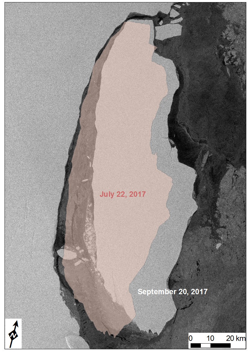
If you look at a sequence of satellite images over the last two months, it is impressive what is happening there. After all, at 5800 square kilometres, the iceberg is seven times larger than Berlin. Despite its size, it is constantly in motion. The iceberg has repeatedly collided with the ice shelf, causing smaller pieces of ice to break off.
The satellite image sequence shows how the iceberg is moving away from the ice shelf. In the southern area, it has moved about 25 kilometres away from the break-off edge at a speed of about 330 metres per day. Very fast, considering the enormous mass of the ice giant. Nevertheless, it has hardly lost any surface area in recent weeks. (Here you can also find the video as a GIF animation with satellite images up to 20 September 2017).
The "Polar and Cold Regions" working group at DLR's Earth Observation Centre will be monitoring the fate of both the iceberg and - above all - the Larsen C ice shelf over the coming years. Was A68 the beginning of a series, as has already been observed several times in other areas of the Antarctic Peninsula? Will the ice shelf collapse or will it remain stable? How will the inland glaciers develop if the ice shelf actually disappears and its braking influence is lost?
Tracking the changes with radar eyes in space
Radar images from ESA's Sentinel-1 satellite are particularly suitable for such long-term observations, as they allow year-round observation through clouds and during the polar night. Sentinel-1 is also designed to map large areas and has a so-called extra-wide swath mode, a 400 kilometre wide "recording strip". However, the additional recording width comes at the expense of image resolution. The German radar satellites TerraSAR-X and TanDEM-X, whose data we receive from our GARS O'Higgins station in the Antarctic, are used for the highly accurate detection of individual fissures.
Our satellite images document the changes on site, the calving of the icebergs, the flow rates of the inland glaciers and the development of the grounding line, i.e. the point where the ice shelf detaches from the ground and the ice begins to float on the sea, with great precision and over a period of years. Despite the comprehensive collection of data from space, definitive answers will be some time in coming. So we need to be patient.