
MACS - Modular Aerial Camera Systems
For several decades, highly innovative digital camera systems have been developed, built and operated at the DLR Institute of Optical Sensor Systems. The ADS-40, the world's first commercial digital aerial camera was also born here. MACS (Modular Aerial Camera Systems) is the current evolution of this development line: a family of airborne camera systems with unique technical capabilities. In addition to their specific capabilities, the cameras are characterized by a high degree of technological and application readiness, which is why they have been used for years in many demanding missions for earth observation and, above all, for security applications worldwide.

Hightech made in Berlin
Our camera systems have mapped the Himalayas, collected glacier data in the Arctic and support emergency services on the ground in major emergencies: what makes MACS so special is its enormous flexibility - both in terms of the applications and the carrier systems used. The spectrum of possible use-cases ranges from high-resolution 3D geodata acquisition, reconnaissance and situation mapping in large-scale and disaster situations to the measurement of climate-relevant environmental changes. To this end, we integrate our systems into and onto research and remote sensing aircraft, helicopters, various drones, small aircraft, gliders and microlight aircraft. The key to the application is the automatic processing of the recorded data into usable information products (in post-processing or in real time) and the seamless integration into the processes and systems of our users.
Real-time image data
In order to obtain optimal image data, camera systems must be individually designed for each mission. This is precisely why we have developed MACS, a highly modular, extremely efficient hardware and software system kit with which customized aerial camera systems can be configured and set up quickly and flexibly. The individual components work together so effectively that they always result in a seamlessly integrated and calibrated overall system: ready for immediate use for any requirement. Whether for forest fires, storms, flooding or monitoring critical infrastructures - high-resolution image data in real time and in an accessible format is important for efficient situation assessment so that those responsible can react quickly and appropriately.
Our real-time mapping technology excels at precisely this, featuring the powerful MACS camera systems and our patented approach for real-time data processing. With this process, the recorded MACS images are immediately processed so that they are transmitted directly to the ground to generate a georeferenced and interactive situation map. This successively builds up a map mosaic of the area flown over, in which the situation on the ground can be tracked and analyzed in real time - an enormous added value for the coordination of complex operations. Precise georeferencing and the use of standard interfaces even enable seamless integration into existing GIS and command support systems.
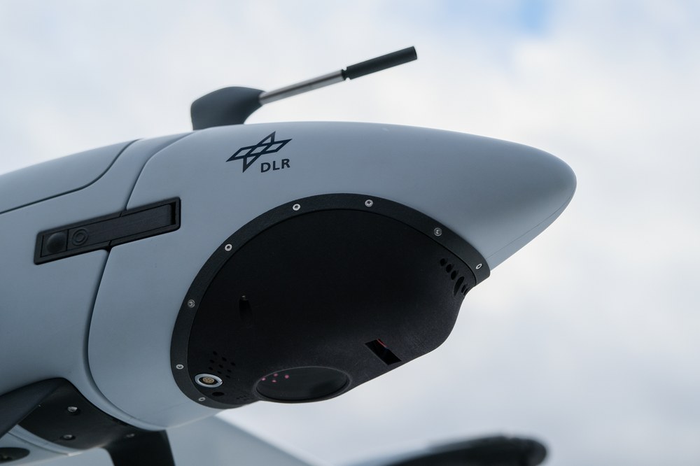
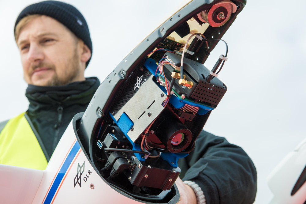
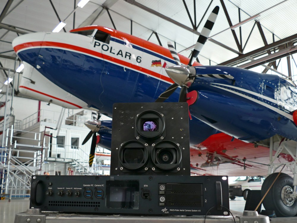
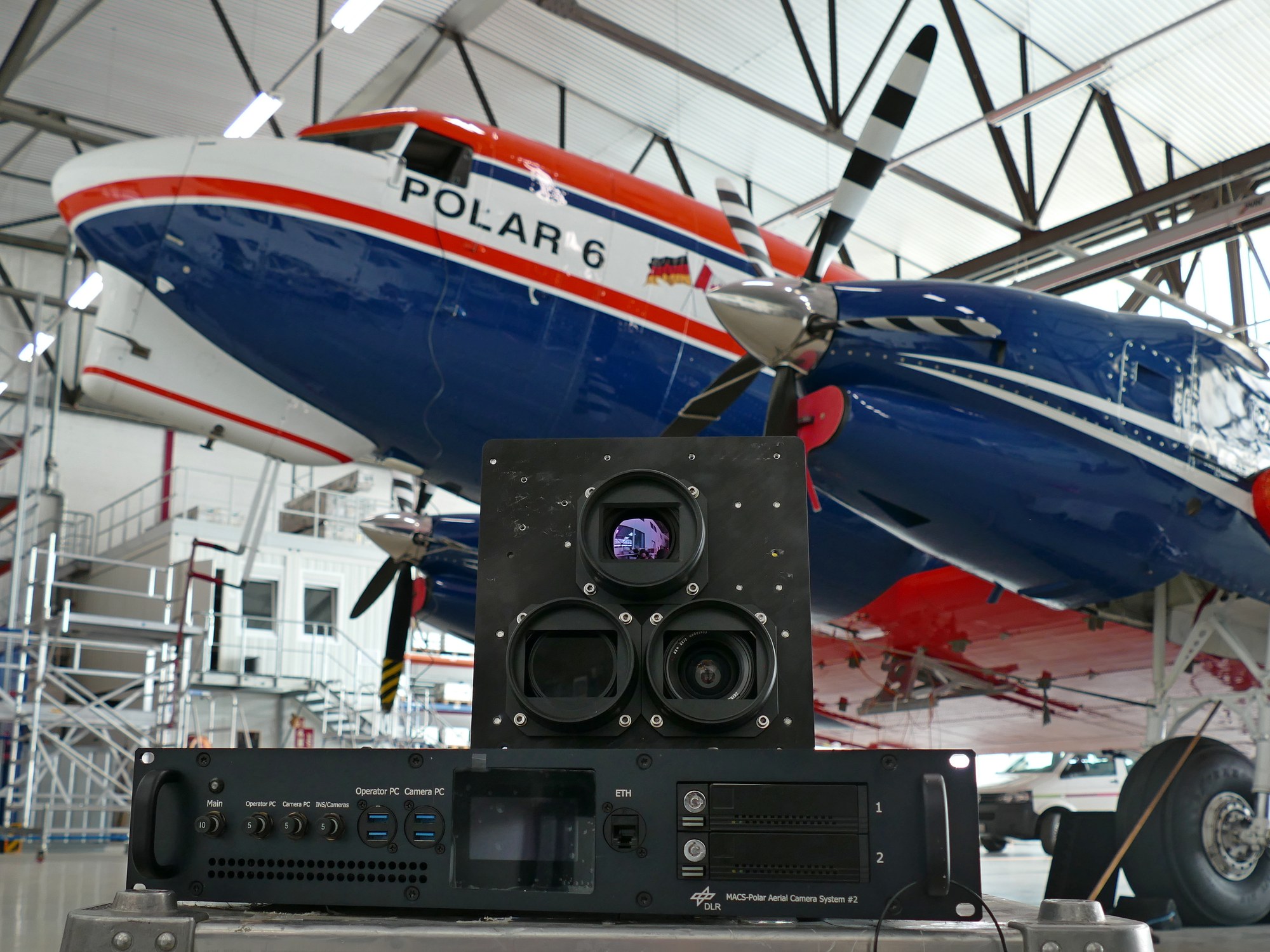
MACS - Polar
MACS - Search and Rescue (SaR)
- Optical reconnaissance system to support international disaster relief operations
- Cooperation with the non-profit aid organization I.S.A.R. Germany (INSARAG certified)
- Generation of up-to-date situational maps of disaster areas using an unmanned aerial vehicle (UAV)
MACS - nano
- Compact reconnaissance system for rapid mapping and exploration of small-scale operations
- Optimized for UAV integration (e.g., vertical take-off and landing fixed-wing or multicopter)
- Modular sensor system (RGB, NIR, or TIR camera)
- Optional: Broadband data link, cell radio
- Camera system for reconnaissance, mapping and remote sensing specifically designed for stratospheric High-Altitude Platforms (HAPs)
- Instrument as payload for the stratospheric aircraft HAP alpha
- Ground resolution of approximately 15 cm per pixel from an altitude of about 20 km AGL
MACS - Maritime Security (Mar)
- Fully automated remote sensing system for real-time monitoring of maritime environments
- Automatic detection of maritime objects and anomalies using an optical multi-sensor system (RGB, NIR, TIR, HS)
- Provision of real-time services via data link
- Tested in national operations
MACS - Himalaya
- Oblique camera system for high-mountain modeling
- Operating altitudes > 10 km
- Fully automated operation with real-time visualization of flight success for the pilot
- Deployed as part of the 2013/2014 Himalaya expedition of the Mountain Wave Project (MWP)
MACS - TumbleCam
- Fully autonomous camera system for use in mini-UAS
- Total weight <5 kg, including power supply for 1 hour
- Robotically controlled camera for arbitrary viewing directions
- Typical ground resolution: 5 cm at 320 m above ground
- Developed for the unmanned research aircraft ATISS of the Technical University of Applied Sciences Wildau (FH)
MACS - Airship
- Flexible camera system for unmanned airships
- Robotically controlled camera for arbitrary viewing directions
- Real-time monitoring of small-scale areas
- Derivation of detailed 2.5D and 3D models of the Earth's surface
- Deployed with the unmanned airship ALTAIR by Airbus
MACS - Real-Time
- Monitoring / mapping of large areas in real time
- Use of various IP-based data links possible
- Real-time visualization of mapping for the pilot
- Fully automated system operation, e.g., in MALE-UAV
- Tested in international operations
MACS - Jet
- Mapping of large areas from high altitudes
- Deployment in fast-flying platforms up to 800 km/h
- Derivation of highly accurate 2.5D geospacial information
- "Single-button" operation
- Tested in international operations
MACS - Heli
- Experimental system for real-time, 2D, and 3D mapping with the highest resolution and accuracy
- Modular sensor system (RGB, NIR, TIR, etc.)
- Real-time visualization of aerial images on the ground via broadband data link
- Transfer of aerial images to geo-information or mission control systems