The European Space Agency's (ESA) Mars Express spacecraft was only intended to orbit Earth's planetary neighbour for two years. But, as of December 2023, it will have been operating there for 20 years. One of the seven experiments on board is the High Resolution Stereo Camera (HRSC), which was built by DLR in cooperation with German industry. To this day, the image data acquired by this instrument continues to provide important scientific insights – from the traces left by water and ice on the Red Planet, some of which date back billions of years, to deciphering the planet's puzzling climate history and the current changes in the martian landscape caused by wind and weather.
Mars – the Red Planet
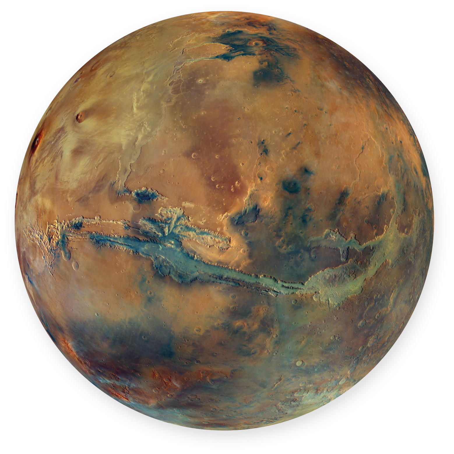
This mosaic of a hemisphere of Mars shows the striking 4000-kilometre-long rift valley system of Valles Marineris in the centre and the huge volcanoes of the Tharsis rise with the highest volcano in the Solar System, Olympus Mons, at the upper left edge of the image. Simply exquisite, Mars, which is also called the Red Planet due to its oxidised iron-containing minerals.
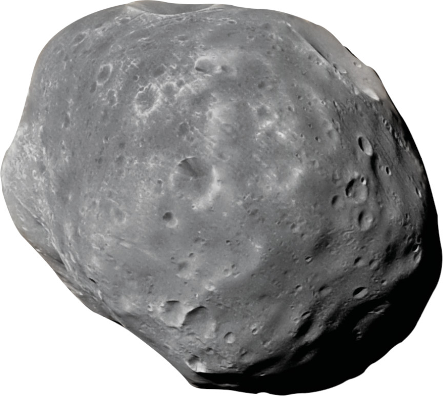
The HRSC uses the Mars Express flybys to study this moon more closely. But the origin of the martian moons Phobos and Deimos has not yet been conclusively explained. The Martian Moons eXploration mission (MMX), which is scheduled to launch in September 2024, has the task of exploring the two moons more closely.
Twenty years ago, on 2 June 2003, during a fine summer's day in Berlin, some 200 pairs of eyes from the fields of scientific research, technology, space administration and the media witnessed the launch of Europe's first mission to another planet on large screens in Berlin-Adlershof. The launch of Mars Express from the distant Kazakh spaceport of Baikonur went perfectly. The sense of relief was enormous, yet the celebrations remained muted. The disappointment over the loss of two DLR camera systems during the ill-fated Russian Mars 96 mission, which crashed into the Pacific Ocean a few hours after launch in November 1996, was still too fresh.
On arrival on 25 December 2003, once again with a DLR camera on board, (almost) everything went as expected. This time, the Mars Express orbiter, referred to as 'MEX' by everyone involved, slowed down to enter an orbit around Earth's outer neighbouring planet. The previously detached British lander, Beagle 2, arrived on Mars but transmitted no data. However, all seven of the orbiter's experiments worked perfectly. Today, after years and 25,000 orbits later, in a small technological miracle, they continue to do so – with minor limitations.
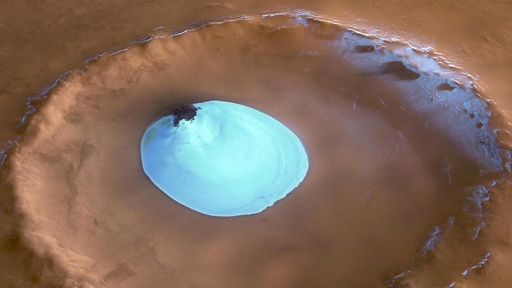
Vastitas Borealis
This iconic Mars Express image shows water ice at the bottom of a crater near the north pole of Mars. The unnamed impact crater has a diameter of about 35 kilometres and lies in the northern lowlands of Vastitas Borealis.
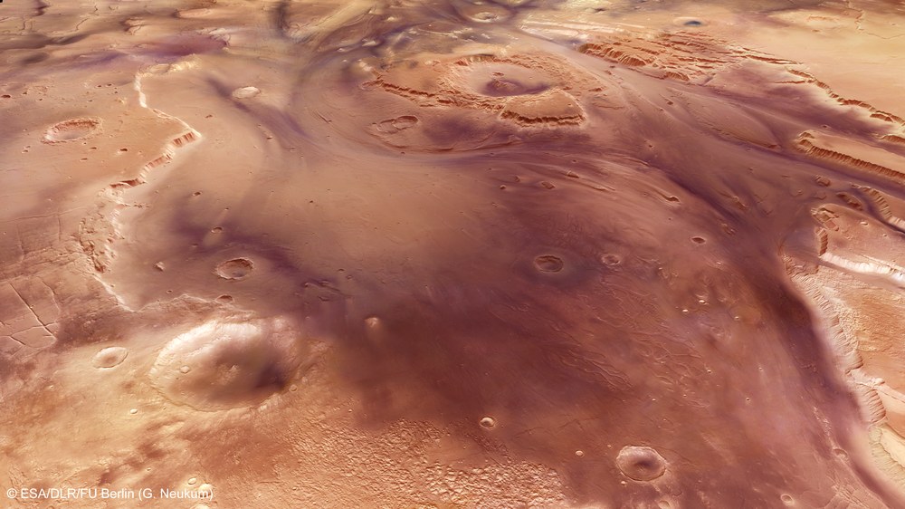
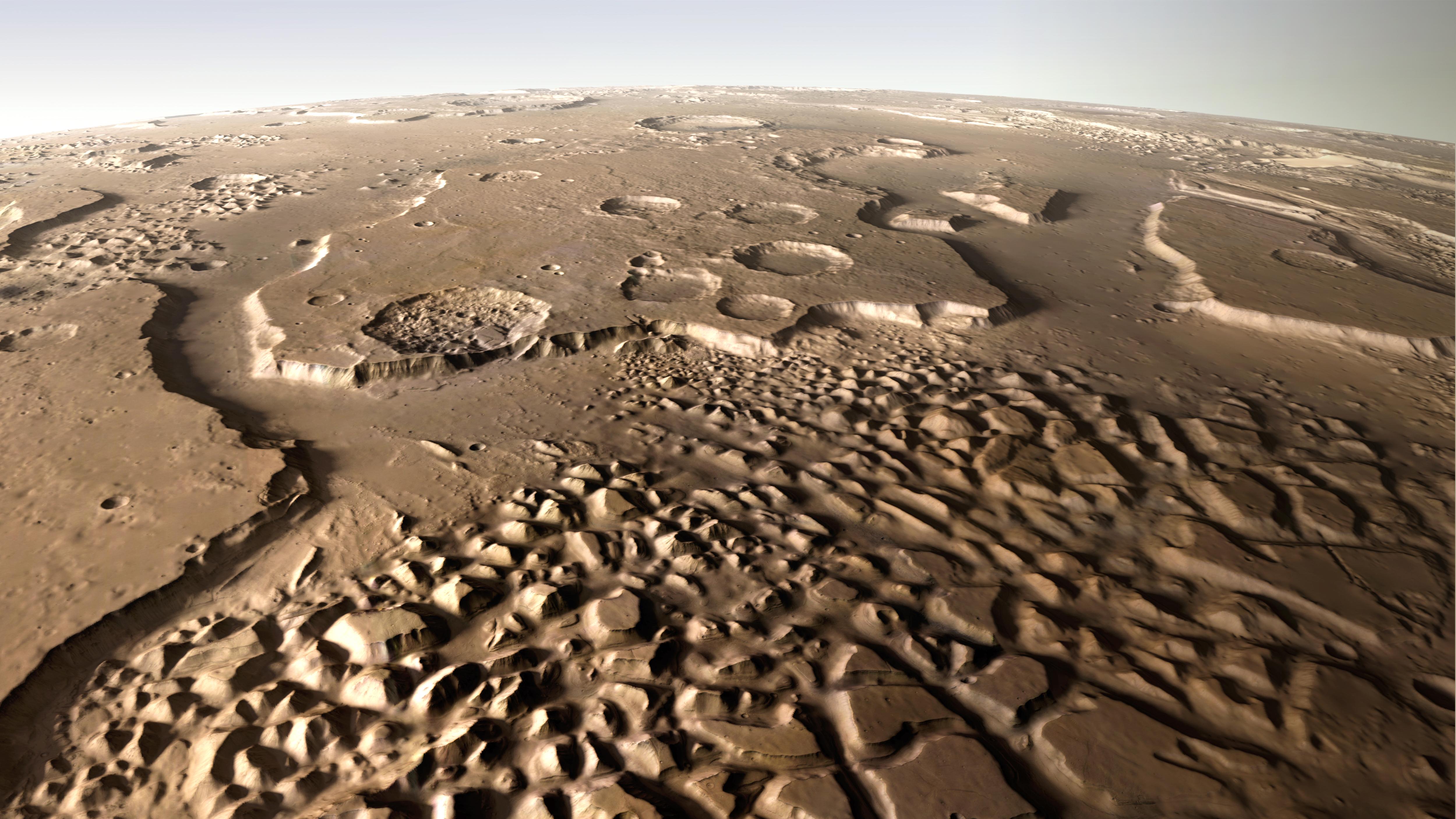
River valleys eroded by flowing water were first observed by the Viking missions of the late 1970s. The high-resolution digital terrain models of the HRSC not only enable better geological interpretations, but also allow quantitative statements to be made about water quantity and erosion rates, like here in the Kasei Valles.
ESA had originally planned the mission to last only one Mars year, or just under two Earth years. But like the famous VW 'Beetle', MEX is indestructible. And so is the HRSC instrument developed at DLR, which is still unparalleled in planetary research. Over the past two decades, HRSC has recorded Mars globally in high-resolution, colour and in 3D, using technology that, despite being completely outdated from today's perspective, is absolutely reliable.
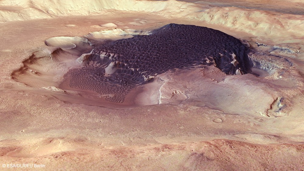
Perspective view of the interior of Rabe Crater
A dark dune field covers the floor of the Rabe impact crater, whose floor is pierced by pits and cavities. On the slopes of the pits, thin dark lines reveal the volcanic ash layers from which the dune material originates. In this contrast-enhanced image, the volcanic sands that are in reality greyblack appear bluish.
The DLR Institute of Planetary Research in Berlin plans the HRSC image acquisitions, manages their usage and, together with the Freie Universität Berlin, processes the image data of the martian surface acquired by nine sensors into high-quality data products. For the first time, these products have allowed geological processes to be quantified and morphological features to be studied spatially. The topographic data have also been used by NASA to select landing sites for other missions – an extremely valuable dataset for scientific research and space exploration. In addition, Mars Express has served as an orbiting radio relay station connecting NASA and Chinese landers with Earth when needed. This will continue for the foreseeable future. ESA has just extended the mission until the end of 2026, with the possibility of further extension until the end of 2028. Not every 'Beetle' has lasted that long!
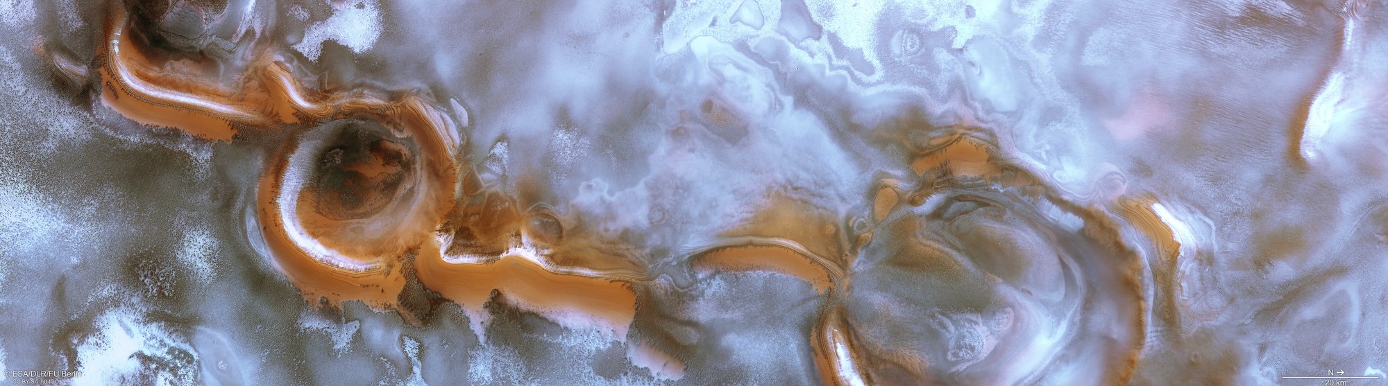
The Hydraotes Chaos region
The Hydraotes Chaos region, first imaged during the 18th orbit of Mars Express, was unveiled to the public in January 2004. Since then, the maze of mesas over 2000 metres tall has been repeatedly observed using DLR’s HRSC.
Digital terrain model of Olympus Mons, the highest mountain in the Solar System (the colours indicate increasing elevation from blue to grey). At its base, the giant volcano has a diameter of about 600 kilometres. The volcanic giant rises more than 22 kilometres above the blue-coloured lowlands of Amazonis Planitia in the west.


