Pilot project provides automated shipping routes through drifting sea ice for first time


Dr. Christine Eis, Universität Bremen
- As part of the FAST-CAST 2 research project, a new satellite-based method has been developed in collaboration with DLR to calculate optimal shipping routes for vessels navigating polar, ice-covered waters.
- The automated route calculation was tested for the first time aboard the Polarstern research icebreaker.
- This new route calculation system is based on high-resolution imagery from the TerraSAR-X and Sentinel-1 radar satellites, alongside predictive models.
- Focus: Space, Earth observation, transport, maritime safety
Navigating ships through ice-covered waters presents a significant challenge for both people and technology, as sea ice is constantly changing. Within just a few hours, winds and ocean currents can compress vast masses of ice, closing previously open areas of water. When the pressure becomes too great, ice floes can pile up on top of each other. The resulting pack ice – any area of sea ice that is not attached to land – can reach several metres in thickness, rendering it impassable even for an icebreaker vessel. Conversely, opposing forces can break up sea ice, creating open channels. As part of the FAST-CAST 2 research project, a new satellite-based method has been developed in collaboration with the German Aerospace Center (Deutsches Zentrum für Luft- und Raumfahrt; DLR) to calculate optimal shipping routes for vessels navigating polar, ice-covered waters. For the first time, an algorithm has calculated shipping routes through drifting ice floes and shifting ice fields – made possible by high-resolution radar satellite imagery and ice drift prediction models.
What satellites see
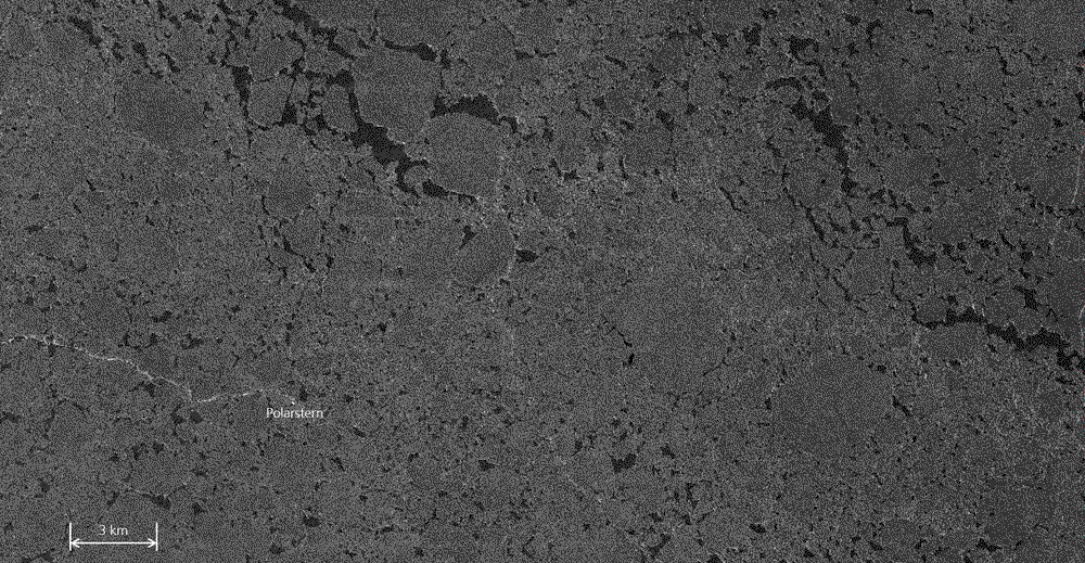
Earth observation satellites provide up-to-date imagery of Earth's surface from space, capturing views of oceans and sea ice. Radar satellites, such as the European Sentinel-1 and the German TerraSAR-X missions, deliver high-resolution views of various structures in the sea ice. Thanks to their active radar antennas, they can operate in all weather conditions, penetrating clouds and functioning even in darkness. Orbiting several hundred kilometres above Earth, these satellites emit radar signals that are reflected differently depending on the type of surface they encounter. This reflected 'echo', known as 'backscatter', is then measured by the satellite. Variations in radar backscatter reveal more detailed insights into ice properties that are invisible to the human eye, such as the age of the ice – a crucial factor in navigating sea ice. Newly formed ice is thinner and therefore easier to traverse than older, multi-year ice. Additionally, the analysis of successive radar images reveals high-resolution changes in the ice caused by drifting. This also helps identify particularly dangerous areas where the ice has become compressed.
A quantum leap: From sea ice mapping to route calculation
Radar satellites have been used for decades to map sea ice conditions. The FAST-CAST 2 research project, however, goes beyond creating a static snapshot of current conditions.
Building on previous research efforts, including the MAP-BORealis, EisKlass31 and EisKlass2 projects, researchers at the DLR Remote Sensing Technology Institute have developed an advanced algorithm that maps the age of sea ice, taking into account the polarisation properties of the backscattered radar signal. The entire process is fully automated and takes place at the satellite data receiving station, operated by the German Remote Sensing Data Center (DFD), immediately after new satellite images are received.
Moreover, the algorithm incorporates high-resolution ice drift prediction models to estimate future ice movements. This spatio-temporal dataset is automatically transferred to project partners at the University of Bremen, who use it to calculate optimal shipping routes. The spatial resolution of the data is 160 metres and the forecast spans the following 72 hours. The calculated route is then delivered to navigators on the bridge of the Polarstern within a very short time via the IcySea app, developed by Drift+Noise Polar Services GmbH.
In spring 2024, a preparatory test was conducted in the waters off West Greenland. During this trial, routes for a Royal Arctic Line supply vessel were calculated using static ice charts, without factoring in dynamic ice movements.
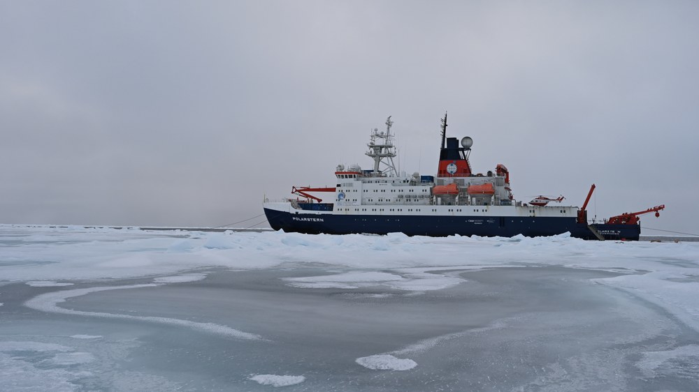
From 22 September to 2 October 2024, the entire process chain, including dynamic ice movements, was tested aboard the Polarstern for the first time. Researchers regularly conduct on-site sea ice thickness measurements on the research icebreaker, operated by the Alfred Wegener Institute, Helmholtz Center for Polar and Marine Research (AWI). As part of the ArcWatch 2 research expedition, the vessel visited various stations in the central Arctic, where scientists gathered data to monitor large-scale changes in Arctic sea ice, the ocean and the atmosphere. Specific route suggestions were calculated for the ship's journeys between these stations.
While much of the central Arctic is now characterised by alarmingly thin ice cover and the increasing loss of sea ice, the test period saw unusually dense ice cover at the stations. Radar satellite images revealed that the area within a 100-kilometre radius of the Polarstern was predominantly covered by multi-year ice, with some sections of younger, one-year-old or newer ice, along with isolated open channels that remained hidden from the vessel's radar due to its shorter range of just a few kilometres – as hidden as the future ice movements. The route calculation algorithm identifies the fastest path through this labyrinth of drifting sea ice, prioritising open channels and areas of younger ice while steering clear of hazardous zones, such as shallows. These shallows are identified by project partner EOMAP GmbH & Co. KG using up-to-date optical satellite data, as the seabed topography of the Arctic remains insufficiently mapped.
The calculated routes were received with great interest by the crew on the Polarstern's bridge and were used in conjunction with other information to navigate through the ice. The tests confirmed the value of these routes, demonstrating in particular that longer journeys through the ice can benefit from this newly developed technology.
"After years of development, this test provided a valuable opportunity to gather crucial feedback. It has brought us significantly closer to our goal of making polar shipping safer and more efficient," explains Christine Eis from the University of Bremen, scientific director of the FAST-CAST 2 project.
The experiment aboard the Polarstern was an initial trial, primarily aimed at incorporating feedback from the ship's crew into the development process. Further tests will be needed to evaluate the accuracy of the route calculations under varying environmental conditions and to identify any necessary improvements, so that such route suggestions can, perhaps, be permanently integrated into decision-making onboard ice-class vessels in the future.
Related links
- IcySea app
- More about the MAP-BORealis research project
- Article about the EisKlass2 project
- The German Remote Sensing Data Center (DFD)
- ESA – Sentinel-1 mission
- TOPAZ5 Arctic Ocean system
- Universität Bremen – Center for Industrial Mathematics
- Drift+Noise Polar Services GmbH
- EOMAP GmbH & Co. KG
- DLR's Maritime Safety and Security Lab in Bremen
- DLR's Maritime Safety and Security Lab in Neustrelitz
- Alfred Wegener Institute (AWI)
- AWI – More about research ice breaker Polarstern
- AWI – Web app Follow Polarstern
- Contribution 12th International Workshop – 'Ice-Track'
- AWI Press release – 'Comprehensive assessment of the changing Central Arctic Ocean' (11 October 2024)
About FAST-CAST 2
The FAST-CAST 2 project is funded by the Federal Ministry for Digital and Transport (BMVD), with a total budget of approximately 1.4 million euros, under the Modernity Fund (mFUND) initiative. The project involves several key partners, including the German Aerospace Center (DLR) Institute for the Protection of Maritime Infrastructures in Bremen, as well as Drift+Noise Polar Services GmbH from Bremen, EOMAP GmbH & Co. KG from Seefeld and the University of Bremen, which serves as the network coordinator.
The experiment received support from the Alfred Wegener Institute, Helmholtz Center for Polar and Marine Research (AWI), the DLR Institute for the Protection of Maritime Infrastructures in Bremen, the DLR New SAR Applications team in Oberpfaffenhofen and the European Space Agency (ESA).

