Alternative Navigation Systems Group
The gold standard in navigation is, without a doubt, satellite-based navigation using Global Navigation Satellite Systems (GNSS). Their services are free, globally available and it is challenging to match their accuracy and reliability. However their high performance does have limitations, for example some environments pose challenges in radio propagation, while some applications require a back-up capability for the unlikely event that GNSS-based navigation were to become unavailable.
Work in the ANS group is structured around three major domains, each with their own associated challenges, developments, and applications:
- Alternative Position, Navigation, and Timing (APNT) services for civil aviation
- Multi-sensor data fusion for urban applications
- Vision-based navigation systems
Regardless of the application, however, the goal in all three domains is to provide reliable navigation with high integrity. This includes characterizing sensor errors, defining integrity budgets, determining the detectability of sensor faults, and ultimately improving the reliability of the entire system.
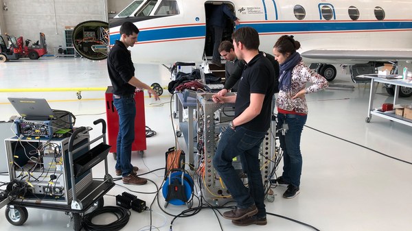
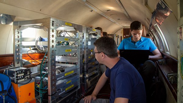
In civil aviation the focus is on leveraging existing aviation systems and combining them with new developments to provide modular solutions. For example we actively support the development of Distance Measuring Equipment (DME) industry standards, as well as the use of the L-Band Digital Aeronautical Communication System (LDACS) as a navigation system. In this area our research has many facets, including the development of the navigation capability of LDACS and its modular integration with DME and other legacy technologies. Ultimately we strive to substantiate all of our developments with flight experiments on DLR aircraft.
There are, of course, non-aviation environments where GNSS signals need complementing. A typical approach is to fuse them with signals from inertial sensors. This is helpful in dealing with challenges like poor visibility of the sky in urban canyons, while at the same time detecting faulted sensors by looking at the redundancy between readings. Some applications where these Safety-of-Life navigation principles are used include train localization and Unmanned Aerial Vehicle (UAV) positioning.
Also vision sensors can be integrated with other sensors to improve the accuracy, availability, continuity and integrity of the navigation system. Meanwhile, integrity monitoring for visual navigation methods remains an open and challenging topic. As such we are working on an innovative integrity monitoring framework for vision systems, including error models, risk quantification methods, as well as innovative visual navigation and sensor fusion algorithms.
Links and more information


