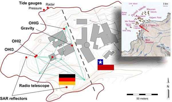
Map showing the Chilean base Bernardo O’Higgins (to the right of the dashed line) and the GARS O’Higgins station with the locations of the geodetic instruments (at left).
Map showing the Chilean base Bernardo O’Higgins (to the right of the dashed line) and the GARS O’Higgins station with the locations of the geodetic instruments (at left).
The local survey network is shown in green. The inset shows the station’s geographic context.

