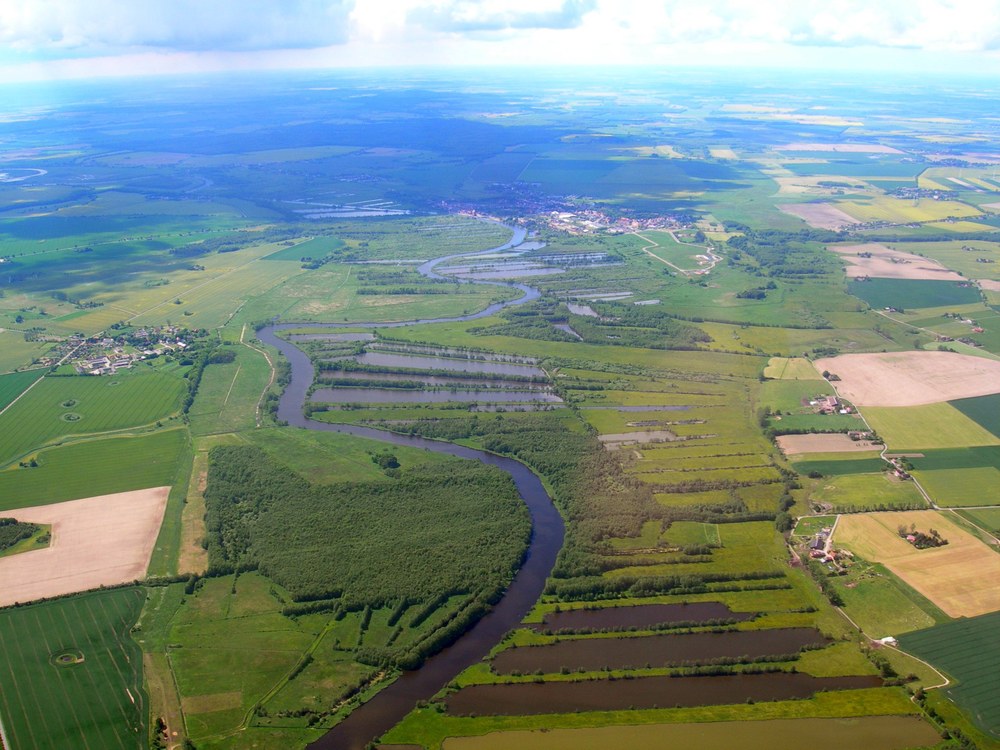
AGRISAR Campaign
In addition to the annual routine campaigns, the DEMMIN test site is also a suitable location for international campaigns like AgriSAR 2006. The campaign goals were to evaluate Sentinel missions 1 and 2, to improve methods for interpreting radar and optical data, to generate data from aerial and ground data which can be used to simulate upcoming Sentinel data, to estimate the market potential of the Sentinel missions, to simulate future end-user products, and to create the scientific groundwork for developing, planning and carrying out new SAR and optical earth observation missions like the Sentinel missions. Accordingly, the data obtained from the AgriSAR campaign were used for such purposes as simulating in advance the data expected to be routinely received from the Sentinel-2 mission (De Miguel, 2007; Timmermans, Verhoef, 2007). The purpose was to assess the potential benefits of the Sentinel missions.
In the AgriSAR campaign DLR’s DO228 research airplane, equipped with an E-SAR sensor, was employed throughout the entire growth period from April to August 2006. On three dates it was assisted by the CASA-212-200 aircraft of the National Institute for Aerospace Technology (INTA), which carried the hyperspectral AHS and CASI instruments from the Canadian company INTRES Research.

Over 15 research institutions participated in this campaign from Great Britain (Canfield University), Spain (Valencia University, Alicante University, National Institute for Aerospace Technology), the Netherlands (International Institute for Geo-Information Science and Earth Observation), Denmark (Technical University of Denmark), Belgium (Gent University), Germany (German Aerospace Center: Flight Experiments, Microwaves and Radar Institute, German Remote Sensing Data Center, German Weather Service - DWD, Free University of Berlin, Neubrandenburg University of Applied Sciences, Ludwig Maximilian University Munich, NODIG GmbH, Kiel University, Jena University, ZALF Müncheberg), Italy (National Research Council, Naples University) and Canada (ITRES Research).
This made the AgriSAR campaign unique both in nature and extent. The radar and optical data obtained in this campaign are being used to develop science methodologies for deriving soil parameters (Marzahn, 2007), vegetation parameters (Dorigo, Gerighausen, 2007; Gandia et al., 2007; Hajnsek et al., 2007 and hydrologically relevant parameters (Hajnsek, 2009; Mattia et al., 2009; Pauwels, et al. 2008; Sobrino et al., 2007).
In order to archive the heterogeneous geodata collected during campaigns and make them optimally available to scientists, the AgriSAR campaign was used to develop an appropriate information technology concept (Schulz, 2008).
Literature
De Miguel, E. (2007): Sentinel-2 Data Simulation Using EAGLE/AGRISAR 2006 AHS Hyperspectral Imagery. In: Proc. on AGRISAR and EAGLE Campaigns Final Workshop, AGRISAR and EAGLE Campaigns Final Workshop, ESA/ESTEC, Noordwijk, The Netherlands, 2007-10-15 - 2007-10-16.
Dorigo, W., Gerighausen, H. (2007): Automatic retrieval of crop characteristics: an example for hyperspectral AHS data from the AgriSAR campaign.- In: Proc. on AGRISAR and EAGLE Campaigns Final Workshop, AGRISAR and EAGLE Campaigns Final Workshop, ESA/ESTEC, Noordwijk, The Netherlands, 2007-10-15 - 2007-10-16.
Gandia, S., Fernández, G., Moreno, J., Delegido, J. (2007): Validation of different methods of chlorophyll content estimation by remote sensing data from AGRISAR campaign.- In: Proc. on AGRISAR and EAGLE Campaigns Final Workshop, AGRISAR and EAGLE Campaigns Final Workshop.- ESA/ESTEC, Noordwijk, The Netherlands, 2007-10-15 - 2007-10-16.
Gerighausen, H.; Borg, E.; Wloczyk, C.; Fichtelmann, B.; Günther, A.; Vajen, H.-H.; Rosenberg, M.; Schulz, M.; Engler, H.-G. (2007): DEMMIN – a test site for the validation of Remote Sensing data products. General description and application during AgriSAR 2006.- In: Proc. on AGRISAR and EAGLE Campaigns Final Workshop, AGRISAR and EAGLE Campaigns Final Workshop, ESA/ESTEC, Noordwijk, The Netherlands, 2007-10-15 - 2007-10-16.- S. 9.
Gerighausen, H., Borg, E., Fichtelmann, B., Günther, A., Vajen, H.-H., Wloczyk, C., Maass, H. (2008): Validation and calibration of remote sensing data products on test site DEMMIN.- In: Proc. on 43. Ziolkowski Conference, 43. Ziolkowski Conference, Kaluga (RUS), 2008-09-16 - 2008-09-18
Hajnsek, I., Horn, R., Scheiber, R., Bianchi, R., Davidson, M. (2007): The AGRISAR Campaign: Monitoring the Vegetation Cycle using Polarimetric SAR Data. In: H. Lacoste & L. Ouwehand (Eds.) ESA Conference Proceedings SP-636: EnviSat Symposium 2007 (CD).
Hajnsek, I., Jagdhuber, T., Schön, H., Papathanassiou, K. (2009): Potential of Estimating Soil Moisture under Vegetation Cover by means of PolSAR. IEEE Transaction on Geoscience and Remote Sensing, 47, 442-454.
Mattia, F., Satalino, G., Pauwels, V. R. N., Loew, A. (2009): Soil moisture retrieval through a merging of multi-temporal L-band SAR data and hydrologic modelling.- In: Hydrol. Earth Syst. Sci., 13.- S. 343–356.
Marzahn, P. (2007): Die Ableitung der mikroskaligen Bodenrauigkeit und ihre Dynamik aus multitemporalen L-Band ESAR Radardaten.- Diplomarbeit.- Christian Albrechts Universität, Kiel, Fachbereich Geographie.- S. 97.
Pauwels, V.R.N.; Timmermans, W.; Loew, A. (2008): Comparison of the estimated water and energy budgets of a large winter wheat field during AgriSAR 2006 by multiple sensors and models.- In: Journal of Hydrology.- S. 425-440.
Schulz, M. (2008): Archivierung und Bereitstellung von heterogenen Geodaten für das Testfeld DEMMIN.- Hochschule Neubrandenburg.- S. 101.
Sobrino, J. A., Jiménez-Muñoz, J. C., Gómez, M., Barella-Ortiz, A., Sòria, G., Julien, Y., Zaragoza-Ivorra, M. M., Gómez, J. A., de Miguel, E., Jiménez, M., Su, B., Timmermans, W., Moreno, J., Guanter, L., Bianchi, R. (2007): Application of high-resolution thermal infrared remote sensing to assess land surface temperature and emissivity in different natural environments.- In: Proceedings of the ISPRS Working Group VII/1 Workshop ISPMSRS'07: Physical Measurements and Signatures in Remote Sensing (Ed.: Schaepman, M.; Liang, S.; Groot, N.; Kneubühler, M.), Davos, Switzerland, 12-14 March, 2007.
Timmermans, J., Verhoef, W. (2007) Simulation of Sentinel 2 using AHS data. In: Proc. on AGRISAR and EAGLE Campaigns Final Workshop, AGRISAR and EAGLE Campaigns Final Workshop, ESA/ESTEC, Noordwijk, The Netherlands, 2007-10-15 - 2007-10-16.
Links
- Institut HR: AGRISAR and EAGLE campaigns in support of ESA's Sentinel-1 and -2 missions
- Institut HR: AGRISAR – Airborne SAR and Optic Campaigns
- ESA - Observing the Earth
