In the FPCUP project, DFD is working on the development of environmental indicators from Sentinel time series and very high-resolution optical data. The aim is to assess the diversity of agricultural areas with regard to the presence and quality of ecologically relevant landscape elements.
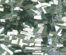
The FPCUP (Framework Partnership Agreement on Copernicus User Uptake) project is funded by the European Commission. The aim of FPCUP is to improve the broad utilisation of Copernicus data. In the now approved FPCUP action "Downstream service / application development for monitoring of environmental indicators", remote sensing-based environmental indicators are being developed in collaboration with the Bavarian State Office for the Environment (LfU), which are derived from Sentinel-2 time series and very high-resolution optical airborne data, among other things. The focus is on the evaluation of agricultural landscapes with regard to ecologically valuable landscape elements such as hedgerows and groups of trees.
The environmental indicators are developed in FPCUP in close cooperation with the relevant user groups.
Die Umweltindikatoren werden in FPCUP in enger Zusammenarbeit mit den entsprechenden Nutzergruppen entwickelt.