
CORINE Land Cover

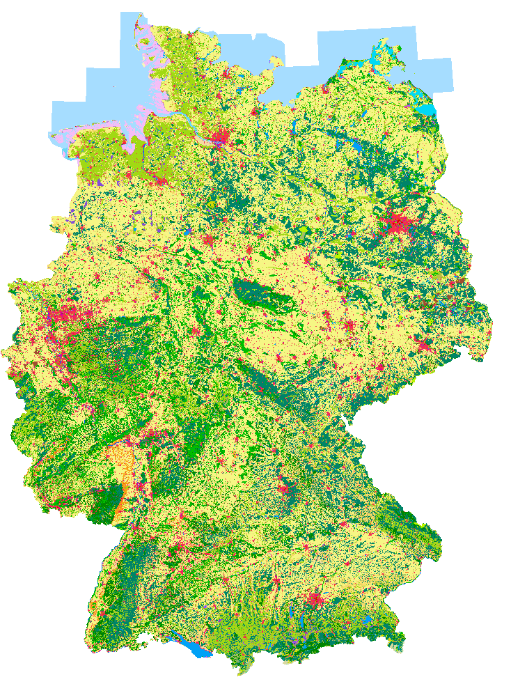
CORINE Land Cover (CLC) is the most prominent database concerning land cover and land use and their dynamics on the European, but also on National and regional levels. It was produced the first time for the reference year 1990, followed by updates for the years 2000, 2006 and 2012. The European wide harmonized nomenclature consists of 44 land cover classes, with a Minimum Mapping Unit (MMU) of 25 ha for areal phenomena and a minimum width of 100 m for linear phenomena. The included change layers are produced by an MMU of 5 ha. For Germany, 37 out of the 44 land cover classes are relevant. The main base for CORINE Land Cover have been satellite images of the types of Landsat TM, SPOT HRV and IRS LISS.
The German Remote Sensing Data Center (DFD) of DLR was responsible for the performance of the CLC updates for the years 2000 and 2006, on behalf of the Federal Environment Agency (UBA). The CLC products could be downloaded at DLR-DFD (for free and also for commercial use since 2010), after filling an online order. This service will be stopped in spring 2017. The products are available now at the GISU platform of UBA.
For the CLC update 2012, a specific national approach was chosen in Germany. This approach uses the more accurate geometry of the Official Topographical Cartographic Information System ATKIS of the land survey authorities (and the derived “Digital Landscape Model for Germany”, DLM-DE, filled with thematic information by satellite images for updating). CORINE Land Cover 2012 was performed under the responsibility of the German Federal Agency for Cartography and Geodesy (BKG), with contributions of DLR-DFD.
More details on the applied approaches and gained results during the years can be found in the document “CORINE Land Cover products for Germany, created by DLR-DFD on behalf of the Federal Environment Agency (UBA) – an Overview”, see link on the right. Other links allow to download the CLC vector data or derived raster products - in the German context at UBA and at BKG, or (in the European context) by the COPERNICUS Land Monitoring Services at the European Environment Agency (EEA). German CLC raster products for WebGIS services are available also by the EOC Geoservice at DLR.