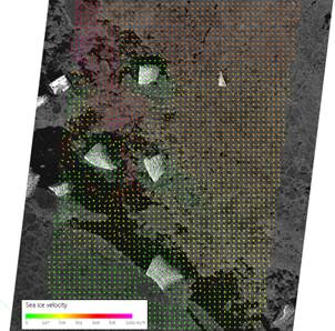
From this TerraSAR-X image along with an image recorded only 27 minute later by the Canadian RADARSAT 2 satellite EOC scientists could determine sea ice drift.
More frequent updates are possible if data from more satellites can be accessed.
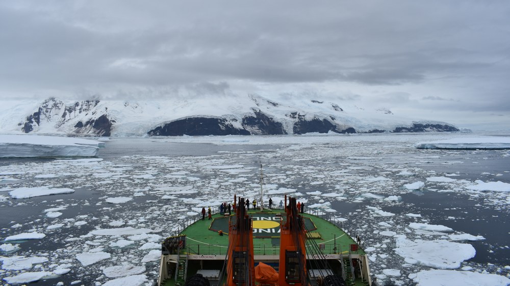
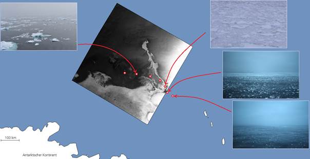
Three weeks ago the research vessel Akademik Tryoshnikov returned from the “Antarctic Circumnavigation Expedition”. This campaign took an international research team once around the Antarctic continent. Scientists at the DLR Maritime Safety and Security Lab in Bremen and Neustrelitz were always there. Not on the ship, but in space. They aided navigation in the ice-covered water by providing images from the TerraSAR-X, Sentinel-1 and RADARSAT-2 radar satellites. For the first time, ice maps generated from the satellite data were sent to the ship in addition to radar images. These maps make it possible to draw conclusions about ice thickness and navigability. In the future these products are to be automatically provided along with the satellite images.
Sea ice is subject to constant change. Within just a few hours the wind can turn, shoving pack ice together over kilometres and causing pressure ridges to form – obstacles that are difficult or impossible even for icebreakers to overcome. Similar situations made the Akademik Shokalskiy unmanoeuvrable in December 2013. At that time, radar images helped rescue teams to better evaluate the immediate ice situation.
The Antarctic expedition proceeded without serious incident. The scientists were pleased about the fact that unnecessary detours could be avoided thanks to timely information from space. Last but not least, this conserves fuel.
The DLR Earth Observation Center (EOC) operates the Maritime Safety and Security Labs in Bremen and Neustrelitz. Their efforts contribute to assuring safe shipping, protecting seas and coastal waters, and assisting public authorities to combat unlawful activities such as hazardous substance dumping, illegal fishing, and piracy. Thematic processors developed in Bremen for such purposes as detecting ships or icebergs are incorporated and operationalised in customised systems created in Neustrelitz. This integrated approach includes additional modules for data fusion, product generation and delivery to users.
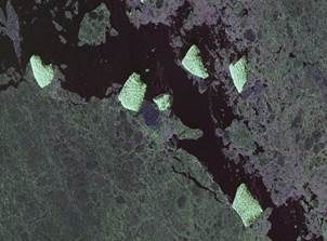
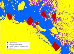
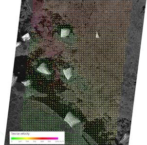
The new processor generates up-to-the-minute ice maps directly after acquisition of the satellite image. It can determine the location and extent of various types of ice, for example, “young ice” and “multi-year ice”. To do this, complex data comprising image features that escape the human eye are analysed. Other processors are being developed to pave the way to detailed insights into the movement of sea ice in high-resolution images of ice floes.


