
Winter Without Snow – DLR analyses snow cover

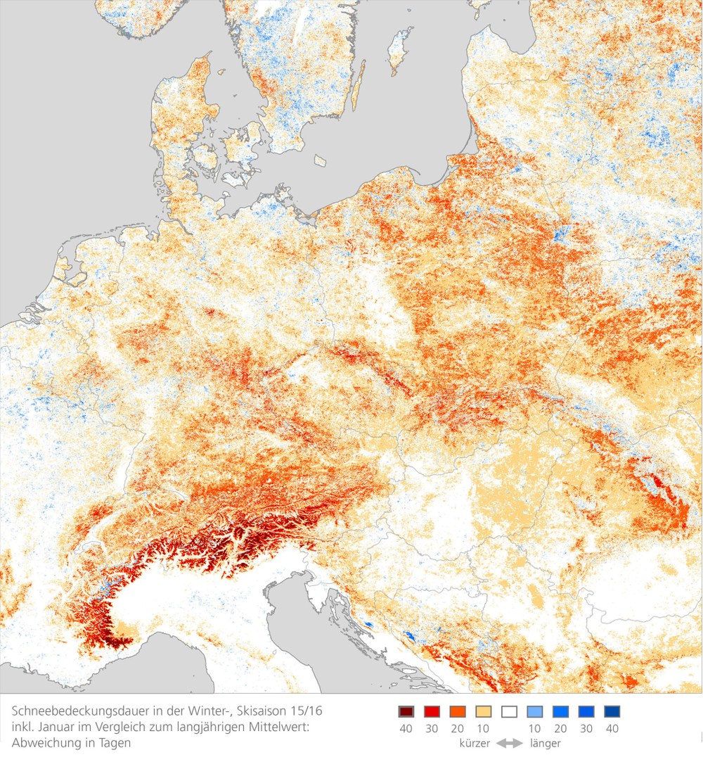
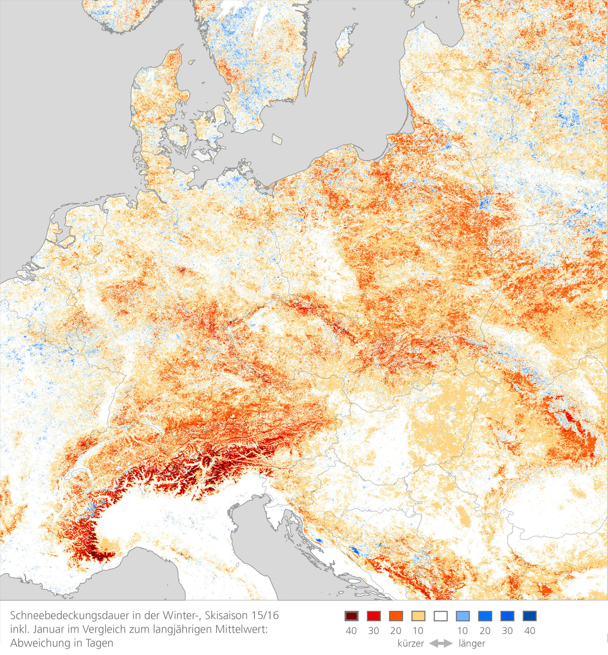
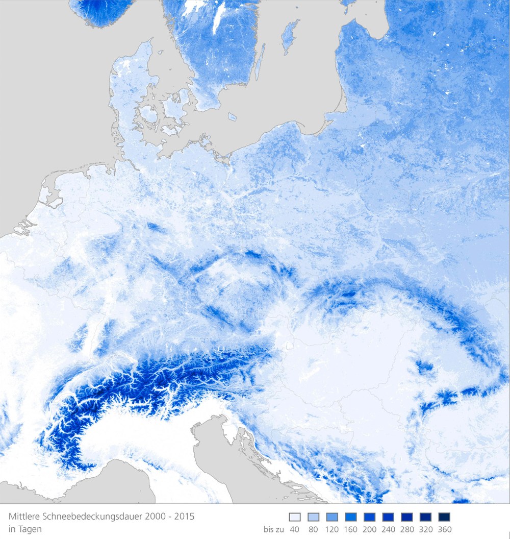
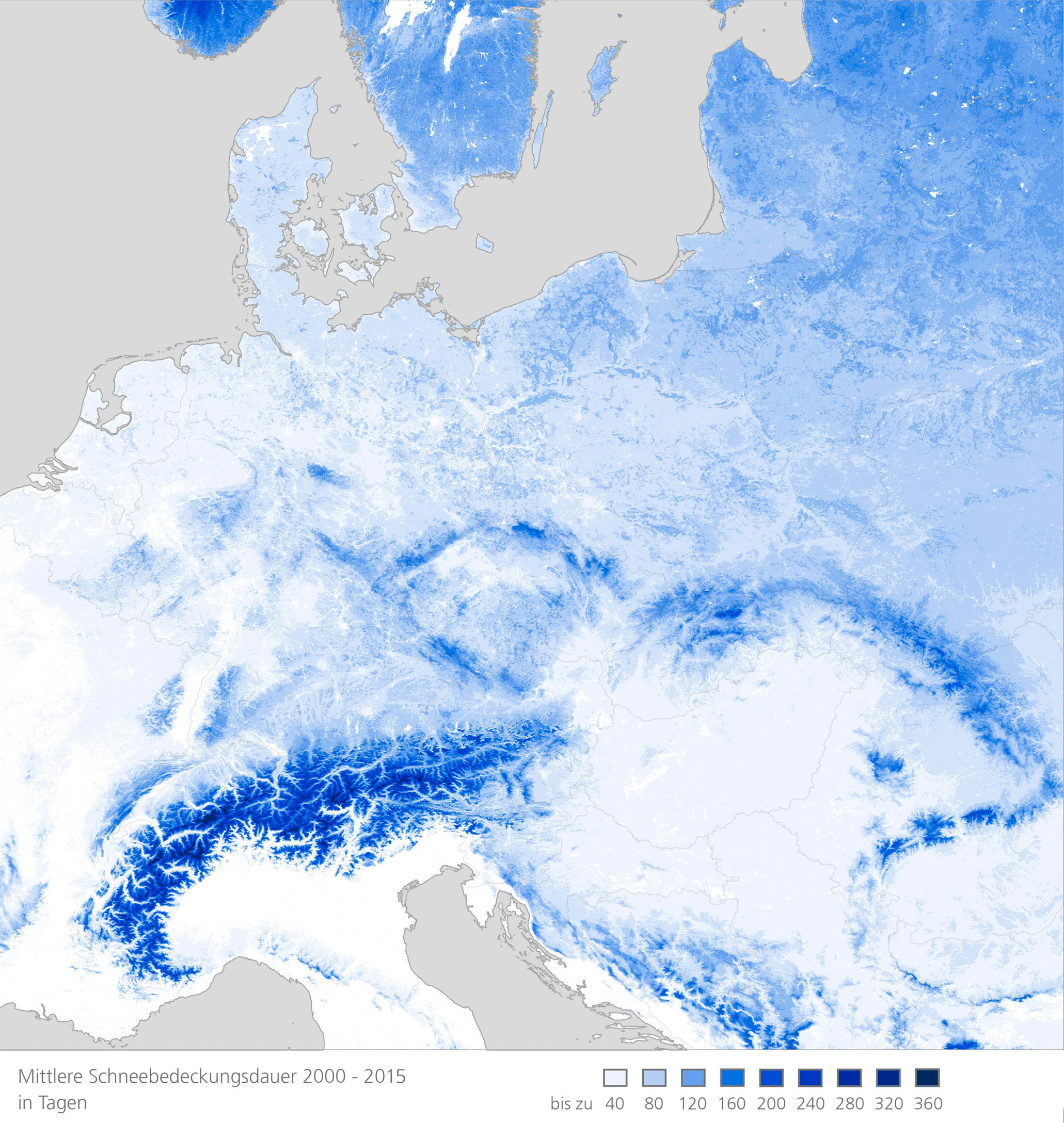
So far, this winter season has disappointed both skiers and winter sports localities. In many places the first snowfall was relatively late, and a mild January caused the thin white layer of snow to melt even at high altitudes. An analysis of satellite images undertaken by the German Aerospace Center (DLR) shows the scale of the lack of snow for all of Europe. Up until the end of January, Europe‘s 2015/16 winter had experienced much less snow than in an average season as far as the duration of snow cover is concerned. Even large parts of the Alps were more than 40 days longer free of snow compared with the long-term average. By mapping the statistical snow cover duration, also called the global snowpack, scientists at DLR’s Earth Observation Center (EOC) can determine the duration of snow cover and the dates of its commencement and termination for almost all locations. The long-term average was calculated using several years of data, and this value was then compared with the values for individual years.
Changes in snow conditions can be forecast with the help of the EOC analyses. An examination of satellite data going back to 2000 reveals that Upper Bavaria is covered with snow for 70 to 80 days on average. The first snow falls in November and the snow cover begins to melt in February. The maps now generated for central Europe include data up to the end of January. A glance at the map for the 2015/2016 winter season says it all: in most of central Europe one was more apt to see spring flowers than a magnificent white landscape.
But the current winter season has not yet come to an end. In the past few years winter often got into full swing only in February, and then brought large amounts of snow. The work of the EOC scientists shows whether it is a question of a short-term outlier or a long-term trend. Dr. Andreas Dietz, an EOC staff member, helped develop the Global SnowPack data set. In his doctoral thesis he could show that over the past 30 years the snow period in central Asia has shifted by as much as two weeks. Both snowfall and snowmelt there begin earlier than previously. This shift, or the reduced snow cover, suggests what might happen in future winters — and they are not apt to be very white. But whether this trend toward warmer winters will indeed continue can only be confirmed in a few years.
Changes in weather conditions are not only important for the tourist industry. The duration of snow cover as well as the date and length of the thaw period affect the growth of natural vegetation, the risk of flooding, the water supply, energy generation, agriculture, food security, and many other concerns. Accurately mapping snow cover and deriving statistics and dynamics for long periods are the preconditions for being able to identify changes and react to them in good time.
In addition to the duration of snow cover, the amount of snow is an important parameter for making precise statements about possible climate trends. The optical data used to assemble the Global SnowPack data set can only reveal snow cover. For that reason research continues on exploiting the data from satellites equipped with other types of sensors.