On 20 and 21 January 2016 the EU project “BASE Platform” (Bathymetry Service Platform) was launched at the EOC Maritime Safety and Security Lab in Bremen. The project has the goal to provide online access to up-to-date, high resolution information on the topography of the ocean floor (bathymetry). Seven European companies and institutions are participating in the Horizon 2020 project, which is being supported with some two million euro. EOC is in charge of the coordination.
Many parts of the ocean have only been roughly measured, or the relevant information is very outdated. This means that existing bathymetric data is often unsuitable for use by the expanding offshore industry. For example, accurate information is urgently needed to find new locations for wind parks.
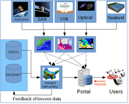
Satellites can help provide a remedy. They supply affordable data for large areas, and these can be used to derive information on the topography of the ocean floor. The EOC research department in Bremen specializes in evaluating radar data. The methodology developed there can be used, for example, to derive the height, direction and frequency of wave fields from radar images, and the DLR scientists can draw conclusions about the shape of the ocean floor from such wave patterns. Other partners contribute optical and altimeter data collected by satellites. The work is being carried out primarily on the basis of data from the European Sentinel fleet.
In order to obtain depth information that is as precise as possible for every area, the satellite images are complemented by in situ measurements using sonar equipment and by models of tide levels. Finally, the data from these various sources of are merged to create a uniform product and then delivered to users.
With this approach, combining automated processes and the availability of timely satellite images worldwide, reasonably priced bathymetry data can be offered. At the end of the two-year project the portal will be maintained by the project partners. The creation of a long-term economical supply source for remote sensing data was one of the main funding criteria within the framework of the EU- Horizon 2020 programme.
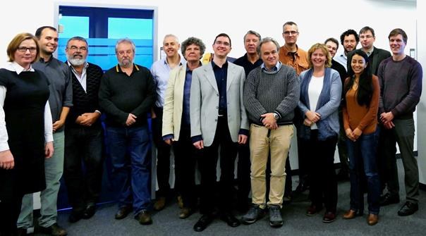
The participants in the BASE Platform kick-off meeting at the EOC Maritime Safety and Security Lab in Bremen

