DLR Science Award 2016 for IMF scientist
At the DLR Annual General Meeting in Bonn, Prof Xiaoxiang Zhu and Sina Montazeri from the DLR Remote Sensing Technology Institute were honoured with the DLR Science Award 2016 for their publication "Geodetic SAR Tomography". The prize honours their work on the geodetic high-precision localisation of dense 4D point clouds generated with TerraSAR-X and a tomographic method. Co-authors were Prof Ramon Hanssen (TU-Delft), Prof Bamler (DLR and TUM) and Christoph Gisinger (TUM). DLR and TUM are closely linked through joint professorships and HGF-funded projects and have jointly developed the "Imaging Geodesy" method.

Prof. Dittus, member of the DLR executive board, and Sina Montazeri of the DLR Remote Sensing Technology Institute

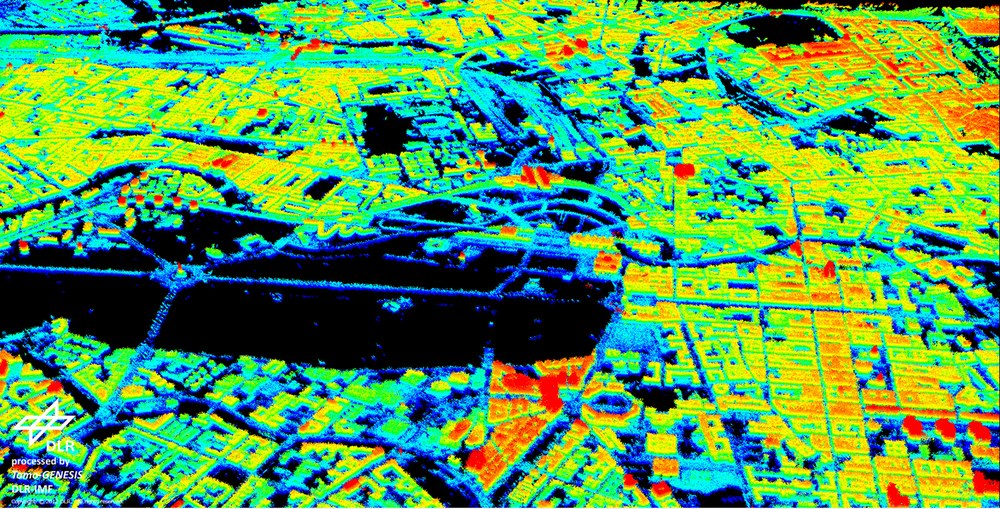
Three-dimensional absolutely-positioned TomoSAR point cloud of Berlin after geodetic fusion of multitrack point clouds.
This allows for a detailed representation of the city where most of the structures can be easily recognized. The absolute height values are color-coded and range from 70 m to 110 m. The horizontal localization accuracy of the point cloud with respect to the LiDAR DSM is approximately 20 cm.
Contact
Prof. Michael Eineder
Acting Co-Director IMF / Head of Department SAR Signal Processing
German Aerospace Center (DLR)
Earth Observation Center (EOC)
Remote Sensing Technology Institute (IMF)
Oberpfaffenhofen, 82234 Weßling
Tel: +49 8153 28-1396
