Enhancing Road Maps by Parsing Aerial Images around the World (ERM-PAIW)
Enhancing Road Maps by Parsing Aerial Images around the World (ERM-PAIW)
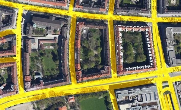
In this dataset, we provide the image characteristics used and the source code of the method. With this methodology, freely available worldwide road maps, such as OpenStreetMap, are supplemented and improved by automated analysis of aerial photographs.
If you use the records or the code, please cite our ICCV paper.
“Enhancing Road Maps by Parsing Aerial Images Around the World”, Gellert Mattyus, Shenlong Wang, Sanja Fidler and Raquel Urtasun, International Conference on Computer Vision (ICCV), 2015.
An example result of our proposed method, where the extracted roads are represented in yellow.

