EAGLE: Dataset for vehicle detection in real scenarios based on aerial images
EAGLE: Dataset for vehicle detection in real scenarios based on aerial images
The automated recognition of different vehicle classes and their orientation on aerial images is an important task in the field of traffic research and also finds applications in disaster management, among other things. For the further development of corresponding algorithms that deliver reliable results not only under laboratory conditions but also in real scenarios, training data sets that are as extensive and versatile as possible play a decisive role. For this purpose, we present our dataset EAGLE (oriEnted vehicle detection using Aerial imaGery in real-worLd scEnarios).
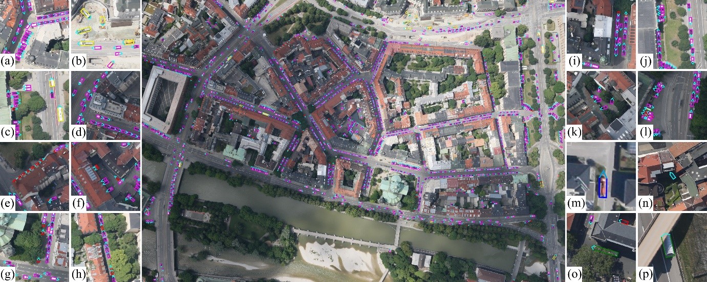
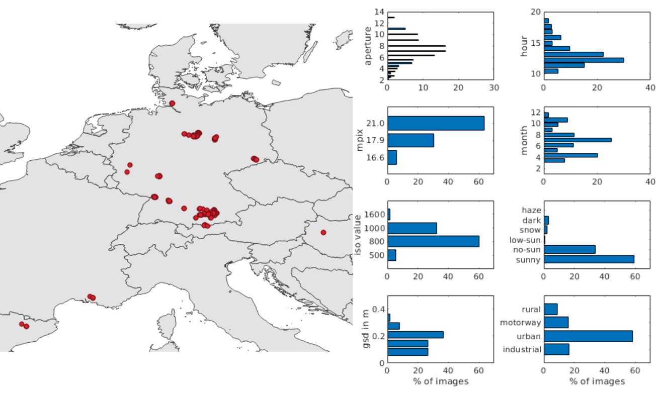
The EAGLE dataset is used to detect vehicles of different classes including vehicle orientation based on aerial images. It contains high-resolution aerial images covering different real-world situations with different acquisition sensors, angles and times, flight altitudes, resolutions (5-45 cm ground pixel size), weather and lighting conditions, as well as urban and rural acquisition regions, acquired between 2006 and 2019. EAGLE contains 215,986 annotated vehicles on 318 aerial images for small vehicles (cars, vans, transporters, SUVs, ambulances, police vehicles) and large vehicles (trucks, large trucks, minibuses, buses, fire engines, construction vehicles, trailers) including oriented bounding boxes defined by four points. The annotation contains the respective coordinates of all four vehicle corners, as well as a degree of orientation between 0° and 360° indicating the angle of the vehicle tip. In addition, for each example, the visibility (fully/partially/weakly visible) and the detectability of the vehicle's orientation (clear/unclear) are indicated.
To evaluate different benchmark algorithms on EAGLE, we propose three different tasks including detection by HBB, RBB and OBB. We use the mean average accuracy (mAP) similar to PASCAL VOC as the evaluation benchmark. We divide the dataset into a training set, a validation set and a test set by randomly assigning images in proportion to each other: 1/2, 1/6 and 1/3 respectively.
Due to its versatility, the dataset can additionally be used for research on haze and shadow removal, as well as super-resolution and in-painting applications.
S. Azimi, R. Bahmanyar, C. Henry, and F. Kurz, "EAGLE: Large-scale Vehicle Detection Dataset in Real-World Scenarios using Aerial Imagery," in International Conference on Pattern Recognition (ICPR), 2020. https://ieeexplore.ieee.org/document/9412353


