Team: Aerosols and Radiation
The focus of the team’s work is on developing algorithms for exploiting satellite data in order to determine the distribution and characteristics of atmospheric aerosols as well as their use for addressing questions relating to climate change, air quality and health, and solar irradiance. New methods investigate the use of machine learning and physics-based approaches for combining output from different satellite instruments in order to derive more information about particles in the atmosphere. These efforts are closely linked to the Copernicus Climate Change (C3S) and Atmosphere (CAMS) services as well as to the ESA climate research programmes “Climate Change Initiative (CCI)” and “CLIMATE-SPACE”. Moreover, the team is responsible for continuous iteration with pilot users in order to produce a detailed analysis of user requirements. This contributes to service-driven evolution of the CAMS services to benefit public authorities as well as commercial users.
The team supervises the scientific work on aerosol algorithms in the CCI programme, thereby contributing to the establishment of international standards for generating climate data records based on the various kinds of information provide by different satellite sensors. In the “International Satellite Aerosol Science Network AEROSAT” (Co-Chair: T. Popp / DFD und R. Kahn / NASA), a forum established in 2013 to facilitate discussions on this matter, ideas are being explored to improve retrieval methodologies for a variety of applications. Experiments carried out in AEROSAT could demonstrate that although regional satellite-based aerosol time series from various instruments yield different absolute values depending on sampling and quality filtering, there are great similarities in their temporal sequence, so they can be used in credible trend analyses.
Embedded in CCI and AEROSAT and in cooperation with metrology experts, the concept of pixel-level error bars for aerosol retrieval using error propagation methods is being further developed and demonstrated. This involves as a high priority careful consideration of the spatial and temporal correlations of all error components. Precise knowledge of the vertical distribution of aerosols is essential for improving the evaluation of satellite data records. Toward this end and building on a feasibility study under the umbrella of the Schneefernerhaus Environmental Research Station (UFS) a 3D measurement scheme using drones is being drawn up with the goal of its mid-term implementation at UFS and other stations in the WMO-GAW network.
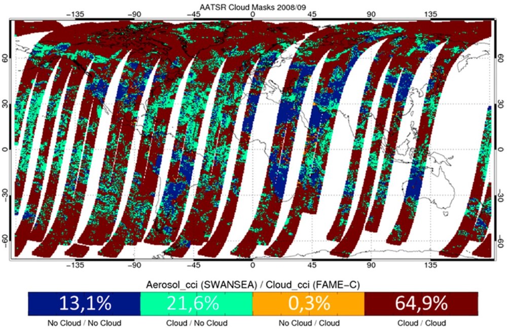
The consistency of independently generated satellite data records for different climate variables must be demonstrated before they can be used as a basis for research on climate change. Toward that end, work common to different CCI programmes (such as finding a comprehensive definition of “consistency” and a strategy for its systematic confirmation) is being coordinated by DFD. In the DFD “Timeline“ project consistent time series for rapidly changing cloud parameters are being developed that take into account shifts in local time of day because of the orbit drift of different satellites.
On the basis of all this R&D work DFD is taking the lead in generating data records that show atmospheric composition (ozone, greenhouse gases, aerosols) for the Copernicus Climate Change Service (C3S) so that these essential climate variables can be continuously monitored. DFD is creating its own data records from IASI und OLCI sensor data as well as error-weighted Ensemble products for the best possible combination of characteristics of several external algorithms for the same sensor. Together with colleagues from IPA, a new Bayesian method for analysing the interaction of aerosols and clouds (the climate’s radiative driver with the greatest uncertainty in the IPCC reports) in satellite and model data records is being developed and applied as part of the DLR MABAK project. Such approaches along with aerosol time series continue under study as to their value for monitoring the Paris Agreement (Global Stocktake) and as climate indicators (the cooling effect of aerosols and clouds in contrast to the warming effect of greenhouse gases).


