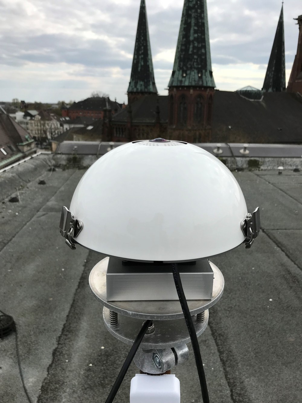
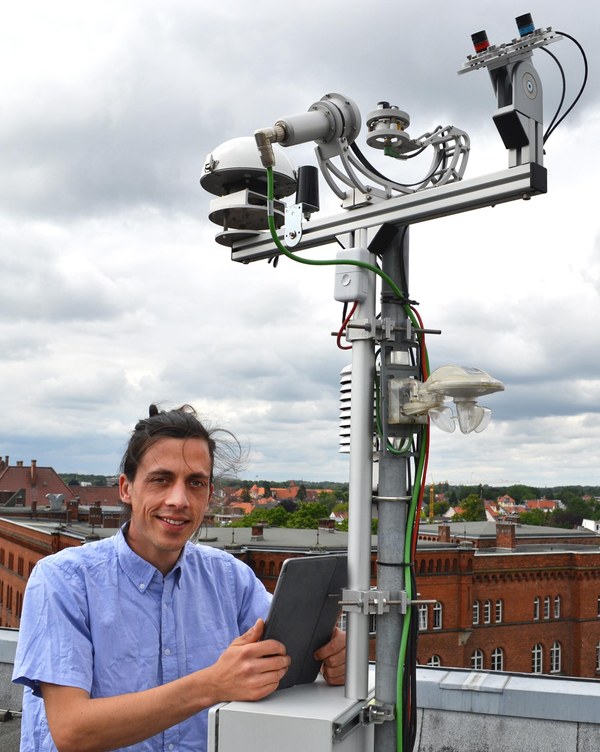
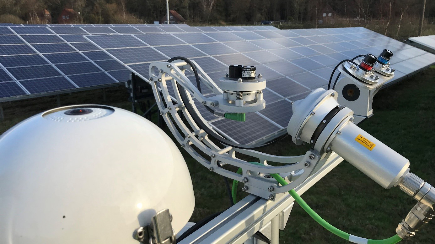
In north-west Germany between Oldenburg, the North Sea coast and the Dutch border, the Institute of Networked Energy Systems operates the unique Eye2Sky cloud camera network as a research infrastructure. The network is growing dynamically and currently consists of around 30 stations. The heart of each station is a cloud camera, also known as an all-sky imager (ASI). This is a commercially available webcam with a fisheye lens supplemented by a ventilation and heating system that ensures optimum image quality even in bad weather. A third of the stations are equipped with a rotating shadowband irradiometer (RSI), other radiation sensors and meteorological sensors for temperature and humidity, for example, to validate and calibrate the algorithms.
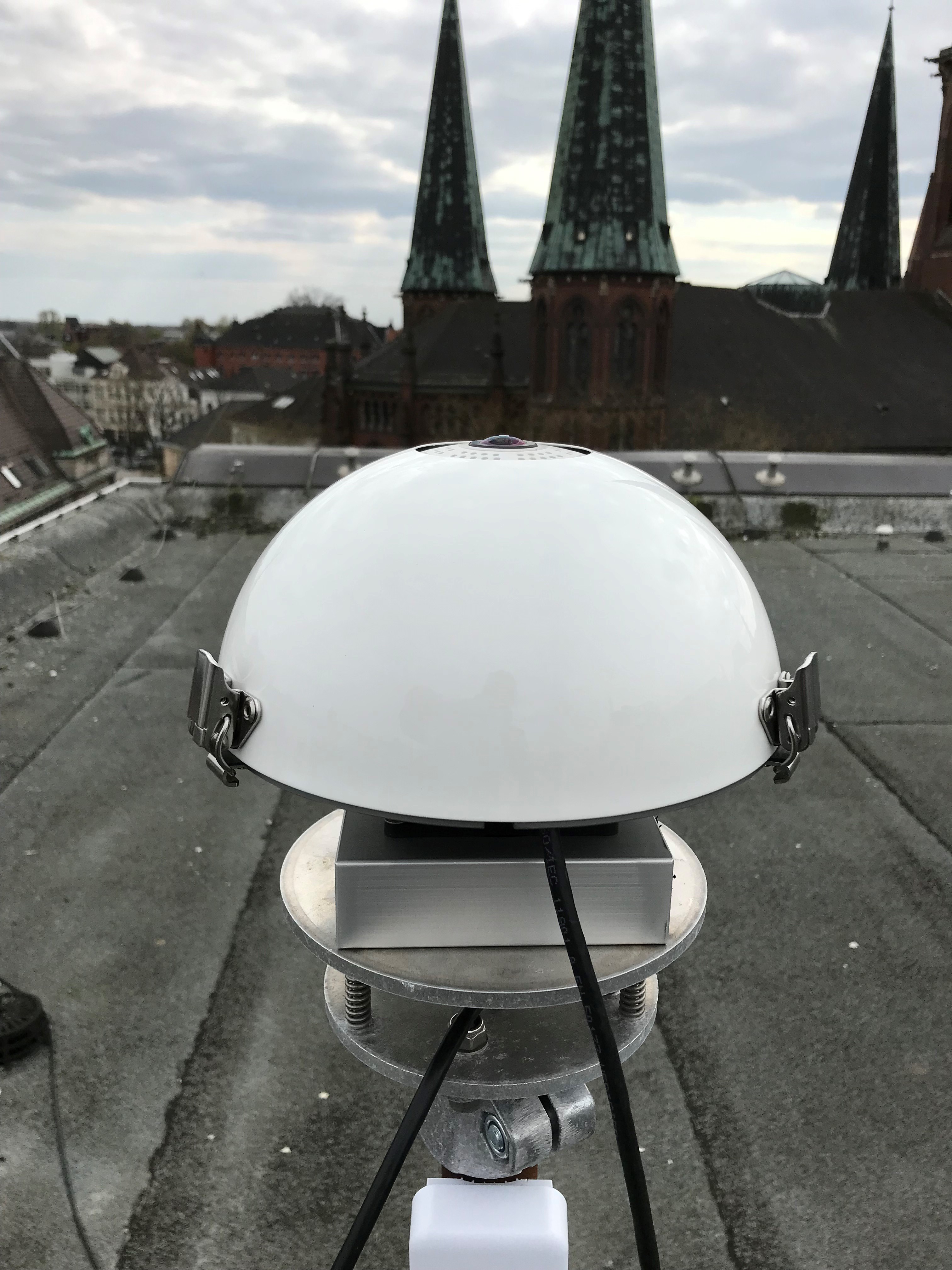
Mobotix Q25 cloud camera with its own ventilation and heating system. A photo of the sky is taken every 30 seconds. The entire sky above the station can be captured through the fisheye lens.
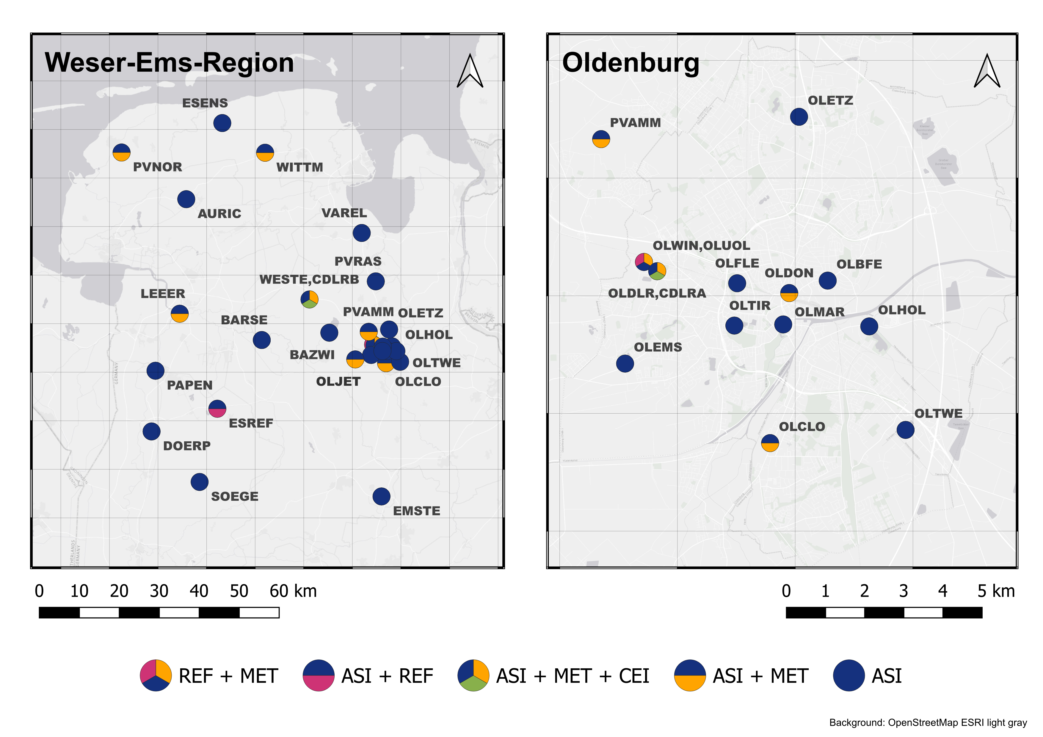
The RSI uses a rotating shadowband to measure the components of solar radiation (global, diffuse, direct) every second. Slightly inclined and south-facing photodiodes measure the irradiation in a non-horizontal plane for additional evaluations. Ceilometers are installed at two locations in the network, which determine the cloud height using lasers and allow the cloud heights derived from ASIs to be validated. The entire network and thus the area of the Eye2Sky laboratory extends over 110x100 km. The station density is lower in the rural area to the west of Oldenburg, where the cameras are distributed over a large area. In the Oldenburg urban area, the station density is significantly higher with 14 stations. This proximity of the cameras to each other allows the clouds to be observed with several cameras from different perspectives. This allows the clouds to be measured with their 3D properties. This allows particularly accurate solar radiation forecasts for the city of Oldenburg.
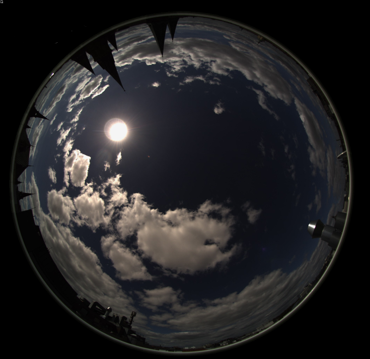
Example image of the sky as seen from the centre of Oldenburg. Cumulus clouds ("fair weather clouds") characterise the summer day.
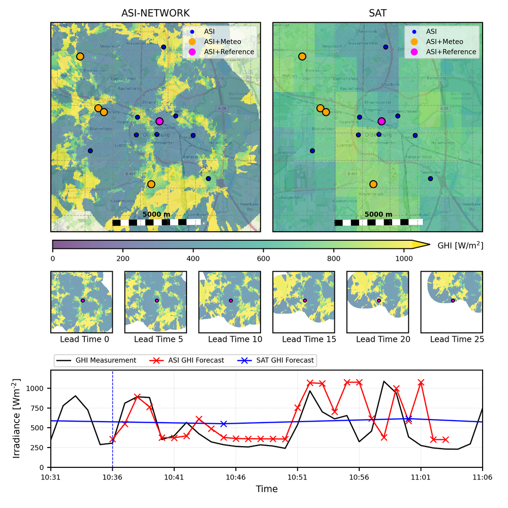
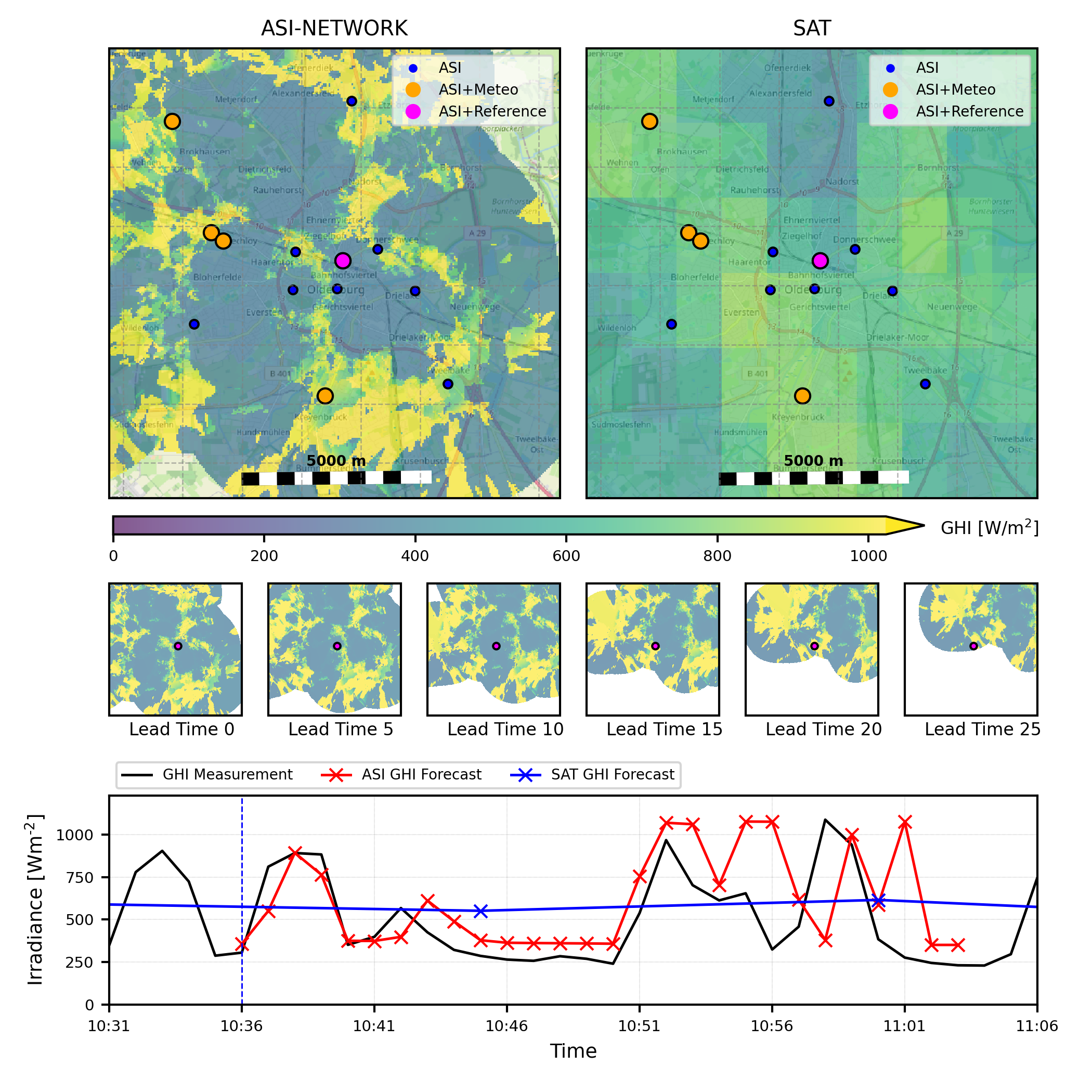
With the help of the WOBAS algorithm developed at the DLR Institute of Solar Research in Almería, Spain, very accurate short-term solar radiation forecasts can be determined from the data collected by the cameras and measuring stations (see ASI video of all active cameras). In contrast to satellite forecasts, a spatial resolution of 50 metres and a temporal resolution of 30 seconds are possible. Figure x illustrates the differences between camera and satellite image-based irradiation maps.
Example of a short-term forecast for the city of Oldenburg in a situation with highly variable cloud cover. The irradiation patterns derived from the camera images in the urban area (top right) show a very heterogeneous distribution of high and low irradiation intensity (light and shade), while the satellite image data only show rough and smoothed patterns. The centre panel shows the forecast distribution for the next 25 minutes. The lower panel shows the data as a time series for the location of the OLDON measuring station in the city centre. The measured irradiation values are used to validate the forecasts.
Overview of the Eye2Sky measuring stations in north-west Germany (right) and in detail in the city of Oldenburg. The colour of the circles indicates the instrumentation of each station (ASI = camera only, MET = meteorological sensors, CEI = ceilometers, REF = reference stations).
The cameras have a limited visibility that varies with the height of the clouds. This means that forecasts can currently be made up to 30 minutes in advance and, in special weather situations, up to approx. 1 hour in advance. The limited spatial range combined with high spatial resolution suggests combining the forecast from the cloud camera network with a satellite forecast for short-term forecasting and/or a numerical weather forecast in order to extend the forecasting horizon. This was tested, for example, in the European research project Smart4RES and in the research project HyForPV.
The high-resolution solar radiation forecast allows precise statements to be made about the short-term solar radiation intensity down to street or neighbourhood level. For example, the movement of a large cloud over the city of Oldenburg and its effect on the feed-in of solar power into the local power grid can be determined and predicted. With the steady increase in PV systems on rooftops and open spaces, expectations of forecasting quality and the integration of weather forecasts into smart energy management systems are rising, both for grid operators and in neighbourhoods, commerce, industry and private homes.
The Energy Meteorology group works closely with the other departments at the institute to achieve this. A direct link to the Emulation Centre for Networked Energy Systems (DLR_NESTEC) is currently being prepared. In ENaQ2, the use of short-term forecasts to optimise the energy management of an innovative district in the north of Oldenburg is being investigated. Forecast data from a cloud camera network is also very useful for larger photovoltaic systems in the MW to GW range in order to forecast the strong changes in production caused by cloud dynamics at short notice and to optimise the use of battery storage. Data from the Eye2Sky laboratory in and around Oldenburg can also be used at the sites of large PV power plants to test the use of a local ASI network in feasibility studies. This can be used, for example, to comply with grid operator requirements regarding maximum ramp heights or to reduce costs on the energy markets caused by incorrect forecasts.
If you are interested in the cloud camera network, please send us a message using the contact field at the bottom of this page.
More information
A data set consisting of camera images and meteorological measurement data from 2022 is publicly available on the Zenodo platform.
Departments and research groups related to the measuring network Eye2Sky:


