Networked cloud cameras forecast light and shadow


- From 2020, 34 cloud cameras will predict solar power output across large parts of the Weser-Ems region of Germany, street-by-street and minute-by-minute.
- The cameras will be able to image clouds at far higher temporal and spatial resolutions than satellites.
- The Eye2Sky measurement network will help improve the stability of power grids.
- Focus: Energy, climate change, energy meteorology
Variations in the intensity of the sunlight over solar power plants is having an increasing impact on the energy supply system. In the future, grid operators will have to react quickly to the passage of individual cloud formations, because the shadows they cast immediately affect the energy yield of the solar panels across entire regions. Precise cloud forecasting will be key to ensuring the stability of future power grids fed by renewable energy sources. In order to gain a better insight into what is happening in the sky, the German Aerospace Center (Deutsches Zentrum für Luft- und Raumfahrt; DLR) is currently building the 'Eye2Sky' cloud measurement network in northwestern Germany. The project aims to enable short-term forecasting of solar power output with unprecedented resolution. If everything goes according to plan, from 2020 it will be possible to predict this output with street-by-street and minute-by-minute resolution across large parts of the Weser-Ems region – making Eye2Sky a pioneering project for improving power grid stability in Europe.
34 cloud cameras transmit 360-degree images every 30 seconds
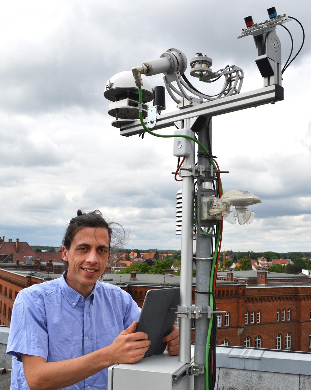
The network is currently being installed between Oldenburg, the North Sea coast and the Dutch border. When complete, it will comprise 34 stations equipped with cloud cameras. These cameras will observe the sky above their locations within an average radius of four kilometres and with a 360-degree view through a fisheye lens. Each camera will send an image of the sky to a high-performance computer every 30 seconds. The computer will then use these data to generate a forecast for the areas of light and shadow on the ground. This forecast will have a resolution of metres and seconds and will be sent to every solar power plant in the region. In addition to their cloud camera, some locations are equipped with other meteorological instruments for measuring direct and diffuse solar radiation and air temperature.
Valuable information for feed-in and storage management
"Eye2Sky will allow us to accurately predict where, when and to what extent solar power can be generated. This will enable us to generate valuable data to help network operators design intelligent feed-in and storage management systems," explains Project Manager Thomas Schmidt of the DLR Institute of Networked Energy Systems in Oldenburg. However, the energy meteorologist also believes that the Eye2Sky concept has other potential applications for the operation of major solar plants. "Cloud cameras allow for high-resolution simulations that can be used to optimise energy production by, for example, generating error diagnostics or performing shadow analysis." Due to the precision of this short-term forecasting, the data may also prove useful for electricity traders and private facility operators who could optimise their own energy consumption based on such forecasts.
Future requirements call for better short-term forecasting
The continuing construction of solar power plants may cause problems for the power grid, particularly in the event of short-term fluctuations in the available supply of electricity. "The forecasting tools that have been used so far, based on satellite images or classic weather models, will not be sufficient in the future," explains Schmidt. "We believe that there is a need to develop methods for faster, more precise forecasting." While predicting the course of clouds may seem easy at first glance, the combination of the many factors that affect cloud formation is so complex that, up until now, short-term, regional forecasts have only been marginally better than those based on human observations. This is still true even with the technologies of the space age. "Compared to satellite images, the cloud cameras allow us to observe the clouds at far higher temporal and spatial resolutions. But it is the shadows they cast, rather than the positions of the clouds themselves, that are key to our applications."
Novel methods for measuring cloud altitudes
A cloud’s altitude is particularly important when it comes to accurately determining the location of its shadow on the ground. However, measuring this height is far from easy. To help with this, the Eye2Sky project team is collaborating with the DLR Institute of Solar Research to test out a new method for calculating cloud altitude. "We have planned for a denser arrangement of cloud cameras in the Oldenburg area so that the camera images overlap," says Schmidt. "This allows us to capture local cloud cover from different perspectives at the same time. We can then determine the altitudes of the clouds using geometry. The more precise the measurement of the cloud’s altitude, the more accurately we can predict the location of the its shadow on the ground. This is crucial for a good local and temporal forecast of cloud shadow and predicting the resulting solar energy that can be fed into the power grid."
Robust power grid operation
A parallel project to Eye2Sky is focused on the advantages of using a network rather than an individual camera. By using multiple cameras with overlapping images, the inaccuracies of individual systems can be identified and corrected. "The projects being carried out alongside Eye2Sky are closely associated with other ongoing research activities at our institute. They all serve the shared goal of developing new network technologies and architectures to ensure the robust operation of power grids that use high proportions of energy from renewable sources," says Thomas Vogt, Head of the Energy Systems Analysis Department at the Institute of Networked Energy Systems. "As we strive for a successful energy transition, we face the challenge of developing innovative individual technologies and integrating them, especially in urban environments."
