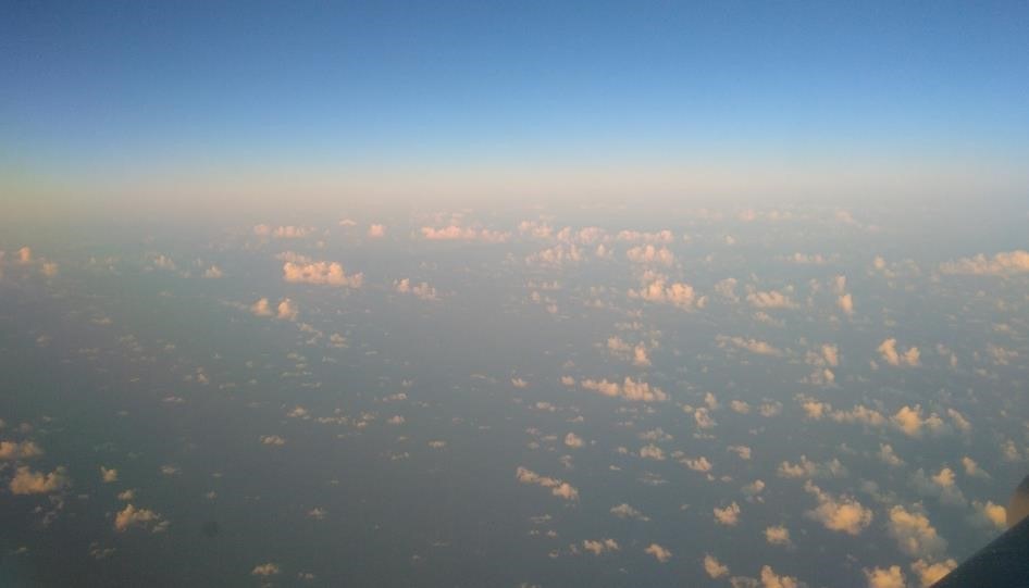
Typical scene with broken clouds embedded in the Saharan dust as seen from the Falcon shortly after sunrise, just before Aeolus passed on its ascending orbit. Accurate measurements of wind are a demanding task for Aeolus in such a heterogeneous atmosphere, given the aerosol and clear air wind channel combination and the comparably coarse horizontal and vertical resolution.
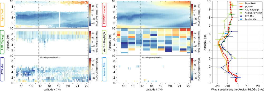
Preliminary results of wind observations from ground up to 10 km altitude along the Aeolus evening underflight between 15°N and 22°N on September 10, 2021. The wind data of the 2-µm DWL and A2D Rayleigh as well as Mie channels are shown in the left column (all projected to the Aeolus HLOS). The right column gives ECMWF and Aeolus wind fields for both channels in the middle. Obvious is the higher vertical and horizontal resolution of the airborne lidars and that Aeolus often incorrectly classified the winds inside the actually dust-laden layer below 6 km as clear-sky Rayleigh winds. All plots share the same color scale. The right plot depicts the corresponding wind profiles of all six data sources while overpassing the ground stations in Mindelo (black dashed line in the left plots).
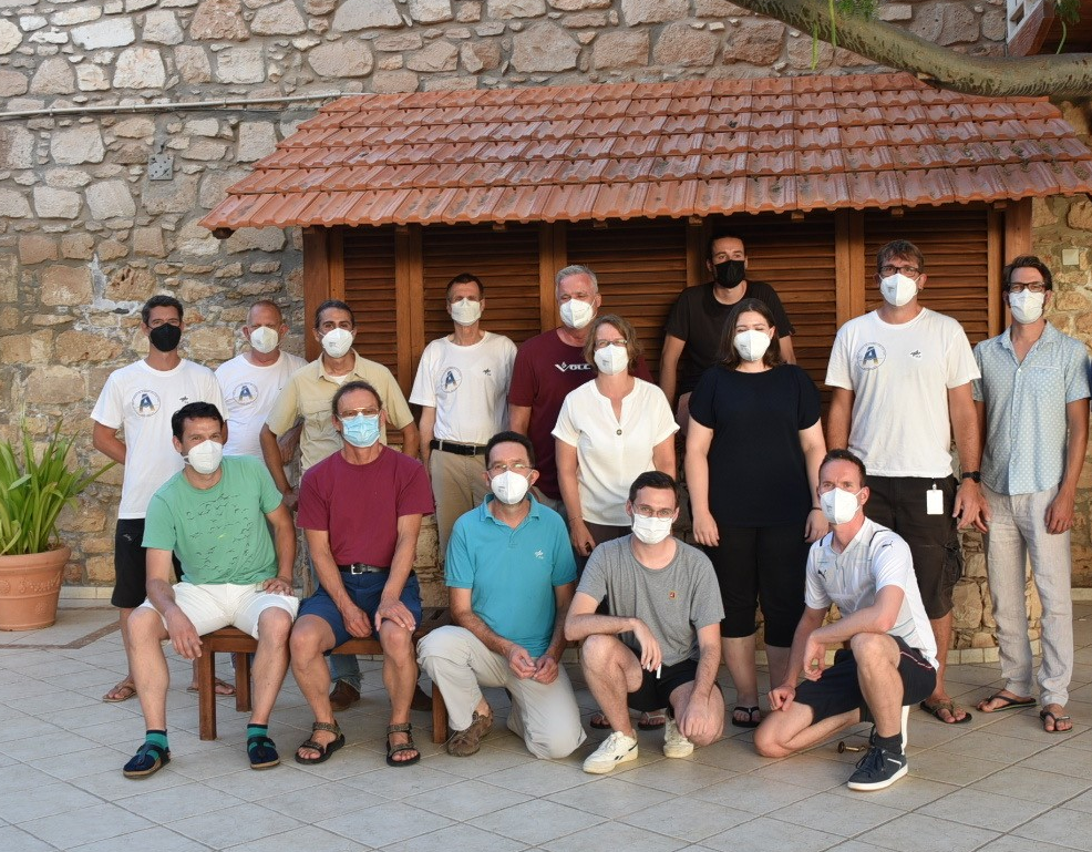
In the frame of the Project, the outstanding experience in lidar-based wind profile remote sensing at the Institute of Atmospheric Physics brought a team of 20 lidar scientists and engineers from the Institute of Atmospheric Physics (IPA) and Flight Experiments Facility (FX) to the Cape Verdean island of Sal in September 2021. Two Doppler wind lidars were operated onboard DLR’s Falcon 20 to support the ESA wind lidar satellite mission Aeolus by validating its wind data products. After three successful airborne validation campaigns over Europe and Iceland, this time the focus lied on the Aeolus performance in the tropics, which is an important area for wind measurements and their impact for improving numerical weather prediction (NWP).
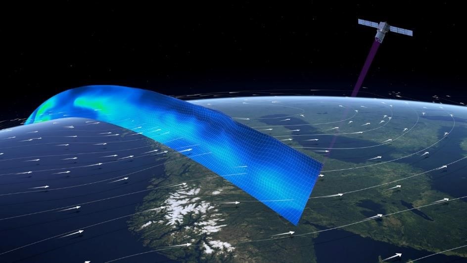
Artist view of the Aeolus satellite measuring a curtain of wind profiles along the orbit with its Doppler wind lidar (DWL).
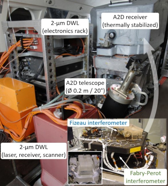
Between August 2018 and July 2023, Aeolus carried its single payload ALADIN. It was the first ever Doppler wind lidar, that was able to measure profiles of the horizontal wind speed in the atmosphere from its 320 km high polar orbit aligned with dusk and dawn. The wind profile was obtained by analyzing the Doppler shift in the return signal of ultra-violet (UV) laser pulses along their path through the atmosphere. To account for the different spectral characteristics of the detected laser return stemming from either Mie scattered light from particles or Rayleigh scattering from molecules in the atmosphere (or a combination of both), the Aeolus receiver optics were equipped with two dedicated interferometers. This unique combination of a Fizeau interferometer for analyzing the spectral features of Mie scattered light and a dual-channel Fabry-Pérot interferometer for analyzing the Rayleigh return enabled to measure the Doppler shift and with that the wind along the line of sight (LOS) from an altitude of typically 25 km down to the ground under various atmospheric conditions. This LOS wind information was used to determine the horizontal wind (HLOS), which was assimilated in near real time into the NWP weather prediction models of e.g. the ECMWF (European Centre for Medium range Weather Forecast) and German Weather Service, DWD (Deutscher Wetterdienst). The global wind information is key for accurate NWP which the Aeolus data has already demonstrated, especially in regions where other wind data sources are sparse, like in the tropics.
Validating the Aeolus wind measurement performance
The IPA team installed two downward-looking DWLs aboard the DLR Falcon to prepare for flying high underneath the satellite measurement track. Co-funded by ESA and DLR, the ALADIN Airborne Demonstrator (A2D) has been developed at IPA already in 2005. It is built around the sophisticated optical spectrometers and detection electronics from the ALADIN pre-development phase. As such A2D features a high degree of commonality with the Aeolus-specific optical receiver and is designed with a similar pulsed UV laser emitting at 355 nm and a 20 cm diameter telescope, all optimized for Doppler wind measurements from ground and aboard the DLR Falcon research aircraft. Parallel reference measurements have been carried out with the aerosol-scattering-sensitive, scanning coherent 2-µm DWL that was also further developed at IPA enabling to measure the wind vector profile with high accuracy and precision. In combination with the 2-µm DWL the A2D has allowed to explore limits in operations and algorithms relevant for Aeolus as a result of various measurement campaigns already during the mission preparation phase (e.g. WindVal, NAWDEX). Together with the in-situ wind measurements of the Falcon nose-boom sensors, wind profiles are sampled from the flight altitude down to the ground with a higher vertical and horizontal resolution than Aeolus. The knowledge and experience gained from the ground and airborne deployment of this wind lidar tandem was an integral part of the fast and successful Aeolus commissioning after launch and continued to support the mission validation on the trail of the wind with a series of airborne campaigns in Europe and Iceland 2018 and 2019. It also was the condensation nucleus for the Aeolus Data Innovation and Science Cluster (DISC), established at IPA in close cooperation with international partners.
Delayed by more than a year due to logistical constraints caused by the COVID-19 pandemic, the IPA team with the two lidars aboard the DLR Falcon 20 finally left Oberpfaffenhofen in September 2021, supported by eleven members of the Flight Experiments facility, with the goal to conduct AVATART (Aeolus Validation Through Airborne lidaRs in the Tropics), the final Aeolus airborne validation campaign in Sal, Cape Verde.
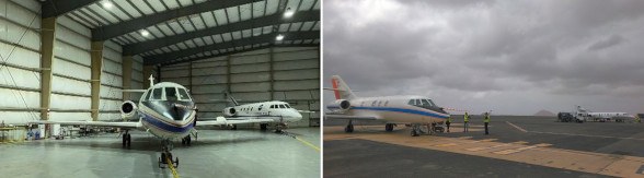
DLR (front) and SAFIRE (back) Falcons ready to roll out of the hangar on Sal Amílcar Cabral International Airport before an early morning Aeolus underflight (left) and while preparing for an ascending orbit flight during dawn with take-off typically 1 hour before sunset (right).
AVATART is the DLR contribution to the international Joint Aeolus Tropical Atlantic Campaign (JATAC), organized by ESA and NASA to bring together several airborne and ground based instruments. The JATAC campaign also included the French SAFIRE Falcon 20 aircraft equipped with a UV Doppler wind lidar, Doppler radar, dropsondes and in-situ aerosol instrumentation.
Because the NASA DC-8 flying laboratory was operating from the US Virgin Islands on the other side of the Atlantic, joint underflights of Aeolus were mainly coordinated with the SAFIRE Falcon flying the CADDIWA campaign, but also with a light aircraft from the Slovenian University of Nova Gorica and the ground measurement site located at the Ocean Science Center Mindelo on a neighboring island forming the ASKOS contribution to JATAC. Among the various goals of JATAC concerning aerosol characterization and tropical dynamics in the frame of Aeolus and in preparation of the next ESA lidar mission EarthCARE, AVATART has a clear focus on wind measurements in parallel with Aeolus. With its unique combination of the 2-µm reference DWL and the A2D, it is studied how the data coverage, accuracy and precision of the Aeolus wind products are influenced by the tropical atmospheric conditions in the region. These are for example airmasses loaded with Saharan dust up to 6 km being transported eastward within the Saharan Air Layer (SAL) along the African Easterly Jet as well as subtropical jet winds north and the Intertropical Convergence Zone south of Sal, all with the associated different cloud systems. The Cape Verde archipelago was a perfect base to operate in the middle of the tropical weather of interest. As already experienced during the previous Aeolus validation campaigns, the dusk-dawn orbit of the satellite required the teams to take their measurement either very early or late during the day.
Flight Planning
To identify the most appropriate scenes for Aeolus underflights with low cloud coverage and interesting wind situation, already three days ahead of each measurement flights, flight plans were discussed based on the most recent forecast. Among other classical forecast products, also a novel 3D visualizations software Met.3D was tested. It allows to combine the different parameters of interest resulting in a comprehensive 3D overview suited to identify the part along the Aeolus track which provided the targeted gradients in aerosol load and wind speed, but is at the same time preferably free of extended high cloud fields. The latter are avoided to maximize the measurement overlap area between Aeolus and the airborne lidars below a typical Falcon flight altitude of 11 km.
The Aeolus orbit weekly repeat cycle allowed to reach several overpasses of the dawn or dusk descending and ascending orbits, respectively, which were within reach of the Falcon from Sal as shown below (week days are color coded). Thanks to often favorable weather conditions eleven underflights could be performed of which five could be coordinated with the campaign partner aircraft. A special focus lied on the Friday evening flights which directly overpassed the ground measurement stations at Mindelo. The latter are mainly equipped with lidars and a radar and provided comprehensive wind and aerosol data for comparison purposes.
Results
After the return to Oberpfaffenhofen, it is now the time to analyze the data collected during the AVATART flights and compare it to Aeolus products as well as the measurements of the various campaign partners. Already a quick look at the preliminary data analysis reveals that the A2D measured significantly more valid Mie winds within the dust-laden SAL below 6 km than Aeolus did. An example is shown in the wind scene below that was captured during the ascending orbit also passing Mindelo on September 10 (bold red UF3 in the above picture). This Mie scattering region (even more obvious in the sensitive 2-µm DWL signal coverage) proves that in many cases the Aeolus processor detected valid clear Rayleigh atmosphere winds inside the dust layer instead of Mie winds. These Rayleigh winds are of decreased quality and likely less accurate than Mie winds which are optimized for aerosol scattering characteristics. A2D signals confirm that a more distinctive separation of Mie and Rayleigh winds is in principle possible with the Aeolus type receiver.
The main task in the coming months of data analysis will be to detect such and more error sources and provide possibilities for optimizing the Aeolus algorithms in close cooperation with the Aeolus DISC and JATAC partners. This has the potential to improve the Aeolus data quality during its remaining lifetime (currently planned well into 2022), but is also expected to provide benefits for the reprocessing of the Aeolus mission results since 2018. Further ahead the findings, methods and lessons learned from the AVATART campaign and JATAC will pave the way for the success of the upcoming European EarthCARE mission and potential Aeolus follow-on satellites.