
Aircraft Measurements of Carbon Dioxide and Methane over Canada
Coal mining, oil and gas production, landfill sites and agriculture – those are anthropogenic sources of the greenhouse gas methane (CH4), which is the biggest contributor to climate change after carbon dioxide (CO2). In addition, large wetlands and thawing permafrost soils are one of the most important but least understood natural sources and sinks in the global CH4 and CO2 budget. In order to investigate more precisely how much these sources emit in detail and how natural and anthropogenic sources can better be separated in the analysis, the German research aircraft HALO was deployed over Canada in August and September 2022. In the frame of the CoMet 2.0 Arctic mission (Carbon dioxide and methane), the German Aerospace Center (DLR) is collaborating with partners from the Max Planck Institute for Biogeochemistry in Jena, the University of Bremen and the Ludwig-Maximilians-Universität (LMU) of Munich to investigate climate gas emissions more accurately and comprehensively and to make future climate forecasts more precise.


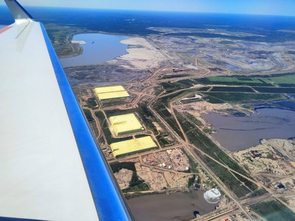
Canada is an ideal target area for such studies. After Siberia, it is home to the largest Arctic and boreal wetlands in the world, such as the Hudson Bay Lowlands, which cover an area greater than Germany. On the other hand, the Canadian province of Alberta is one of the largest suppliers of oil and natural gas in the world. The oil sands in Alberta are among the largest crude oil reserves on Earth. Thus, the international airport of Alberta's capital Edmonton was chosen as the campaign base for CoMet 2.0 Arctic. Within the framework of a total of about 135 flight hours, including the transfer flights from Oberpfaffenhofen, various target areas in Canada were approached from there. These include the large Canadian wetlands such as the Mackenzie River Delta, the Peace-Athabasca River Delta, and the Hudson Bay Lowlands on the one hand, and anthropogenic sources such as the Athabasca Oil Sands, the gas production regions in western Alberta, and open-pit coal mines in the Rocky Mountains on the other. In some cases, the measurement flights were coordinated with NASA and Canadian partners. A large team was involved in the preparation of the flights, in the operation of the instruments, and also, in Germany, in the modelling and forecasting of the greenhouse gas fluxes and the weather conditions over Canada. Flight planning was accompanied by extensive forecast simulations using a coupled global/regional climate chemistry model. As an input, greenhouse gases from different global and regionals emission inventories were incorporated. This was an important prerequisite for successful flight planning and execution of the measurement flights.

In addition to addressing scientific questions, the mission also served to test new types of instruments for monitoring greenhouse gases and to prepare future satellite missions. Developed at the DLR Institute of Atmospheric Physics, the CHARM-F (CH4 Atmospheric Remote Monitoring) lidar instrument enables the measurement of methane and CO2 independently of sunlight, from a great distance and with a high degree of accuracy. CHARM-F was developed as an airborne demonstrator for the French-German climate mission MERLIN, which will measure methane globally from satellite from 2028 onwards. Because a lidar brings its own light source, the laser, MERLIN is - unlike most other remote sensing techniques - independent of sunlight. Therefore, MERLIN is able to measure at all latitudes regardless of time of day or season. Especially for the high Arctic latitudes were low solar irradiance is prevailing this is a crucial advantage.

In addition, HALO carried the MAMAP2DL imaging spectrometer from the University of Bremen, which captures methane and carbon dioxide images from local sources and is also an airborne demonstration experiment for future satellite sensors such as CO2M (Copernicus CO2 Monitoring Mission). The hyperspectral imaging spectrometer specMACS from LMU Munich also characterizes the reflectivity of the ground and allows the precise detection of clouds that interfere with methane remote sensing. The scientific instrumentation was complemented by two cavity ring-down spectrometers from the Max Planck Institute for Biogeochemistry in Jena and from DLR, which measure the most important greenhouse gases in situ, as well as a flask sampler to determine these and other gases in subsequent laboratory analyses of the collected air samples.
All instruments worked flawlessly and a comprehensive and valuable data set has been collected. The data analysis already started on site and is in full swing now.
Further Reading