Article from DLRmagazine 171: A combination of remote sensing data grants new insights into the structure of forests
Deep into the forest
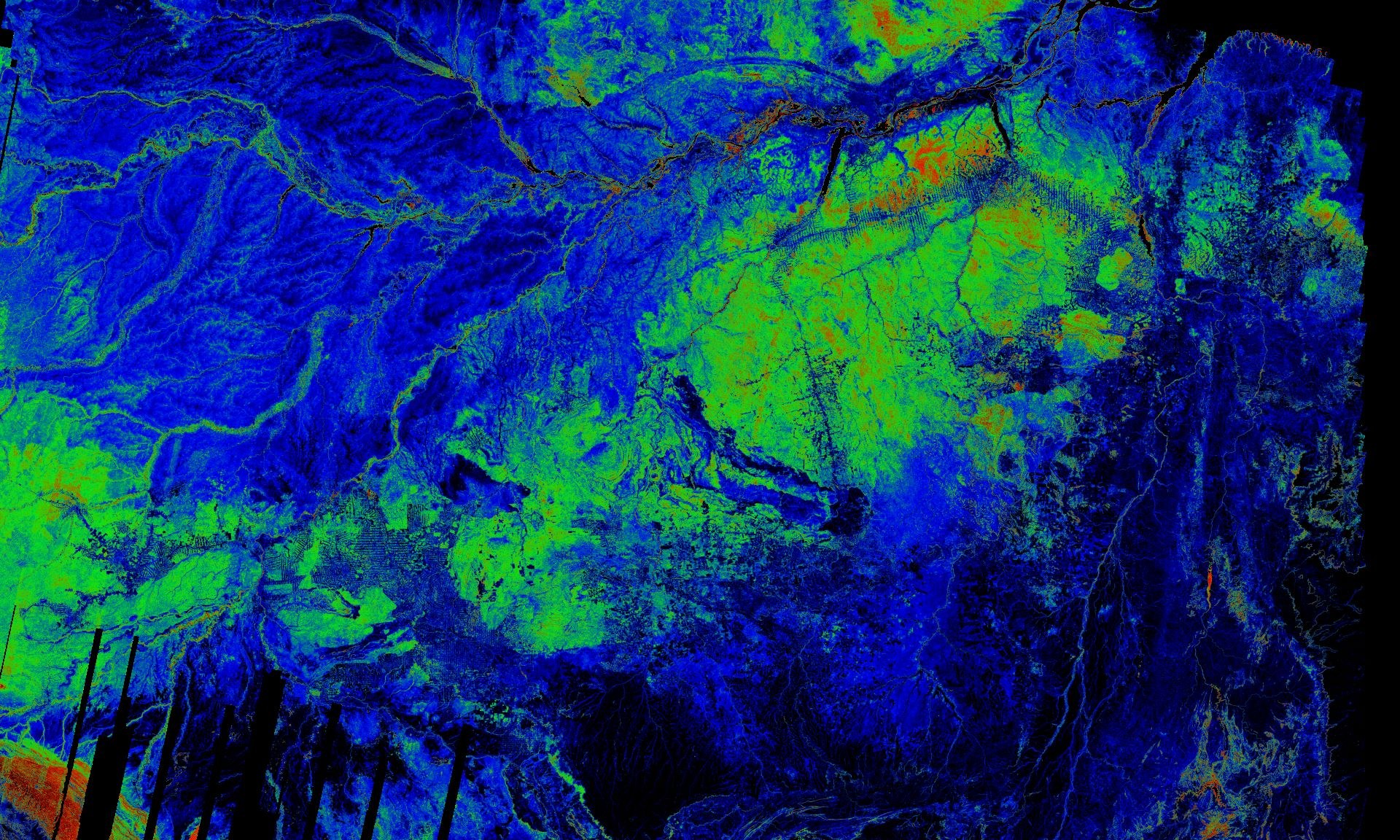
Amazon in the eyes of TanDEM-X
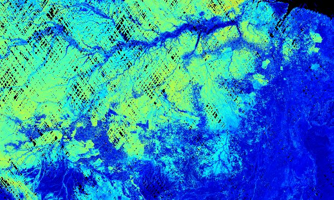
DLR researchers used TanDEM-X measurements to calculate forest density of this region of the Amazon rainforest. The map has a resolution of 100 metres.
Forests are gigantic carbon reservoirs – they store half of the terrestrial carbon. They also control the water and carbon transport between the ground and the atmosphere. As such, they play an important role in climate change. Changes in temperature and precipitation and the intensification of extreme weather pose major threats to forests and their role. For this reason, knowing the condition of Earth's forests and how their spatial structure is changing is especially vital. To this end, DLR researchers have combined data from various remote sensing missions. But that's not all: a future satellite mission has the potential to reveal the spatial forest structure and its change over time with unprecedented detail.
Mapping the structure of forests by means of remote sensing techniques is particularly challenging because of its strong spatial variability, which is the result of natural, climatic and anthropogenic processes. As a result, the vast majority of remote sensing data cannot provide reliable information about key parameters such as vegetation structure, height or biomass.
Twin satellites characterise Earth's forests
The German TanDEM-X mission was the first to capture elements of vertical forest structure. It consists of two X-band synthetic aperture radar (SAR) satellites flying in formation and has been mapping Earth since 2010. TanDEM-X uses interferometric and tomographic SAR measurements. Their data have given researchers an initial impression of the potential that the 3D forest structure offers for characterising forests.
When radar waves penetrate into forest, a complex interaction occurs. To make it computable, physical models are used that make it possible to determine relevant forest structure parameters from the radar measurements, even if they cannot be measured directly. However, in the case of TanDEM-X the amount of radar measurements is not sufficient to provide enough information to determine the forest structure parameters of the model.
To get around this problem, the researchers used measurements from NASA's Global Ecosystem Dynamics Investigation (GEDI) mission. GEDI is a waveform lidar system on board the International Space Station ISS. Since it entered operations in late 2018, the system has provided more than 10 billion lidar waveforms to date along its designated ground track between 51.6 degrees north and 51.6 degrees south. Combining the interferometric TanDEM-X measurements with GEDI's lidar waveforms makes it possible to generate continuous largescale forest canopy height and density maps.
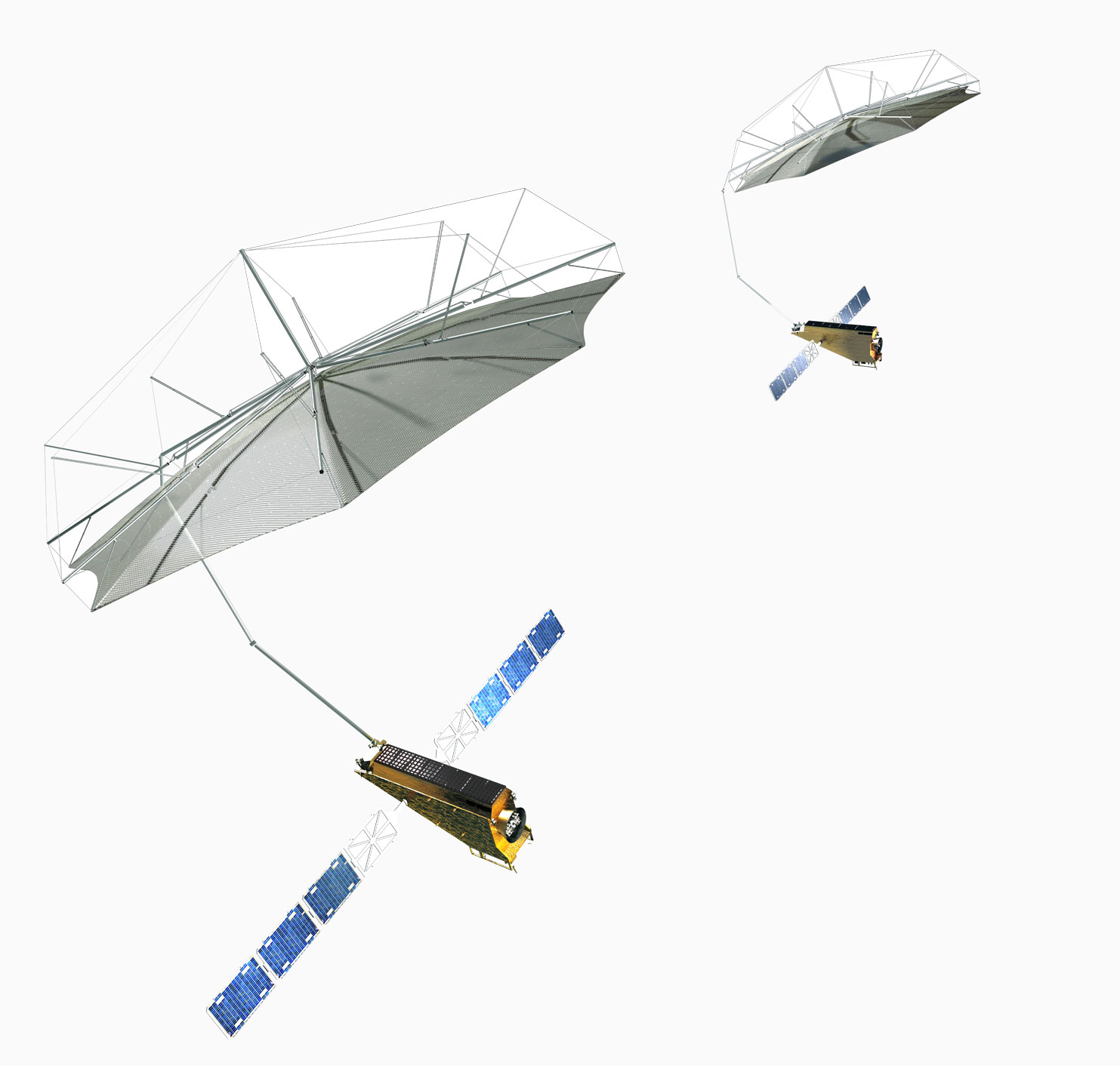
The twin satellites of the Tandem-L
The twin satellites of the Tandem-L mission could deliver an up-to-date, 3D image of Earth's entire landmass on a weekly basis. This would enable the visualisation of dynamic processes taking place on Earth's surface.
While the results of combining TanDEM-X and GEDI data are impressive, this is rather a demonstration project that merely hints at the potential of dedicated interferometric or tomographic SAR configurations for mapping 3D forest structure. At X-band the foliage penetration is limited, making the determination of forest canopy heights in dense forests often imprecise. Furthermore, TanDEM-X has a rather limited acquisition capability that restricts the collection of dense time series. To complicate matters further, the limited spatial coverage provided by the GEDI data only allows measurements to be conducted at a few locations and at different times. Both factors limit the ability of the researchers to measure changes to forest structure over time.
Tandem-L – looking deep into forests
The satellite duo Tandem-L has the potential to measure the spatial and temporal variation of the 3D forest structure with unprecedented accuracy and resolution. Tandem-L is an innovative radar mission proposed by DLR. It would be the world's first mission capable of carrying out global 3D forest structure measurements using innovative tomography technology. The foundation for the 3D forest structure image is the polarimetric SAR tomography technique developed by DLR. This can record and document the extent and degree of disruption to the global forest and how it is changing. Based on reconstructions of the 3D forest structure, researchers can go on to create ecological growth models that allow statements to be made about the biomass and productivity of the forests. The Tandem-L measurements could also be integrated into forest ecology and climate modelling, making it possible to address aspects far beyond biomass and productivity. This would transform global forest and climate research over the long term.
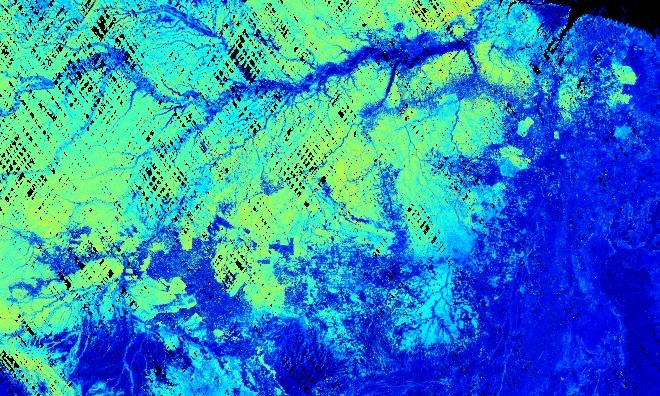
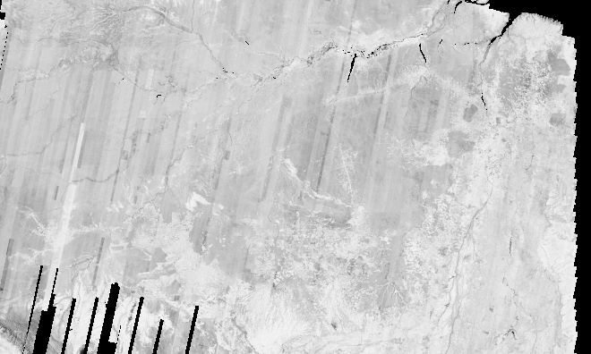
TanDEM-X measurements of a region of the Amazon rainforest
This map combines a total of 12,000 TanDEM-X images
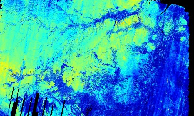
GEDI forest height measurements of a region of the Amazon rainforest
NASA's Global Ecosystem Dynamics Investigation (GEDI) mission is a waveform lidar system on board the International Space Station ISS. This image contains 60 million GEDI measurements. Since GEDI does not provide continuous imaging, there are large measurement gaps between its ground tracks.


