Flight through the 'labyrinth of the night'


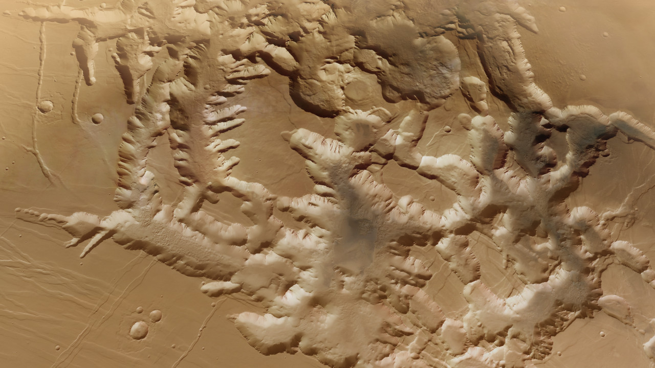
- Noctis Labyrinthus is an extensive rift valley system near the Martian equator.
- The region is characterised by a system of mesas with flat plateaus and deep valleys, with steep walls in between.
- The video shows a virtual flight over the eastern part of this maze from eight individual observations by DLR's HRSC camera.
- Focus: Spaceflight, Mars, planetary research, Mars Express mission
'Noctis Labyrinthus' – Latin for 'labyrinth of the night' – is an extensive rift valley system six degrees south of the Martian equator. It marks the transition between the large Tharsis volcanoes in the west and the 4000-kilometre-long Valles Marineris canyon system in the east. The video takes the viewer on a virtual flight over the eastern part of this 'maze' and was created using data from eight single-orbit observations acquired using the German Aerospace Center (Deutsches Zentrum für Luft- und Raumfahrt; DLR) High Resolution Stereo Camera (HRSC) on board the European Space Agency (ESA) Mars Express spacecraft.
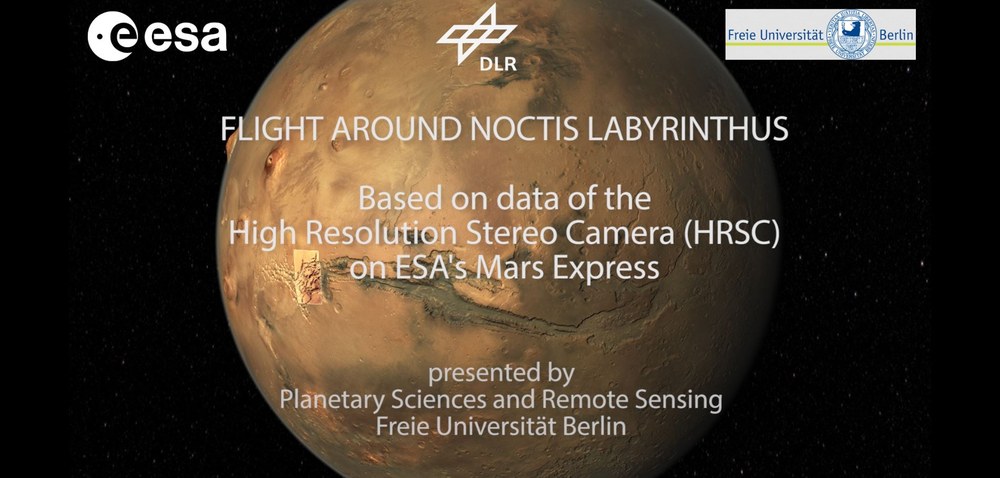
Animation: Virtual flight through Noctis Labyrinthus
Your consent to the storage of data ('cookies') is required for the playback of this video on Quickchannel.com. You can view and change your current data storage settings at any time under privacy.
ESA/DLR/FU Berlin
The underlying image mosaic on which the video is based was combined with topographical information from a digital terrain model computed using data acquired by HRSC. Each second of the film consists of 50 individual images that were created to represent the view of a camera following a predefined path through the landscape. Vertical distances in the animation are exaggerated by a factor of 1.5 – so an altitude difference of 1000 metres is depicted as 1500 metres. As a result, the mountain flanks appear somewhat steeper than in reality. The haze in the background, at a distance of 150 to 200 kilometres, was added to conceal the limits of the terrain model. This makes the already fascinating landscape appear even more spectacular.
The opening sequence, a view of the equatorial region of Mars with the Valles Marineris rift valley adjoining Noctis Labyrinthus to the east, is shown with a vertical distance exaggeration factor of three. It was created using the global Mars colour mosaic produced for the 20th anniversary of the launch of Mars Express ('20th Anniversary Special').
Formation through tectonic stresses
The Noctis Labyrinthus region is located between the western end of the Valles Marineris – the 'Grand Canyon of Mars' – and the Tharsis highlands adjoining it to the east. The spiderweb-like 'labyrinth' is almost 2000 kilometres long and is characterised by a system of mesas with flat plateaus and deep valleys, with steep walls in between. These were formed by tectonic faulting. Many have the classic appearance of a tectonic rift. Due to crustal extension, most likely as a result of the uplift of the Tharsis region, parts of the surface have subsided in relation to the blocks on either side. The faults generally slope towards the centre of the rift from both sides. This was due to intense volcanism in the Tharsis region, which was associated with the uplift of an area the size of Europe. Tectonic stresses resulted in thinning and stretching of the crust. The result is the grabens visible today and the inselbergs or mesas situated between them.
Large plateaus, built up from solidified, low-viscosity basaltic lava, are the dominant feature of the region at the original surface level of the Martian highlands. They were formed during the Hesperian age of Mars, a period of strong volcanic activity that occurred between 3.8 and three, or even two, billion years ago. The intersecting canyons and valleys are up to 30 kilometres wide and as much as six kilometres deep. There is no comparable landscape on Earth, nor on any other planet or moon in the Solar System. Large landslides have occurred in many places, their debris and masses of dust covering the steep valley slopes and the valley floors.
Signs of past presence of water
In 2009, a team led by the US-American scientist Catherine Weitz demonstrated that locally occurring mineral salts such as gypsum (calcium sulphate dihydrate) or kieserite (magnesium sulphate monohydrate), but also hydrated silicates and clay minerals, are present in the rock layers of these steep slopes. Such minerals are indicative of a previously existing aqueous environment. It is likely that Noctis Labyrinthus experienced a complex hydrological period following its tectonic formation phase. This may be significant with regard to the question of whether life was once present on Mars.
Elsewhere, long, extensively interconnected linear structures can be observed along the valley slopes. These are sand and dust deposits that have been shaped by the wind into extensive ribbed fields whose ridges are separated by distances of between 150 and 400 metres. These sand ridges are oriented perpendicular to the wind direction and are often formed on large bodies of sand or dune surfaces. The almost vertical orientation of the ridges on numerous slopes indicates that sand was transported there parallel to the slope, while on the valley floors or on shallower slopes, the wind transported the fine-grained material from different directions along the valleys and also uphill.
HRSC is a camera experiment that was developed and is operated by the German Aerospace Center (DLR). The systematic evaluation of the camera data was carried out at the DLR Institute of Planetary Research in Berlin-Adlershof. Personnel in the Department of Planetary Sciences and Remote Sensing at the Freie Universität Berlin used these data to create the image products shown here.
Related links
The HRSC experiment on Mars Express
The High Resolution Stereo Camera (HRSC) was developed at the German Aerospace Center (DLR) and built in cooperation with industrial partners (EADS Astrium, Lewicki Microelectronic GmbH and Jena-Optronik GmbH). The science team, led by Principal Investigator (PI) Thomas Roatsch of the DLR Institute of Planetary Research, consists of 50 co-investigators from 35 institutions and 10 nations. The camera is operated by the DLR Institute of Planetary Research in Berlin-Adlershof.
These high-resolution images and more images acquired by HRSC can be found in the Mars Express image gallery on flickr.