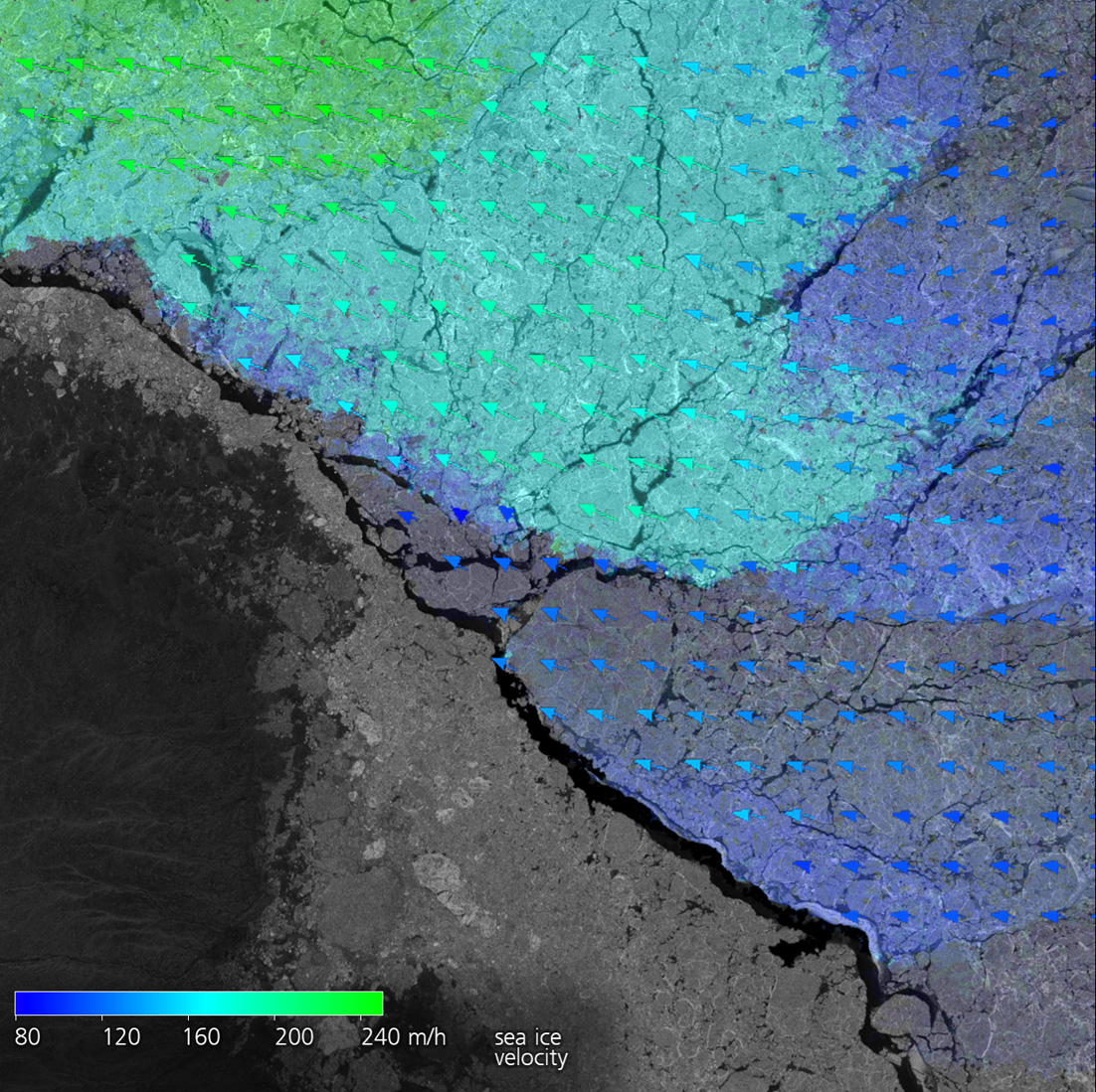
Sea ice can be dangerous for ships. If it is shoved together by storms, pressure ridges several metres thick can form, invincible even for icebreakers. EOC is working on methodologies for distinguishing types of sea ice and monitoring their drift to identify where potential pressure ridges could form. For this purpose EOC scientists rely on radar images that provide a picture of the ice situation regardless of cloud cover or polar night. For the analysis near Price Patrick Island in Canada shown here a time series recorded by the German radar satellite TerraSAR-X was used.
Through its Maritime Safety and Security Lab in Bremen the Earth Observation Center (EOC) specializes in remotely sensing the oceans from space. Especially radar images are used there to measure not only sea ice drift, but also wind and waves, oil pollution, and the shifting of coastlines over large areas. In order to continue improving its Information products, EOC collaborates with research vessels in the Arctic and Antarctic and is currently supporting the MOSAiC Expedition, which is led by the Alfred Wegener Institute. The research results are then incorporated in processing chains that can take over the satellite data immediately after acquisition at the EOC ground stations, for example, in Neustrelitz in Mecklenburg-Western Pomerania, at GARS O’Higgins in the Antarctic, or at the Arctic station in Inuvik, Canada. From there, the so-computed and customized information products can be supplied a few minutes later to users, for example, ship-owners, police, rescue teams, public authorities, and offshore wind farm operators.


