
Atlas of the Paraguayan Chaco
The Chaco is a South American landscape characterized by dry forests and thorn-bush savannas. It takes up over 60% of Paraguay’s total area and provides a habitat for species such as the lowland tapir and the jaguar. However, extensive disruption to the natural ecosystem seriously endangers its biodiversity. In a project financed by the Federal Ministry of the Environment, Nature Conservation, and Nuclear Safety, collaboration between EOC and the World Wildlife Fund (WWF) has produced an Atlas of the Paraguayan Chaco.
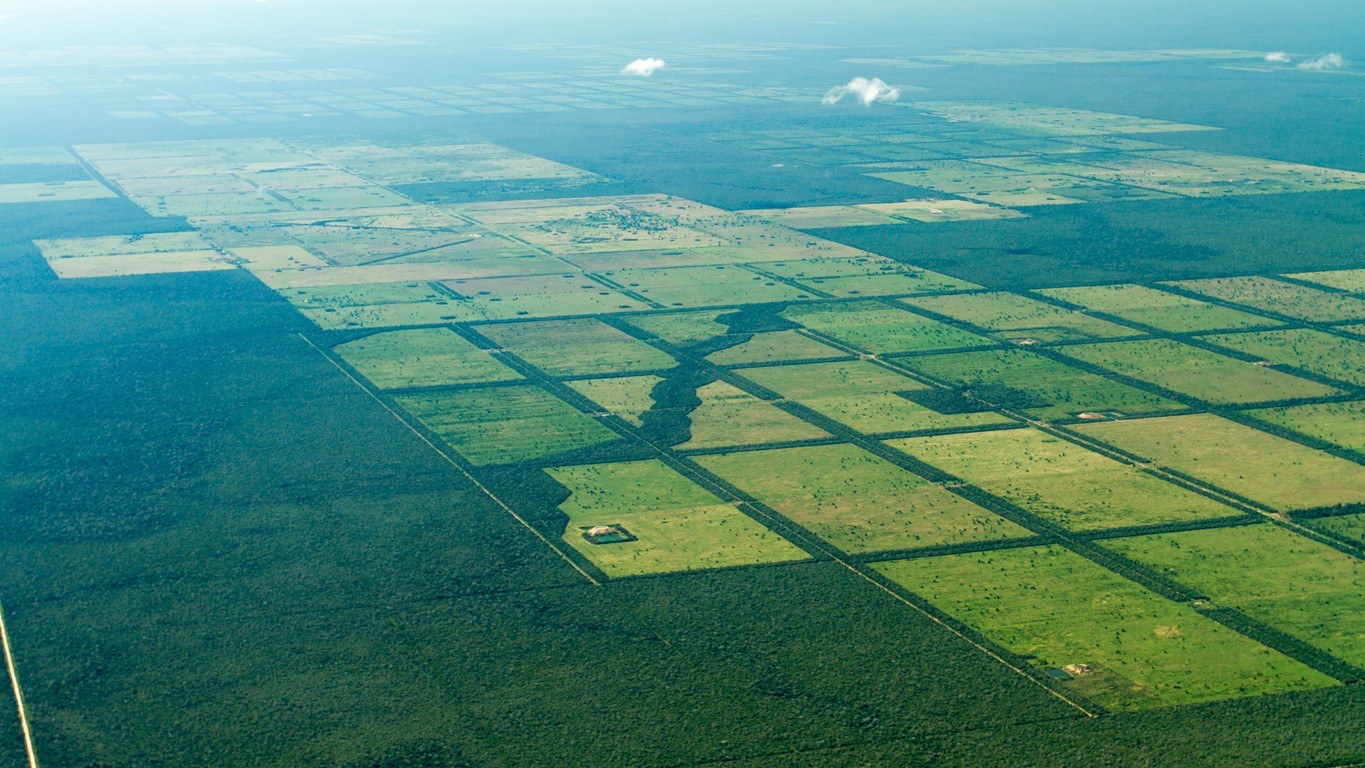

The rapid upsurge in cattle breeding in this region has high economic relevance for this South American country. Increasing international demand for meat leads to a continuous expansion of pasturage in the Chaco, which is accompanied by woodland clearance. Between 1987 and 2012 over 27% of the natural forest cover was lost in the Paraguayan Chaco. In most cases the remaining forested areas exist only as isolated islands in what is otherwise an agricultural landscape. This extensive encroachment on the natural ecosystem of the Chaco has led to a drastic and continuous decline in biodiversity.
The Atlas of the Paraguayan Chaco contains extensive maps supplying qualitative and quantitative information on the condition of the Paraguayan Chaco region and the changes it is undergoing. The Atlas describes the importance, complexity of Chaco ecosystems and sharpens awareness of the region’s fragility. The maps serve local decision makers and government authorities as a foundation for discussing further measures to protect the Chaco and can be used as illustrative material for educational programmes. All the maps, statistics, spatial analyses and numerous texts were produced at EOC in cooperation with WWF Paraguay. The Atlas contains 29 thematic maps based on remote sensing data, surveys from other research fields, and national data sets. It has two sections: (1) the overall characteristics of the Chaco and (2) detailed presentations of the condition of and changes to vegetation and land use in the ecoregions.
The Atlas can be obtained free of charge in digital or print form. Over 300 copies are being distributed to Paraguay’s most important governmental and private bodies as well as to research and university-level educational institutions.
