DLR radar simulator aids discovery of caves on the moon
July 29, 2024
DLR radar simulator aids discovery of caves on the moon
Since radar instruments function differently than optical cameras, radar images are often hard to understand. Images of cities are in particular very complex. The DLR radar simulator was developed to ease understanding of such images. Now it has helped to identify potential cave entrances in radar images of the moon's surface.
Work on the RaySAR radar simulator began in 2005. Two years before the launch of the German radar satellite TerraSAR-X it was clear that the instrument would provide very high resolution images thanks to its synthetic aperture radar (SAR). For the first time even structures in cities could be depicted sharply. It was generally known that radar signals from airborne sensors were repeatedly reflected back and forth in the streets before they returned to the satellite. Since with SAR instruments the length of the transit time of the radar signal determines where in the image an object is depicted, abstract overlapping arises that initially eludes our understanding.
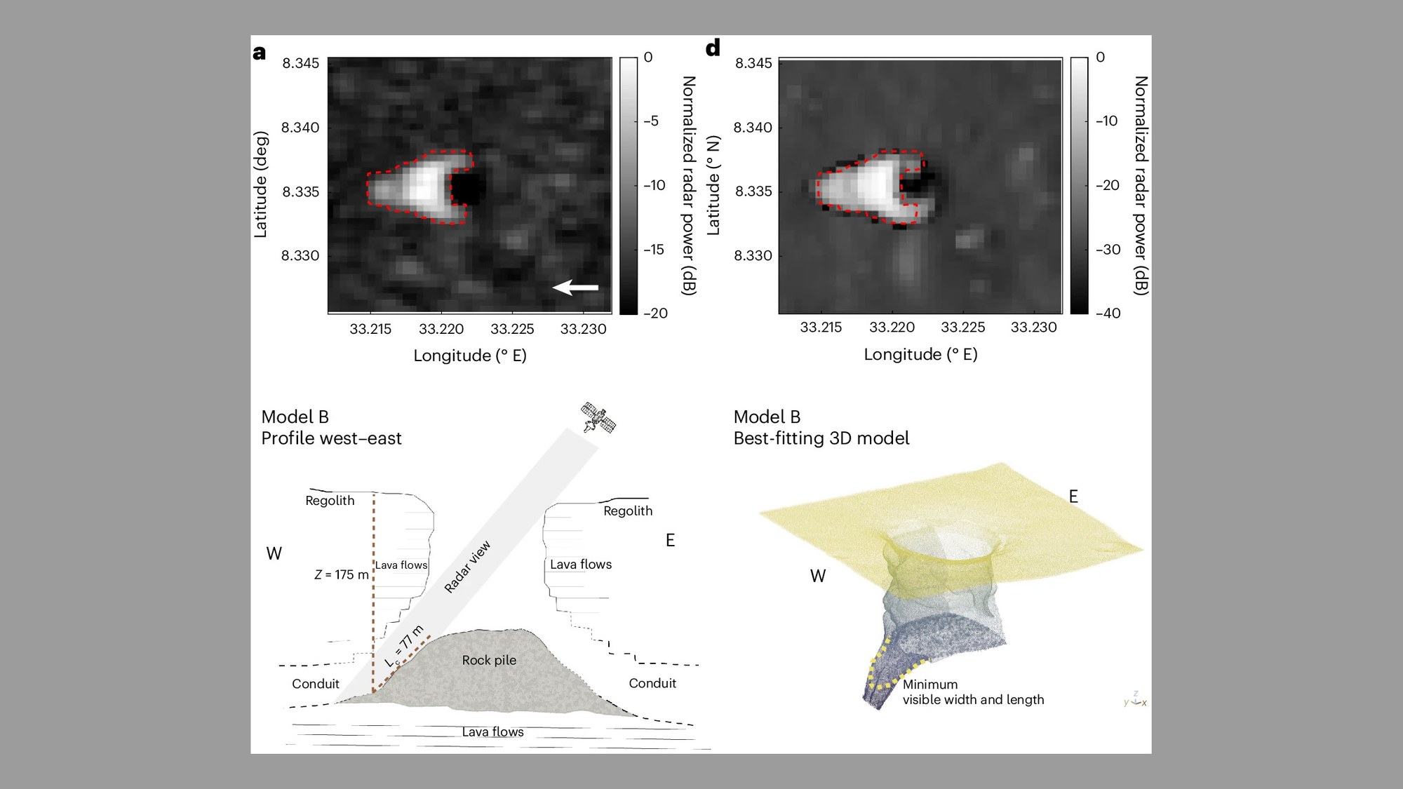
Comparison from SAR to RaySAR
Upper left (a) SAR image of the Lunar Reconnaissance Orbiter Upper right (d) mit RaySAR simulierte Variant of cave model B simulated with RaySAR The images were taken from the publication "Radar evidence of an accessible cave conduit on the Moon below the Mare Tranquillitatis pit” by Leonardo Carrer et al.
Credit:
The images were taken from the publication "Radar evidence of an accessible cave conduit on the Moon below the Mare Tranquillitatis pit" by Leonardo Carrer et al.(Nature Astromomy)
So in the TUM/EOC team of Prof. Bamler it was decided to develop a simulator for SAR instruments. This simulator was created in the context of a dissertation and in due course it was also made available to the research community in 2016. The simulator provides radar images on the basis of 3D city or terrain models. With these one can thus simulate the radar response of any complex 3D formations and make natural images more easily comprehensible.
A research team from Italy and the USA has now used RaySAR to reinterpret radar images of the lunar surface. Using RaySAR radar images the team simulated vertical pits that continue as horizontal cave entrances and compared them with historic SAR images provided in 2010 by the lunar probe Reconnaissance Orbiter. With this approach the researchers were able to generate synthetic radar images that strikingly resemble the images from 2010. It could thus really be a question of caves that could have once arisen from thin lava streams. Such lava tunnels can also be found on Earth.
Since the caves would provide protection from the extreme temperature variations and the high level of radioactivity that exist on the moon's surface, they would be especially interesting for future manned lunar stations and deserve further research.