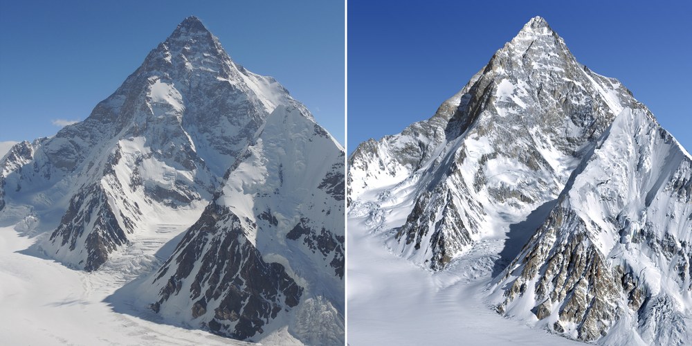
This rare image was photographed by the German extreme moutaineer Ralf Dujmovits from the slopes of Praqpa Ri. Next to it on the right is a view of K2 computed from satellite data.
In autumn 2010 K2 was measured from three different angles by the US satellite "Worldview-2". From the differences in the viewing angles of these images, EOC scientists calculated a high-resolution elevation model with a methodology specifically developed for the purpose at DLR. With this virtual image, K2 can now be visualized from any angle, also, of course, from the direction of Praqpa Ri. A comparison shows how faithfully the virtual portrayal reproduces the original. The methodology has since been tested also on other “world-class mountains”.

