Healthy soil is closely linked to efficient agriculture. Characterising and monitoring Germany’s soils with remote sensing is an important aspect of the cooperative project AGRO-DE. This three year project is supported by the Federal Ministry of Food and Agriculture with the goal of providing on a regular basis for all of Germany key agricultural information based on satellite data.
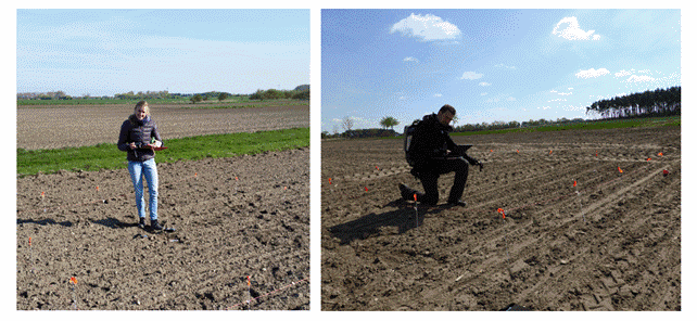
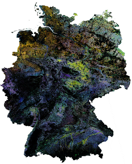
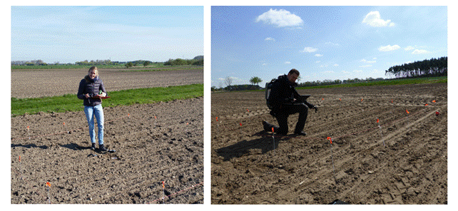
In a first AGRO-DE field campaign end of April, vegetation and soil samples were collected and on-site measurements were made. EOC scientists equipped with GPS tools and field spectrometers collected ground samples for laboratory measurements, determined the reflectivity properties of the soil, and systematically surveyed soil anomalies in individual fields (Figure 2). The selection of suitable vegetation-free areas was facilitated by maps of vegetation-free soil in Germany that are currently being drawn up at EOC based on satellite data (Figure 1). This German soil archive contains data on different ground formations and anomalies throughout Germany. EOC scientists are particular interested in the latter. Such soil variations can be caused by a particular mineral composition, erosion, or constant waterlogging. Soil formation is decisively influenced by the topography as well as by the geological subsoil and ground use. In AGRO-DE the variations are to be comprehensively recorded for all of Germany and made available to the agricultural sector. The on-site ground measurements made at point locations were accompanied by wide-area overflights of aircraft equipped with DLR’s HySpex spectrometer and augmented by Sentinel-2 satellite images. These large-area recordings will be evaluated using the information obtained from the ground samples and analysed for their information value.
The field measurement campaign was conducted together with project partners from the Julius-Kühn Institut (JKI) and Hanse Agro Beratung und Entwicklung GmbH. In addition, the DLR spin-off company EOMAP also participates in AGRO-DE. Another goal of the scientists is to determine whether and how precisely information gleaned from Sentinel-2 data can be used to derive the extent of nitrogen fertilization in specific fields, something that is normally recorded by customized sensors installed on on agricultural machinery. If the answer is favourable, small farms could also have access to preliminary information about the supply of nitrogen on their land. Meanwhile, the researchers’ focus of interest is on the many technical and scientific issues that must first be resolved.
Figure 2 – EOC scientists gather spectrometric data on soil in the Wolfsburg area.


