Do not disturb!

We frequently hear reports that the satellite navigation systems of aircraft and ships are being deliberately disrupted. Such incidents are becoming increasingly common, particularly near conflict zones, and in worst-case scenarios can disable on-board navigation equipment. False signals can even mislead ships and aircraft, taking them off course. DLR has been investigating this threat, known as jamming and spoofing, for many years. This article explains the nature of these disruptions and the available countermeasures.
It is a calm morning on the Baltic Sea. A ship is heading towards Hiddensee, approaching an anchored vessel from astern. Suddenly, several warning signals sound on board, alerting the crew that something unusual is happening. The navigation systems intermittently display either no position or an incorrect one. Now, the captain faces a difficult task – he must quickly assess the danger and choose the safe course of action …
Jamming and spoofing explained

This ship was the target of a combined jamming and spoofing attack. In a jamming attack, global navigation satellite system (GNSS) signals are submerged by an interfering signal. This prevents a standard navigation receiver from detecting them, meaning it is unable to determine a position. Technically, such interference is relatively simple to carry out. Since navigation satellites are over 20,000 kilometres from Earth, GNSS signals are quite weak. As a result, small, portable jammers can easily block these signals within a radius of a few kilometres. Although the trade and use of such devices are prohibited, they are regularly seized by police and customs officials. For large-scale disruptions, however, more powerful equipment is required, which is not easily available commercially and is likely employed by state players. Spoofing, on the other hand, involves transmitting deceptive signals that appear to a receiver to be genuine satellite signals but actually generate false position and time information. This type of attack is much more technically demanding.
Neither jamming nor spoofing are new phenomena. Jamming, in particular, has been observed for some time in conflict zones. Currently, experts are reporting severe disruptions to GNSS reception in the Baltic Sea region, whilst the intensity of spoofing incidents is rising, especially in the eastern Mediterranean.
Robust receivers
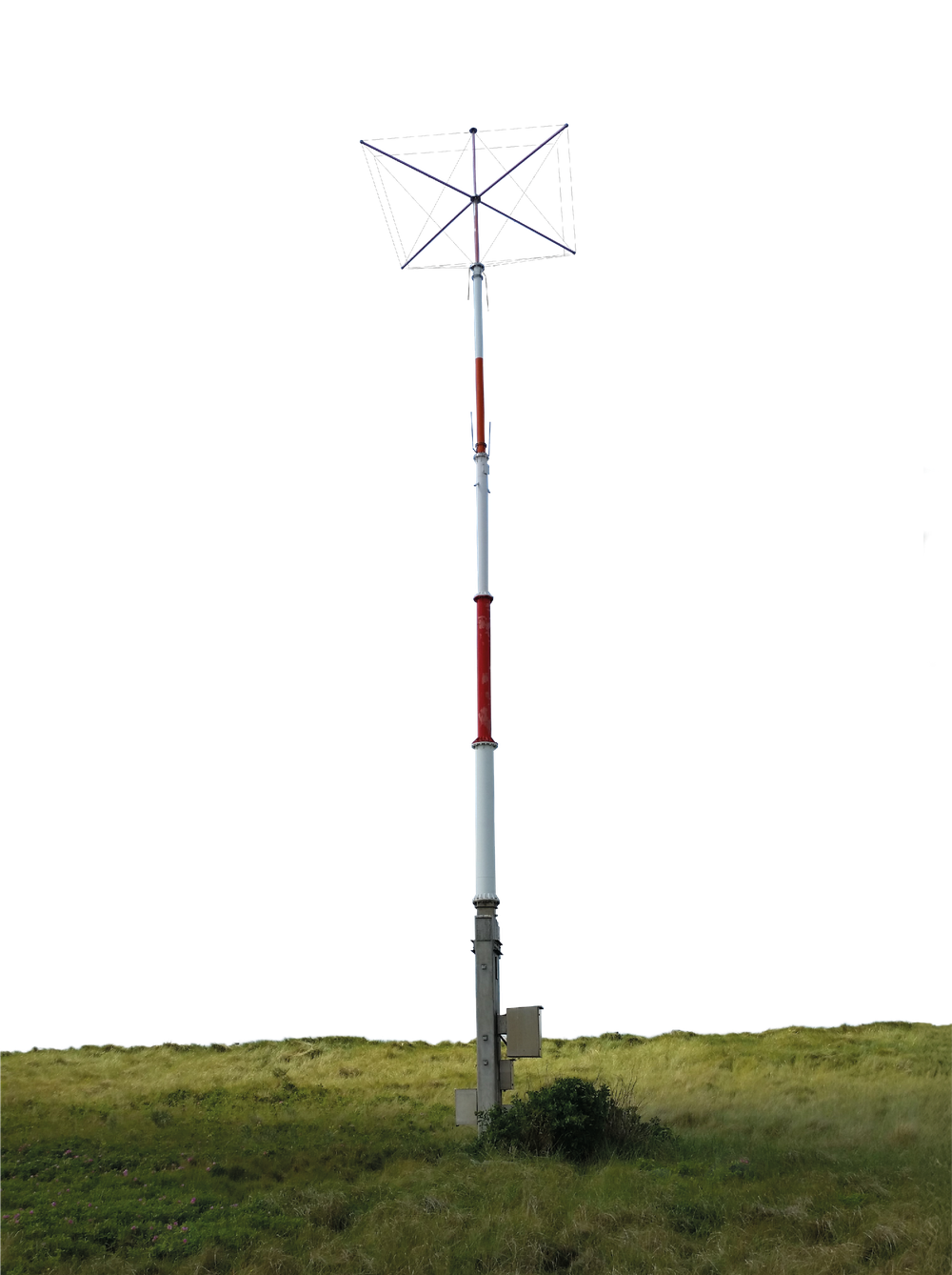
DLR is developing GNSS receivers capable of detecting and suppressing jamming and spoofing. These receivers feature digitally controllable antennas, allowing them to accurately identify the direction of the incoming signal, block interference and verify the authenticity of signals. Such robust receivers can enhance the resilience of various modes of transport as well as reference ground stations. In the InVo technology transfer project, DLR researchers are developing a device that can be connected to conventional GNSS receivers, allowing existing systems to be retrofitted with this capability. This system is nearing product maturity.
Multi-sensor technology
Applications in which valuable goods or even human lives depend on accurate positional information in emergencies require exceptionally reliable navigation systems. This is the case, for example, with automatic aircraft landings in poor weather conditions or autonomous driving. To achieve the necessary level of reliability, data from a variety of sensors – such as inertial sensors and cameras – are analysed and integrated with GNSS data. These multisensor solutions combine the strengths of different sensor types, mitigate the weaknesses of individual sensors and ensure safety through redundancy. In the data fusion process, researchers account for the error characteristics of each sensor to derive the most reliable positioning information possible. Both conventional sensors and novel sensors developed at DLR, based on quantum technology, are considered in this process.
Research on land, air and sea
The DLR Institute of Communications and Navigation in Oberpfaffenhofen and Neustrelitz has been researching jamming and spoofing for many years. Both types of interference signals can be detected.

To achieve this, DLR researchers analyse the received signals in detail using specialised receiving systems that allow them to determine the direction from which the interference originates. Over recent years, the researchers have tracked this interference across the globe. They have conducted investigations aboard a merchant ship circumnavigating the world, on a DLR research aircraft in the eastern Mediterranean and, most recently, on ships in the Baltic Sea – where they detected real instances of jamming and spoofing attacks.
Once the interference is detected, it can be analysed. DLR researchers are particularly focused on identifying which systems and transmission frequencies are affected, as well as the structure of the jamming signals. The goal of their work is to develop effective countermeasures. These include, for example, GNSS receivers that are resistant to interference and deception (see robust receivers info box) or backup systems for positioning, navigation and timing in aviation and maritime contexts (see alternative navigation systems info box). Such systems can act as fallback options in the event of a GNSS outage.
Alternative navigation systems for ships and aircraft

As a backup to GNSS, DLR is collaborating with international governmental organisations, academia and industry to develop the R-Mode system and operates a test field in the Baltic Sea. R-Mode is designed as a maritime alternative to GNSS, providing navigation information in the event of outages or local disruptions. Additionally, R-Mode can detect situations where GNSS delivers incorrect positioning data. A key advantage of R-Mode over other GNSS alternatives is that it uses the existing maritime infrastructure of GNSS reference stations and base stations based on the AIS (Automatic Identification System) radio system used in shipping. These stations have been modified to emit additional signals, which can be interpreted by appropriately equipped receivers. The R-Mode test field has been available for testing by interested parties since 2022.
In the field of aviation, the DLR Institute of Communications and Navigation is leading the international standardisation group for the L-band Digital Aeronautical Communications System (LDACS). This is the future standard for digital aeronautical radio, as a large proportion of air traffic management is currently still carried out via analogue radio. For LDACS, the researchers have also developed and flight-tested solutions that will make it possible to navigate using these radio signals. This system, known as LDACS-NAV, is currently being advanced towards product maturity as part of the European SESAR programme (Single European Sky ATM Research) and is expected to serve as a backup navigation system for aviation.
Simulating jamming and spoofing for research
Before these technologies can be deployed, they must undergo extensive testing. One such test site is the National Experimental Test Center for Unmanned Aircraft Systems, a DLR research airport near Cochstedt, Magdeburg, where DLR researchers can conduct controlled GNSS jamming and spoofing tests in a controlled environment. In 2023, they successfully tested a cyber-secure, GNSS-based aircraft landing system developed by DLR, demonstrating that it was immune to targeted jamming attempts. They are also investigating drones, given that these are vulnerable to jamming and spoofing as well.

Off the coast of the Darß peninsula in the Baltic Sea, the institute is operating the first maritime test area in collaboration with Germany's Federal Network Agency, Bundesnetzagentur, to study the effects of jamming and spoofing attacks. DLR also plays an active role on various committees involved in the technical coordination and standardisation of systems. These committees include the German air navigation service provider Deutsche Flugsicherung, the European Organisation for the Safety of Air Navigation (Eurocontrol), the European Organisation for Civil Aviation Equipment (EUROCAE), the International Association of Marine Aids to Navigation and Lighthouse Authorities (IALA), the International Maritime Organisation (IMO) and numerous other stakeholders.
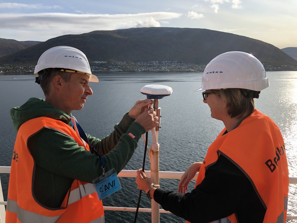
And what happened to the ship en route to Hiddensee? In this case, the crew was well-prepared – the scenario was part of a series of DLR experiments investigating the effects of jamming and spoofing. The data acquired during the trials are used by the scientists to improve the self-developed antenna system to make it resistant to such attacks.
Danger averted?

Florian David heads up the DLR Institute of Communications and Navigation, which carries out extensive research into interference with navigation signals and the development of appropriate countermeasures.
How dangerous are jamming and spoofing?
Jamming and spoofing can disrupt systems and applications that rely on global navigation satellite systems (GNSS) for positioning. In addition to many applications in aviation, maritime transport and logistics, this also affects sectors such as agriculture and tourism. GNSS signals are highly precise time signals, also used for synchronising systems such as telecommunications, power grids and financial networks. Attacks in these areas could potentially result in significant economic losses. However, safety-critical systems generally use multiple sensors to determine their position, which has so far prevented any major incidents. That said, we cannot afford to be complacent. We must continue developing countermeasures, particularly as automation increases, for instance in the mobility sector. It is essential to be prepared for disruptions and offer robust solutions.
What contribution can DLR make in this area?
We have been working on this topic for many years and have a great deal of expertise in the field of satellite navigation. This applies to the systems themselves, but also to their applications in the fields of aviation, transport and shipping. Moreover, with our test fields in the Baltic Sea and Cochstedt Airport, as well as our research aircraft and ships, we have excellent infrastructure for conducting trials and tests. The solutions developed here at the DLR Institute of Communications and Navigation have reached an advanced level of maturity and could be deployed in the coming years. We are collaborating with other parties on numerous expert and standardisation committees to ensure these are practical solutions that are useful in various application domains.
Can we continue to rely on satellite navigation in the future?
Resilience and reliability are increasingly important. Redundancies and specialised protective measures are playing a growing role in the development of future systems. However, it is no longer sufficient to rely solely on satellite navigation. We need to adopt an integrated approach to navigation, combining a wide array of available sensors to ensure reliable positioning at all times. Quantum sensors, like those already being developed at DLR today, could play a significant role in the future. We are closely collaborating with the relevant institutes to integrate these sensors into our solutions. Through our research, DLR aims to help ensure that efficient and safe navigation remains possible in the future.
An article by Julia Heil from the DLRmagazine 176
