How a Space Shuttle mission revolutionised Earth observation
February 11, 2025 | 25 years of SRTM – Anniversary video on YouTube
How a Space Shuttle mission revolutionised Earth observation
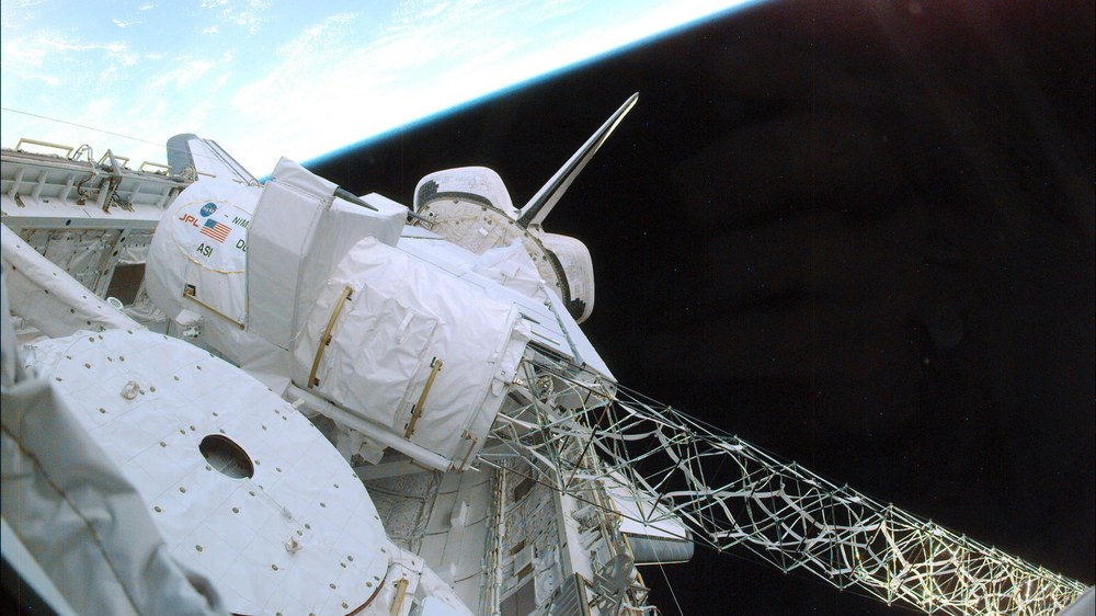
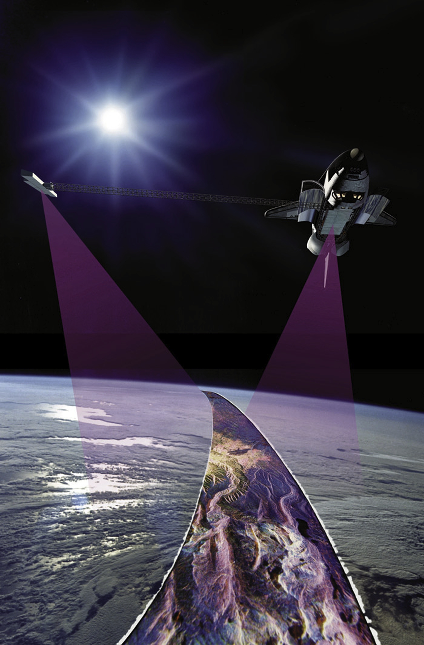
Cargo bay of the Space Shuttle Endeavour with deployed radar antenna
This image shows the cargo bay of the Space Shuttle Endeavour with parts of the SRTM hardware. Clearly visible is the approximately 60-metre-long mast, at the end of which one of the two antennas is mounted.
Image: 1/5, Credit:
NASA
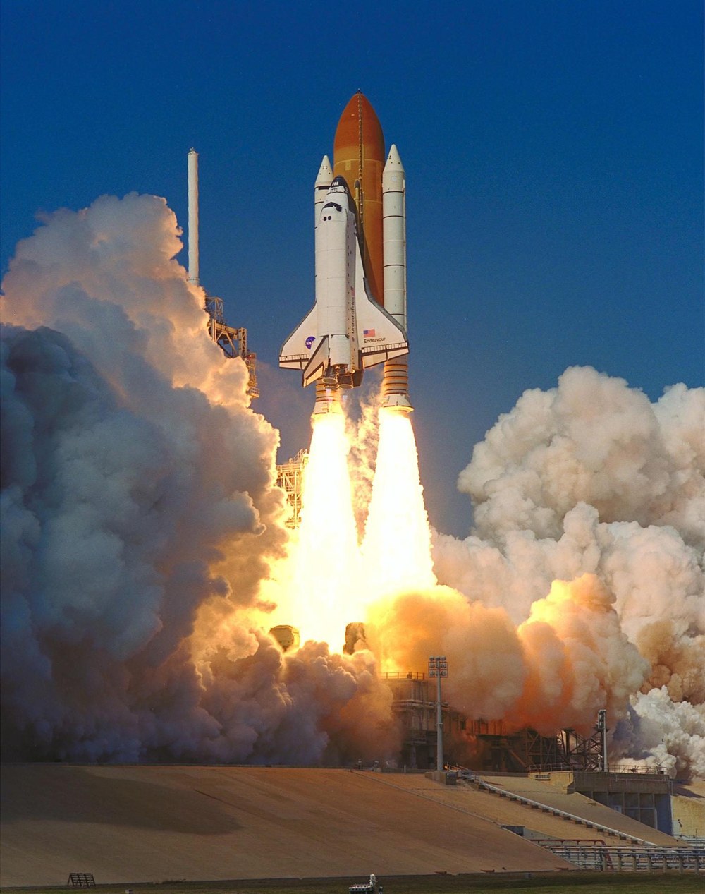
Launch of the SRTM mission onboard the Space Shuttle Endeavour
On 11 February 2000, NASA's STS-99 mission launched from Launch Pad 39A at the Kennedy Space Center aboard the Space Shuttle Endeavour. Onboard was the Shuttle Radar Topography Mission (SRTM).
Image: 2/5, Credit:
NASA
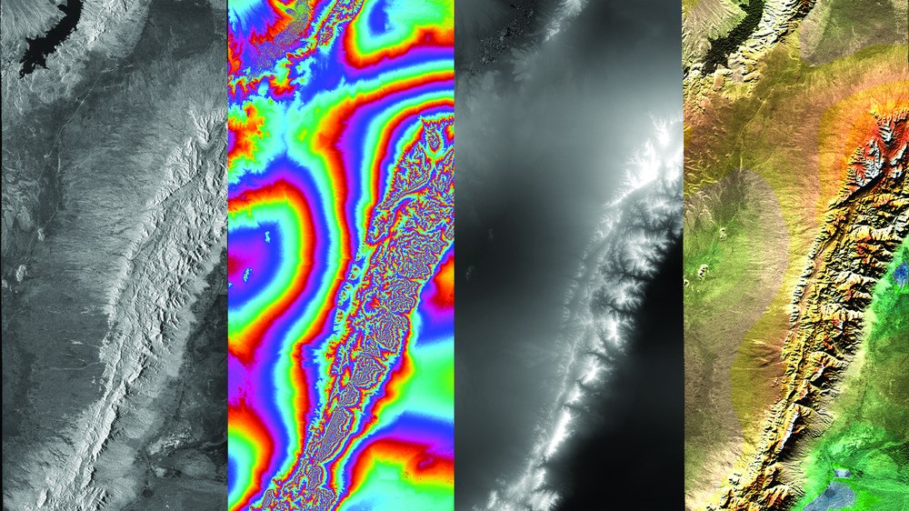
Representation of SRTM data
Starting with two radar images provided by SRTM (one of the two images can be seen on the far left of the image), the first intermediate step calculates their differences. These differences in ‘phase information’ are represented as 'fringes' in the second image from the left. From this, the elevation model (the third image) can be derived. Low-lying regions are shown in dark shades, while higher areas appear light. Each shade of grey represents an elevation value in metres above sea level. The final image in the sequence shows the shaded digital elevation model coloured with atlas tones. To enhance interpretability, the radar image was incorporated into the colouring.
In 2000, SRTM delivered the first near-global elevation model of Earth.
Through the processing and analysis of the mission’s data, DLR has shaped the field of remote sensing.
25 years on, DLR has released an anniversary video on YouTube with exclusive insights from astronaut Gerhard Thiele, Anke Pagels-Kerp and other DLR experts.
Focus: Space, human spaceflight, Earth observation
Shuttle Radar Topography Mission (SRTM)
The Shuttle Radar Topography Mission (SRTM): In addition to the main antennas in the cargo bay of the space shuttle, further receiving antennas were attached to the top of a 60 metre long, extendable mast. This combination made it possible to generate a three-dimensional view of the Earth from space for the first time.
On 11 February 2000, NASA's Space Shuttle Endeavour launched on mission STS-99. Onboard was the groundbreaking Shuttle Radar Topography Mission (SRTM), which for the first time conducted highly precise measurements of almost all of Earth's surface. Over the course of 11 days, the radar system collected unique terrain data that remains invaluable today for science, climate research and disaster management. Among the crew was the German ESA astronaut Gerhard Thiele.
The German Aerospace Center (Deutsche Zentrum für Luft- und Raumfahrt; DLR) played a key role in processing and analysing this data. Institutes involved included the DLR Institute for Microwaves and Radar Systems, the DLR Remote Sensing Technology Institute, the German Remote Sensing Data Center (DFD) and the German Space Operations Center (GSOC).
To mark the anniversary, DLR is releasing a documentary featuring Gerhard Thiele, who shares first-hand accounts of the mission's challenges, his personal impressions onboard the Endeavour shuttle and the significance of SRTM for modern geodesy and remote sensing.
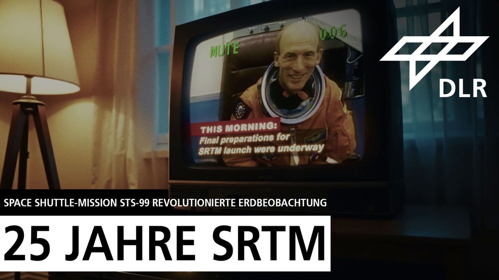
25 years ago, NASA’s Space Shuttle Endeavour launched on mission STS-99 with the groundbreaking Shuttle Radar Topography Mission (SRTM) onboard. Among the crew was German ESA astronaut Gerhard Thiele. In just 11 days, nearly the entirety of Earth's land surface was mapped in high-resolution 3D quality – an achievement that marked a milestone in geodesy and remote sensing. The German Aerospace Center (DLR) played a central role in processing and utilising the SRTM data. In this video, Gerhard Thiele shares his experiences in space, while DLR Divisional Board Member for Space, Anke Pagels-Kerp, discusses the mission's scientific achievements and its long-term significance for Earth observation.
Video: 25 years of SRTM – How a Space Shuttle mission revolutionised Earth observation
Your consent to the storage of data ('cookies') is required for the playback of this video on Youtube.com. You can view and change your current data storage settings at any time under privacy.
Video: 25 years of SRTM – How a Space Shuttle mission revolutionised Earth observation
25 years ago, NASA’s Space Shuttle Endeavour launched on mission STS-99 with the groundbreaking Shuttle Radar Topography Mission (SRTM) onboard. Among the crew was German ESA astronaut Gerhard Thiele. In just 11 days, nearly the entirety of Earth's land surface was mapped in high-resolution 3D quality – an achievement that marked a milestone in geodesy and remote sensing. The German Aerospace Center (DLR) played a central role in processing and utilising the SRTM data. In this video, Gerhard Thiele shares his experiences in space, while DLR Divisional Board Member for Space, Anke Pagels-Kerp, discusses the mission's scientific achievements and its long-term significance for Earth observation.
25 years of SRTM. I am proud of it because we were truly the first mission to remap Earth in high resolution, creating the foundation for what's known as a three-dimensional digital elevation model. The most rewarding part of such an endeavour is seeing what grows from it.
Anke Pagels-Kerp, DLR Divisional Board Member for Space, places the mission in the context of contemporary Earth observation and highlights its enduring significance for research and applications.
DLR, with all of its institutes and facilities, is truly a leader in the field of remote sensing. This is something we are very proud of, making us a sought-after collaborator for other countries and missions. We will do our utmost to maintain this reputation.
Manfred Zink from the Microwaves and Radar Institute and Michael Eineder from the Remote Sensing Technology Institute provide further insights into the mission's scientific and technological achievements.
This elevation model was, for many years until quite recently, the most important remote sensing dataset of all.
In hindsight, the SRTM mission holds great significance for DLR, as it proved that radar interferometry works exceptionally well for creating digital elevation models. This laid the foundation for the TanDEM-X mission, which we later developed.

