A tour of the Ares Vallis valley on Mars

Video: A virtual flight over the Ares Vallis region on Mars
Your consent to the storage of data ('cookies') is required for the playback of this video on Quickchannel.com. You can view and change your current data storage settings at any time under privacy.
FU Berlin (CC BY-SA 3.0 IGO)
- A new animation shows the geological diversity of the Ares Vallis Martian region.
- Ares Vallis was formed by enormous amounts of water during the 'Hesperian period'.
- Image data from DLR's HRSC stereo camera, onboard the European Mars Express satellite mission, served as the basis for this video sequence.
- Focus: Spaceflight, planetary research, Mars Express
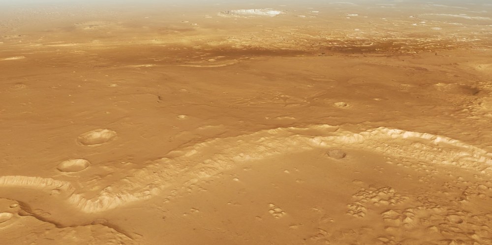
A new animation offers a fascinating virtual round trip between the landing sites of a past and future Mars rover mission. The location? Ares Vallis. Named after the god of war in Greek mythology, Ares, this valley was sculpted long ago by vast flows of water. The video sequence was created using image data captured by the High Resolution Stereo Camera (HRSC) operated by the German Aerospace Center (Deutsches Zentrum für Luft- und Raumfahrt; DLR) onboard the European Mars Express satellite. The journey is akin to a round trip flight over Central Europe, providing a bird's-eye view of an area twice the size of Germany.
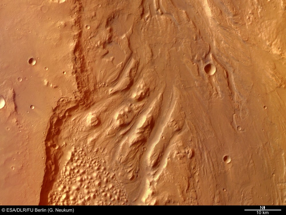
The starting point of the tour is one of Mars's most impressive outflow channels: Ares Vallis, a sprawling valley carved by ancient masses of water. Stretching nearly 2000 kilometres, the channel empties into the vast lowlands of Chryse Planitia. The virtual journey commences with a flyover of the Sojourner landing site – this pioneering vehicle and first Mars rover touched down almost thirty years ago on 4 July 1997, US Independence Day, as part of NASA's Mars Pathfinder mission. Over the course of three months, Sojourner explored its surroundings. At the end of the mission, the rover was renamed the Carl Sagan Memorial Station, in honour of the renowned astronomer and planetary scientist Carl Sagan, who passed away in 1996.

ESA/DLR/FU Berlin (G. Neukum) CC BY-SA 3.0 IGO
Craters, islands and a labyrinth of hills
Further south, the journey passes two large craters: the Masursky crater (measuring 117 kilometres in diameter and named after the American geologist Harold Masursky who, alongside Carl Sagan, was responsible for selecting the Viking landing sites in 1976) and the Sagan crater (at 98 kilometres in diameter). The partially eroded rims of these craters reveal the immense force of ancient water flows that once surged from the neighbouring valleys of Ares Vallis and Tiu Vallis. The erosive power of these flows is also evident in other geological features, such as streamlined 'islands' and terraced riverbanks along the valley walls.
Next, a change of course towards the north brings the Hydaspis Chaos region into view. This area is distinguished by a labyrinthine landscape of table mountains, rocky outcrops and hills, interrupted with deep fissures of varying sizes. Such 'chaotic terrain' is frequently observed at the headwaters of ancient Martian river valleys. Here, massive quantities of ice once lay in the ground, suddenly melting – possibly triggered by volcanic heat – and releasing vast volumes of water, which rushed northwards to carve the outflow channels. The surface above the ice caved in on the resulting voids, leaving behind broken structures with a chaotic appearance.
Further north, the large Galilaei crater comes into view. With a diameter of 137 kilometres, this large crater also displays a heavily eroded rim. Beyond it, streamlined islands reappear, offering clues to the direction of the ancient water flows during the Hesperian period of Mars, roughly 3.7 to 3 billion years ago. The tapered end of each island always points downstream, marking the direction these ancient currents flowed in.
The journey then continues towards the landing site ellipse of the European Space Agency’s (ESA) planned ExoMars rover, Rosalind Franklin. Named after the pioneering British biochemist who made fundamental discoveries about the genetic information stored in DNA, the mission's primary objective is to search for evidence of life, past or present, on Mars. The tour of Ares Vallis concludes with a bird's-eye view of the entire mosaic used to create this animation.
Image processing
This video was created using HRSC Mars Chart (HMC30) data, comprising image mosaics generated from multiple images captured by the High Resolution Stereo Camera (HRSC) aboard the Mars Express spacecraft. The mosaic image, MC-11W, was combined with topographical data from the corresponding digital terrain model (DTM) to produce a three-dimensional landscape. The flight over Ares Vallis spans an area of approximately 890,000 square kilometres – more than twice the size of Germany. The view is centred at 12 degrees north and 330 degrees east. Each second of the film is composed of 50 individual images following a predefined camera path through the scene. A threefold vertical exaggeration was applied for the animation. Atmospheric effects – clouds and haze at a distance of 300 kilometres from the observer – were added to mitigate the limitations of the terrain model.
The HRSC camera onboard Mars Express is operated by the German Aerospace Center (DLR). Systematic processing of the camera data was carried out at the DLR Institute of Planetary Research in Berlin-Adlershof. The Planetary Sciences and Remote Sensing Group at the Freie Universität Berlin utilised this data to produce the film presented here.
Data set
The HMC30 products comprise multi-orbit digital terrain models (DTMs) and orthorectified image mosaics derived from HRSC images, as well as derived products such as pan-sharpened colour mosaics. These data products are organised according to a modified version of the USGS MC-30 tile scheme. All HMC30 products are based on a bundle block adjustment of the stereo images and are registered to the global MOLA reference frame. This animation specifically utilises data from the MC-11W quadrangle.
Downloads
Related links
The HRSC experiment on Mars Express
The High Resolution Stereo (HRSC) was developed at the German Aerospace Center (DLR) and built in cooperation with industrial partners (EADS Astrium, Lewicki Microelectronic GmbH and Jena-Optronik GmbH). The science team, led by Principal Investigator (PI) Daniela Tirsch from the DLR Institute of Planetary Research, consists of 52 co-investigators from 34 institutions and 11 nations. The camera is operated by the DLR Institute of Planetary Research in Berlin-Adlershof.
