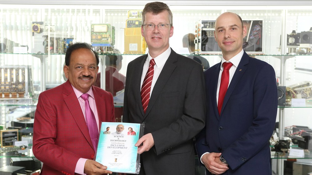
Indian minister visits DLR


- The visit focused on research into disaster control
- Various projects and work from the DLR Institutes of Optical Sensor Systems and Transportation Systems were presented
- Focus: aerospace and environmental monitoring
Harsh Vardhan, Union Minister of Science and Technology, Earth Sciences of the Government of India, visited the German Aerospace Center (Deutsches Zentrum für Luft- und Raumfahrt; DLR) on 29 May 2017 as part of the German-Indian Intergovernmental Consultations.
During his visit to the DLR site in Berlin, Dr Vardhan was initially introduced to the diverse research activities at DLR as a whole and those in Berlin specifically. This focused in particular on research in the field of disaster control. Among other things, the camera system MACS (Modular Airborne Camera System) was presented at the DLR Institute of Optical Sensor Systems . MACS is a system that has been installed in an unmanned aerial vehicle in order to contribute rapid reconnaissance of disaster areas during international rescue operations. In situations in which every minute counts, it is capable of providing emergency services with up-to-date situational pictures, almost in real time.
Dr Vardhan also attended a presentation of the FireBIRD mission. Its two microsatellites TET-1and BIROS are currently engaged in a joint Earth observation mission to detect forest fires and so-called high-temperature events from their position in orbit. The innovative infrared sensor system delivers high-quality data that enables precise measurements of the spread and heat development of fires. DLR cooperated with Indian partners on this mission as well: fitted to a PSLV launcher (Polar Satellite Launch Vehicle), the BIROS (Bispectral InfraRed Optical System) satellite was launched successfully from the Indian Satish Dhawan Space Centre in June 2016.
The DLR Institute of Transportation Systems then presented its Vabene++ project, which is short for 'Verkehrsmanagement bei Großereignissen und Katastrophen' (transportation management for significant events and disasters). This project develops high-performance support tools that help government agencies/organisations entrusted with security tasks and transportation authorities to manage disasters and significant events. The project aims to devise efficient rescue logistics and organise the flow of traffic in the surrounding vicinity, hence enabling the rapid deployment of emergency services at the rescue site, even under extreme conditions. The project involves collaboration between scientists from various DLR institutes, supported by DLR's flight operations.
Other Indo-German collaborations
In addition to the launch of the BIROS microsatellite, DLR and India have already cooperated in other areas as well.
The PSLV-D3 launch vehicle brought the Modular Optoelectronic Scanner (MOS) into Earth orbit in March 1996 as payload on the Indian satellite IRS-P3 as part of the Indo-German Science & Technology cooperative programmes. The main purpose of the imaging spectrometer was to map seasonal changes of water constituents (chlorophyll, sediment, light-absorbing substances) in the open seas and the far more productive coastal waters, to record the condition of land-based vegetation and investigate atmospheric influence on remote sensing data.
The successful launch of the DLR satellite BIRD in October 2001, on board the PSLV-C3, was yet another milestone in the Indo-German collaboration. BIRD was the first satellite in space to be specifically designed to detect and analyse fires. It used radiation in the infrared wavelength range to detect flames. For this purpose, DLR developed a new generation of infrared sensors that were tailored to the needs of remote fire sensing and designed specifically for use on microsatellites. Before their final deployment, a series of laboratory and in-flight tests were successfully carried out.
In June 2014, the AISat satellite also took off from the Satish Dhawan Space Centre on board a PSLV-C23 rocket. AISat is used to receive AIS signals (Automatic Identification System) from seafaring vessels to pinpoint their precise location. In addition, a number of Indian satellites use the DLR ground stations in Weilheim and Neustrelitz to transmit their data.

