Colour-coded representation of the topography in Memnonia Fossae

Colour-coded representation of the topography in Memnonia Fossae
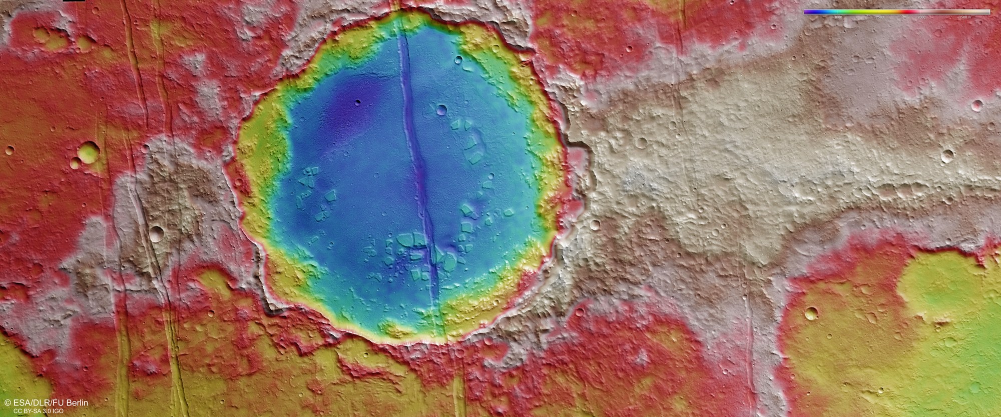
Digital terrain models of the Martian surface with a resolution of down to 10 metres per pixel can be derived from data acquired by the HRSC nadir channel, which is directed vertically onto the surface, and the oblique views of the stereo channels. In this colour-coded image, the absolute elevations above a reference level, the areoid (derived from Ares, the Greek word for Mars), are depicted.
Using the colour scale in the upper right of the image, it becomes clear that the interior of the 52-kilometre wide crater in the centre of the image is around 1400 to 1700 metres deeper than the heavily eroded crater rim in the surrounding Martian highlands. The dimensions of the tectonic expansion can be derived from the 200- to 400-metre-deep, straight grabens. Geologists can use measurements of the subsidence of blocks of terrain in such structures to calculate the level of tectonic expansion stress in the region.