The Python-based tool 'Bikeability' can calculate the bike-friendliness of any spatial unit.
It is based on a standardised definition of bike-friendliness derived from weighted indicators.
The results are both transferable and comparable.
The 'Bikeability' tool has been published on Github under the MIT licence.
The Python-based tool 'Bikeability' can calculate the bike-friendliness of any spatial unit using the OpenStreetMap (OSM) geodatabase. The classification is based on a standardised definition of bike-friendliness, using weighted indicators such as the presence of cycling infrastructure, green paths, or street connectivity. The results of the calculation are transferable and provide a comparative basis, highlighting the impact of bike-friendliness on transport mode choice.
Improved comparability through a uniform basis
Cycling is an integral part of the transport transition, thus research into the willingness to use the bicycle as a means of transport is increasingly coming into focus. While many studies include the concept of bike-friendliness, it is recorded in various ways, affecting the comparability of results. The 'Bikeability' tool can create a unified basis.
The idea for the tool came during project work on the impact of cycling infrastructure on cyclists' route choice. From this, the researchers identified several factors influencing bike-friendliness:
Street types – the frequency of neighbourhood streets
Street connectivity – as direct routes as possible
Cycling infrastructure along main roads
Green paths – green cycle paths away from the road network
Other facilities for cyclists – rental or repair stations
These were weighted in an expert survey. The exact procedure for determining the spatial indicators of bike-friendliness is described in the paper More than bike lanes - a multifactorial index of urban bikeability. There, information on the relevant factors and their weighting by the surveyed experts from science and practice can also be found.
Evaluation and visualisation
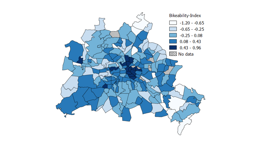
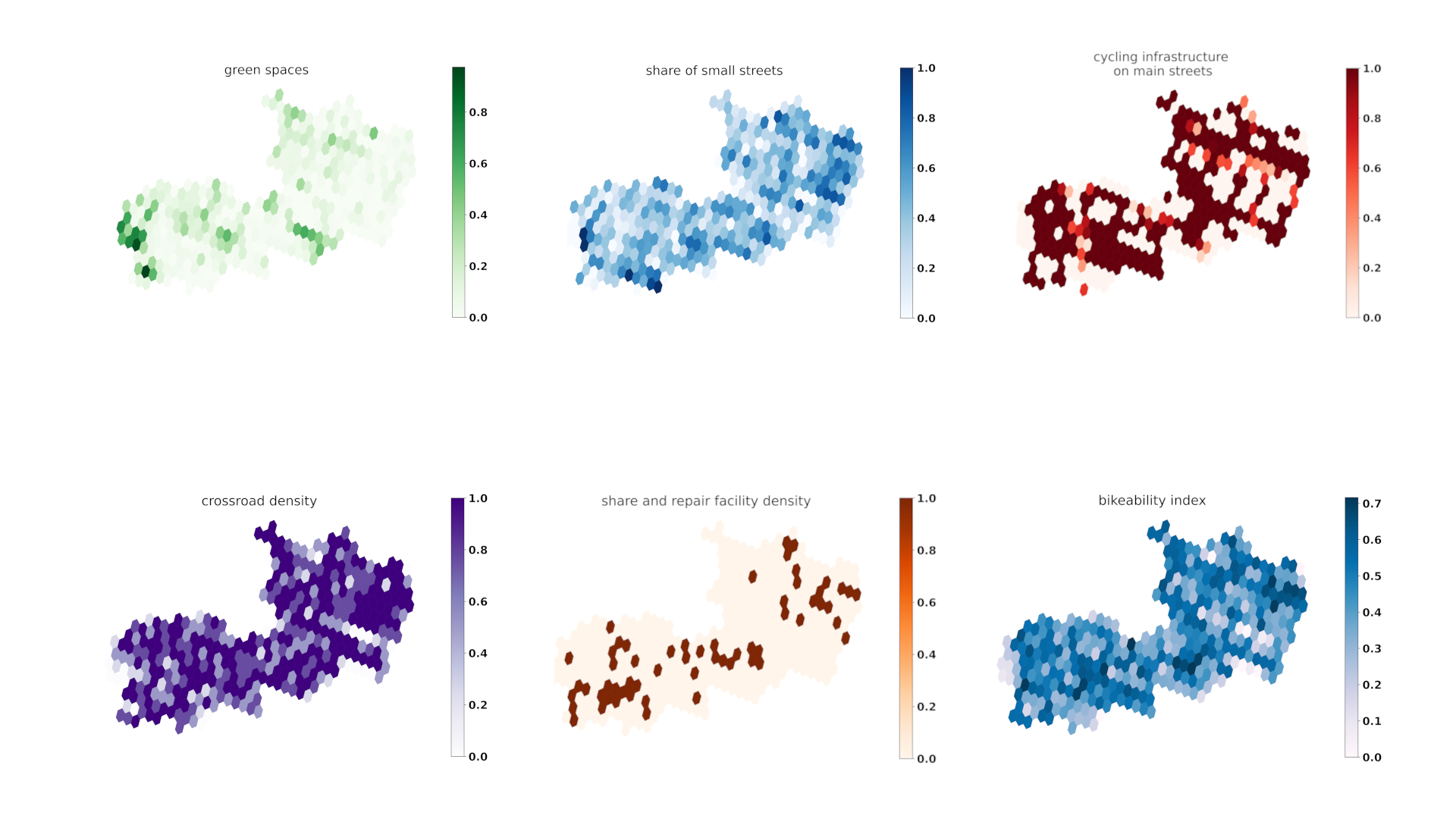
The Bikeability Index and the Underlying Factors
In addition to the bikeability index, the "Bikeability" tool also provides the basis for the calculation: Green spaces, road types, cycling infrastructure along major roads, crossroad density and share and repair facilities for bicycles.
To ensure the transferability of the index, 'Bikeability' uses data from OpenStreetMap (OSM). The OSM data provides information on the existing infrastructure, street types, and more - the individual evaluations are output together with the bike-friendliness index and can be visualised in a map representation.
'Bikeability' has been published on Github under the MIT license and is available for download. Further information on using the Python package can be found in the User Guide.


