Flight Experiments
DLR’s Flight Operations Facility is responsible for the deployment and utilisation of DLR’s fleet of highly-modified research aircraft.


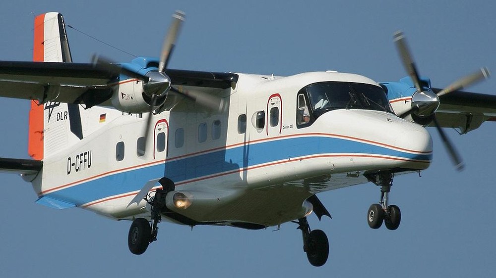
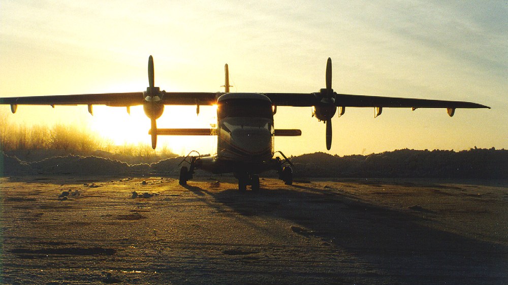
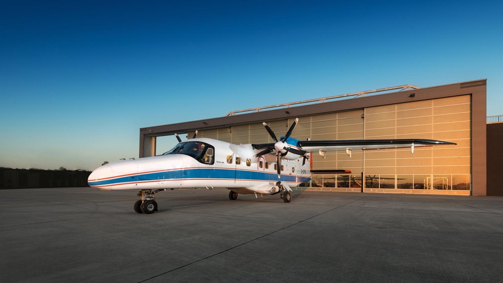
The twin-engine turboprop Dornier DO 228-212 (registration D-CFFU) is primarily used for remote-sensing missions by the German Aerospace Center's (Deutsches Zentrum für Luft- und Raumfahrt; DLR) Oberpfaffenhofen flight facility. It has a large box-shaped cabin and large cabin floor openings. This makes it especially well suited for setting up special camera systems such as the High Resolution Stereo Camera (HRSC), which is also used for space observation.
Digital sensors are installed as required. These sensors deliver optical remote-sensing data in the infrared spectrum in high resolution. The so-called multi- and hyperspectral sensors were developed by the German Aerospace Center in cooperation with its partners.
Depending on the image scale, the airborne digital sensors obtain measuring data in a range of between several kilometres and a few decimetres. Repeat measurements are performed at the same location, using different digital sensors such as the Digital Airborne Imaging Spectrometer (DAIS), the Reflective Optics System Imaging Spectrometer (ROSIS), the Hyperspectral Scanner (HYMAP), and the Airborne Reflective Emissive Spectrometer (ARES). This yields much more precise information about the Earth's surface and its vegetation than could previously be obtained using camera systems.
The DLR Microwaves and Radar Institute (DLR-Institut für Hochfrequenztechnik und Radarsysteme) operates DLR's Experimental Synthetic Aperture Radar system (E-SAR) and its successor F-SAR, to gather data for atmospheric research. Because of their modifications, only this longer 212 variant of the Dornier 228 can fly with these radar systems. Amongst other uses, the E-SAR and F-SAR systems are deployed in preliminary studies for future satellite missions, such as the German TerraSAR-X radar satellite.
Amongst other uses, the DO 228-212 research aircraft is deployed for the following fields of research:
Using the E-SAR radar system developed by DLR, geophysical radar measurements of the internal structure of the Antarctic and Greenland ice sheets are performed on board the DO 228-212. The research contributes to the determination of ice dynamics and makes it possible to predict changes in the large ice sheets as a result of climate change.
The German Aerospace Center participated in a large-scale measurement campaign in connection with the International Polar Year 2007/2008. By doing so, DLR was hoping to gain new insights into the formation and properties of land and sea ice. Between March and April 2007, scientist and technicians of the DLR Microwaves and Radar Institute used the E-SAR airborne radar system to conduct research in Spitsbergen, Norway, within the framework of the ICE-SAR campaign (Iceland Association for Search and Rescue). The aim is to find - in cooperation with the Alfred Wegener Institute, the German institute for polar and marine research (Alfred-Wegener-Institut; AWI) - characteristic parameters of land and sea ice, which are required in order to be able to establish the mutual influence between ice and atmosphere.
Of great importance in this respect are the extent of sea ice coverage, the sea ice surface roughness, the thickness of land-ice masses and the determination of structures in land ice. The sea-ice surface influences the flow of air, especially in the lower 100 metres of the atmosphere. In order to precisely calculate the exchange of energy and impulse between the surface and the atmosphere, one has to know the roughness of the ice. In climate and weather prediction models, the complex topography of sea ice and the distribution of ice are represented as simplified shapes.
The terrestrial part of the ICE-SAR-campaign takes place on Spitsbergen, over the Austfonna ice cap. This is a well-researched subpolar area which is easily and quickly accessible from Germany. With the support of the European Space Agency ESA and the Norwegian Polar Institute NPI, regular expeditions are organised with the participation of a European research team.
What makes the current ICE-SAR campaign so remarkable is that it is the first occasion on which very large datasets are collected at the same time by different European research teams. Teams of scientists from the University of Oslo and the British Antarctic Survey (BAS), for instance, are recording land-based data on the land ice; atmospheric data about sea ice are gathered using the AWI's aeroplane and the Norwegian "KV Svalbard" expedition vessel (Ice-Strengthened Norwegian Coast Guard Vessel); the measurements are completed by radar remote sensing data obtained with the German Aerospace Center's E-SAR radar system on board the Do 228-212.
The International Polar Year 2007/2008 is a global scientific research campaign covering both the Arctic and the Antarctic. It receives substantial support from ESA. Scientists from over 60 countries participate in this two-year research programme.
Dornier DO 228-212 | Data |
|---|---|
Length: | 16.56 metres (18.7 metres including nose boom) |
Height: | 4.86 metres |
Wingspan: | 16.97 metres |
Cabin length: | 8.93 metres |
Cabin width: | 1.35 metres |
Cabin height: | 1.55 metres |
Seats: | Originally 21 seats. For DLR research purposes, however: three seats for crew members and up to four seats for scientists. |
Empty weight: | 3.7 tonnes |
Total weight: | 6.57 tonnes |
Engines: | two Garret Turboprop TPE 331-5 engines with 715 shp each |
Propeller: | Four-blade Hartzell propeller |
Range: | 1000-2700 kilometres |
Flight altitude: | maximum 7620 metres (25 000 feet) |
Speed: | maximum 389 kilometres per hour |
Endurance: | 8h 20mins (without payload) |
Fuel tank capacity: | 2252 kilograms |
riginal use: | Civilian and military uses, passenger flights, cargo transport - mainly deployed in countries with restricted infrastructure and over water |
DLR flight facility: | Oberpfaffenhofen |
