The networking of transport is no longer limited to vehicles on the road. Communication with ground-based air traffic is also becoming increasingly important in order to increase the safety and efficiency of transport. A good example of the benefits of cross-domain networking is rescue mobility, including the supporting police, the fire brigade and emergency services from the air.
Nine institutes and facilities of the German Aerospace Center (Deutsches Zentrum für Luft- und Raumfahrt; DLR) are working together in the institutionally funded KoBoL project, pooling expertise from the transport, aeronautics and space programmes. The aim is to research the optimisation potential of connecting air and ground using the example of socially significant rescue mobility. To this end, the researchers are developing and demonstrating a cross-domain system that integrates networked emergency vehicles, automated networked vehicles, drones, helicopters and the transport infrastructure such as traffic lights.
The cooperation between ground-based vehicles and air traffic can help to comprehensively record the overall situation by providing an overview in real time with information from the air (aerial images from drones, satellite images) and on the ground (information from the emergency vehicle) and thus make it easier for the emergency services to reach the scene. It can also help with the landing of rescue helicopters by keeping a suitable landing site clear for vehicles on the ground. Overall, the cooperation between ground and air has the potential to speed up rescue operations and thus achieve a high level of social benefit.
Cross-domain communication is analysed and demonstrated in KoBoL using two use cases:
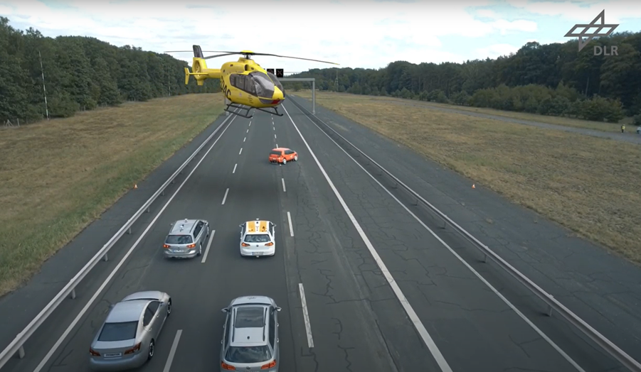
Ground-to-air coordination for helicopter landings
The focus here is on the cooperation between the helicopter and ground-based traffic when the helicopter lands on the road. The researchers are developing a pilot interface with a display on the helicopter's head-down display that supports the pilot during landing. The pilot can use this to select a suitable landing site and request it from the automated vehicles on the ground. The automated vehicles stop and form a barrier for the following vehicles so that the helicopter can land. The communication module required for this is integrated into the helicopter. This enables rescue helicopters to land more quickly and prevent any danger to traffic on the road.
The methods and technologies developed are being tested using various use cases and the pilot interface is being iteratively optimised. The scientists are also investigating problematic situations that can occur in mixed traffic with automated and non-automated vehicles.
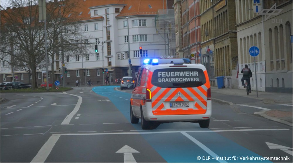
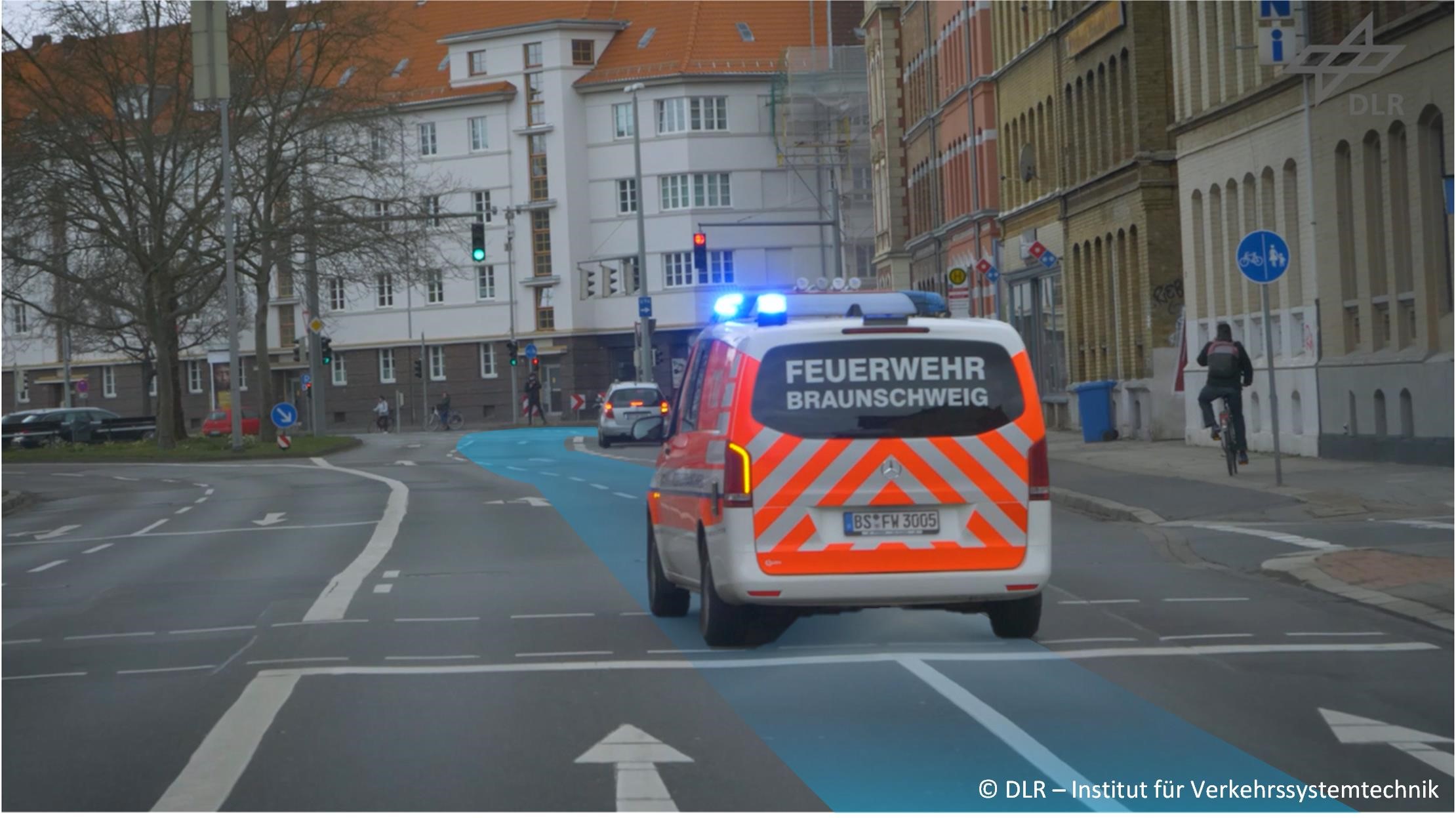
Accelerated rescue mobility on the ground
Increasing traffic problems in urban areas are making it more and more difficult to comply with the legally prescribed time until the emergency services arrive at the scene. Even today, despite the use of special signals such as blue lights and sirens, the emergency services are repeatedly hindered or involved in accidents with emergency vehicles.
The aim of this use case is to speed up rescue mobility on the ground. To this end, the researchers are connecting automated ground vehicles with the infrastructure in order to give priority to emergency services at traffic lights, facilitate the formation of rescue lanes and divert other traffic. They are also investigating the use of drones for initial reconnaissance with camera and infrared images to make it easier for emergency services to choose the best route to avoid losing valuable time.
Ground systems in cooperation
The emergency vehicle is given priority at the traffic lights so that it can cross the junction safely.
However, drones are not always sufficient for investigating large-scale damage situations. Satellite images offer an alternative here. To this end, the scientists are investigating how satellite-based information can be integrated into the rescue chain.
The project incorporates all relevant aspects, from planning and coordination to testing and evaluation of impact and acceptance, in order to analyse the potential for rescue mobility in its entirety. External experts support the project by providing technical advice in an advisory board.
The project KoBoL – coordinated autonomous ground-to-air systems for new rescue mobility
Project type: Basic funding
Funding body: DLR Transport Programme Directorate
Duration: January 2022 to December 2025
Project budget: 5.9 million euros
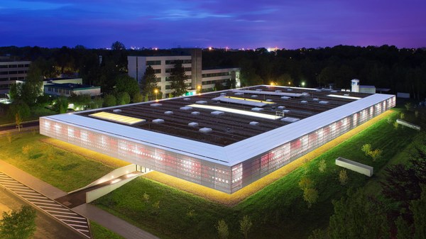
Lead institute: DLR Institute of Transportation Systems


