The first missions


GEOHALO
The GEOHALO mission signifies 'Geophysical Research of the Mediterranean using the HALO Research Aircraft'. Its aim is a better understanding of tectonics and the mechanism of earthquakes. Scientists intend to use it to capture details of Earth‘s gravitational and magnetic fields. The focus of the measurement flights is the tectonically active zone of the Mediterranean where the African and Eurasian continental plates meet. Of particular interest in this regard is the Aegean, through which several critical zones run and where the precise boundaries of potential microplates are still being debated. There is an increased threat of earthquakes and tsunamis in this region. Researchers want to compare the data they collect with independent data and contribute to a refined model of plate tectonics.
The aircraft contains a comprehensive set of instruments for the complex measurements. GEOHALO is the first project in a geodetic and geophysical sequence of flights using HALO, effectively making it a pilot for subsequent projects, such as a planned mission over Antarctica where HALO‘s long range will be critical. Participants in the mission include the Technical University of Dresden, the Potsdam Helmholtz Centre – German Research Centre for Geosciences, the Federal Institute for Geosciences and Natural Resources, the German Aerospace Center, the Institut de Ciències de l'Espai and ETH Zürich (Eidgenössisch-Technische Hochschule Zürich).
TACTS
In the TACTS atmospheric mission (Transport and Composition in the Upper Troposphere/ Lowermost Stratosphere), scientists are investigating seasonal changes in the structure of the tropopause region, especially during the shift from summer to autumn. Located between the troposphere and the stratosphere, it is especially important for the radiation budget of the atmosphere and hence for our climate.
To this end HALO is set to carry out a number of measurement flights to the Cape Verde islands and back at intervals of 2 to 3 weeks. Both the large range of HALO and the maximum flight altitude of 15 kilometres are necessary for this, as the researchers will be measuring the tropopause region from the mid-latitudes to the subtropics. During the flight, highly specialised measurement equipment will be used to measure the chemical composition of the tropopause region at latitudes between 50 and 10 degrees north, enabling conclusions to be drawn on the atmospheric transport process. In this way TACTS is expected to improve our understanding of the dominant atmospheric transport processes and so contribute to a better understanding of the atmospheric models that will be used for future projections of the development of Earth's atmosphere and the climate as the chemical composition changes.
TACTS is a cooperation between various German universities, major research institutes and the Max Planck Society, and will be coordinated by the University of Frankfurt.
NARVAL
The NARVAL mission (Next-generation Aircraft Remote-Sensing for Validation Studies) will investigate the potential of HALO as a remote sensing platform for cloud and precipitation research. During the mission, a standard remote sensing configuration, consisting of a cloud radar, a LIDAR (Light Detection and Ranging) emitting laser pulses and a microwave radiometer will be tested. This standard instrumentation will contribute to a better understanding of cloud and precipitation processes. The scientists are particularly keen on addressing how very low clouds come to dominate the trade wind region of the tropical oceans and the North Atlantic cold air region.
Once the standard instrumentation on HALO has been tested, more missions in this research area can follow. HALO will carry out more flights over the tropical Atlantic and North Atlantic under the NARVAL project. The following partners are participating in the mission: DLR, the Max Planck Institute for Meteorology, the University of Hamburg, the University of Heidelberg, the University of Cologne, the University of Leipzig and the Jülich Research Centre.
ML-CIRRUS
Cirrus clouds, which often occur in the upper troposphere, are very important for the weather, atmospheric chemistry and the climate. Air traffic may form artificial cirrus clouds via condensation trails, which quickly develop into widespread cirrus clouds in ice supersaturated air. However, the detailed mechanism through which ice crystals form is still largely unknown. During the ML-CIRRUS mission (Formation, Lifetime, Properties and Radiative/Chemical Impact of Mid-Latitude Cirrus Clouds), comprehensive instrumentation will be used to measure the properties of cirrus clouds.
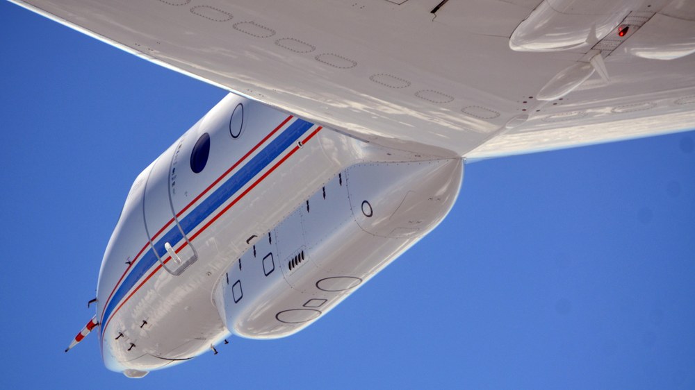
To do this, HALO will be fitted with equipment such as a LIDAR, a measuring instrument that emits laser pulses and receives the signals backscattered from molecules and particles in the atmosphere. This enables to measure, among other things, the concentration profiles of water vapour, aerosol and cirrus particles below the flight altitude to be surveyed. In order to characterise ice particles in terms of size, number concentration and shape, special measurement probes will be fitted under the wings.
During the mission, the scientists are aiming to investigate both the formation processes of natural cirrus clouds and the formation of ice clouds induced by air traffic. Some of the measurement flights will take place in the North Atlantic flight corridor, including about 1000 flights per day. ML-CIRRUS is being coordinated by DLR. Participants in the mission include various universities, the Jülich Research Centre, the Karlsruhe Institute of Technology, the Institute of Tropospheric Research in Leipzig and the Max Planck Society.
