Simulating a mission to Venus is no mean feat, but it is possible – to a certain extent. Venus-like conditions do not exist anywhere on Earth – temperatures at which lead melts, a toxic atmosphere heavy with clouds of sulphuric acid and an atmospheric pressure 90 times higher than here. However, an island in the North Atlantic comes close, mainly due to its volcanic origin – Iceland. This was the destination of an expedition in preparation for NASA's VERITAS mission to Earth's 'evil twin'.
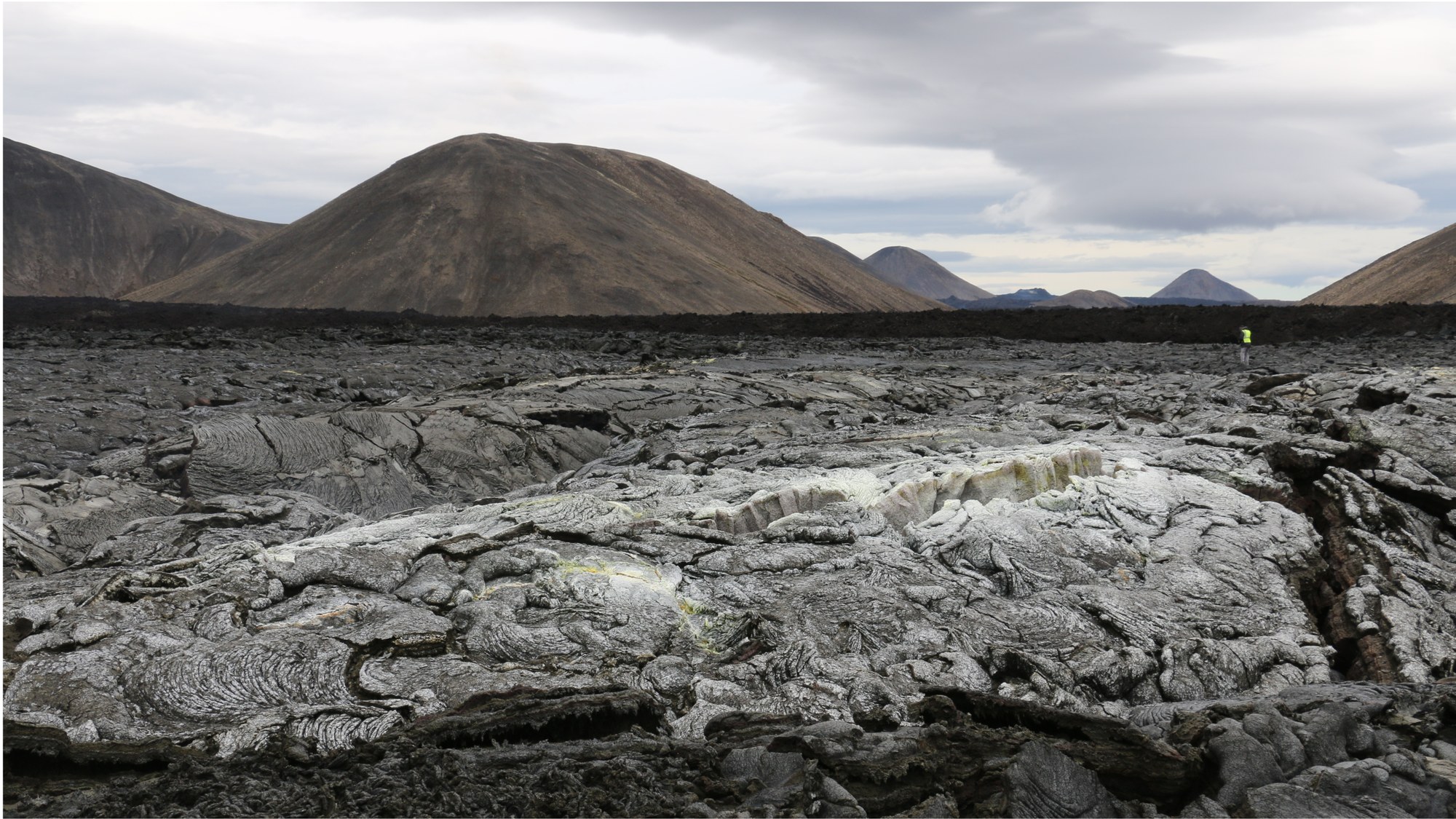
How often have you heard the phrase 'Iceland – the island of fire and ice'? The cliché is of course true, at least in part. The island in the North Atlantic is home to the largest glaciers in Europe and is one of the most volcanically active regions in the world. In summer 2023, again in December and also after the turn of the year, there were spectacular volcanic eruptions near the capital, Reykjavik. The first of those was a real stroke of luck for a field campaign that studied some of the most recent solidified lava flows in Iceland, and in which DLR was involved in various ways. The eruption of the small volcano with the hard-to-pronounce name, Litli Hrútur, not only provided excellent visual material but also made it possible to carry out radar measurements from the air as well as acquiring multispectral images of the lava on the ground, which in places was still at a temperature of over 400 degrees Celsius. The DLR team even conducted some measurements at night to avoid the possible influence of sunlight.
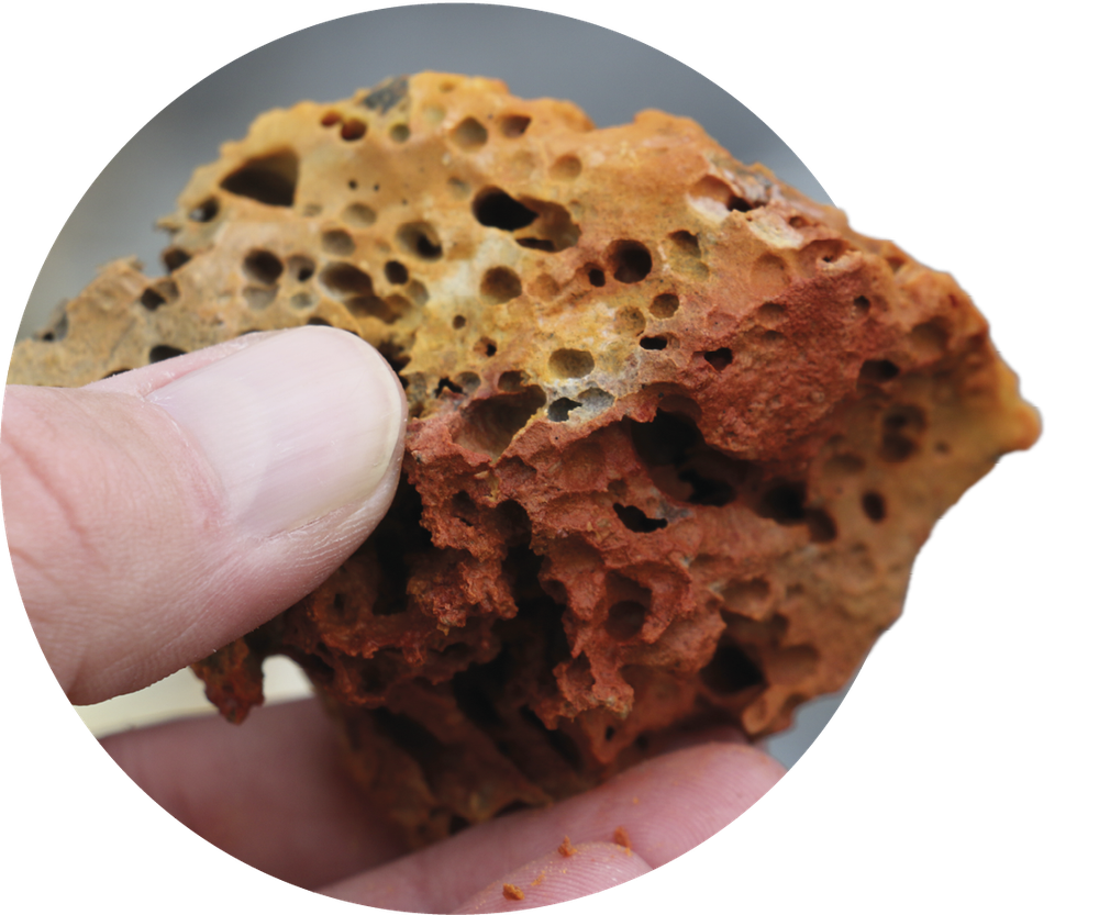
Volcanic rock
Sulphur-containing vapours colour the black-grey volcanic rock orange. Approximately 60 kilograms of volcanic samples were brought to the DLR Planetary Spectroscopy Laboratory in Berlin for analysis.
The purpose of the expedition, led by the Jet Propulsion Laboratory in Pasadena, California, was to optimise experiments for NASA's VERITAS mission to Venus. Both VERITAS and ESA's EnVision mission are scheduled for launch to Earth's neighbouring planet after 2030. There, they will acquire data from orbit, in order to help answer the numerous questions that have puzzled Venus researchers for the past three decades. Why did Earth's inner neighbour, which was probably physically similar when the two bodies formed, evolve so differently? Do these disparities stem solely from Venus orbiting the Sun 50 million kilometres closer than Earth, thereby receiving double the solar energy per square metre? The main reason for the extreme greenhouse effect on Venus is its atmosphere, which consists almost entirely of carbon dioxide, which maintains surface temperatures consistently above 460 degrees Celsius and renders the existence of water or life impossible today.
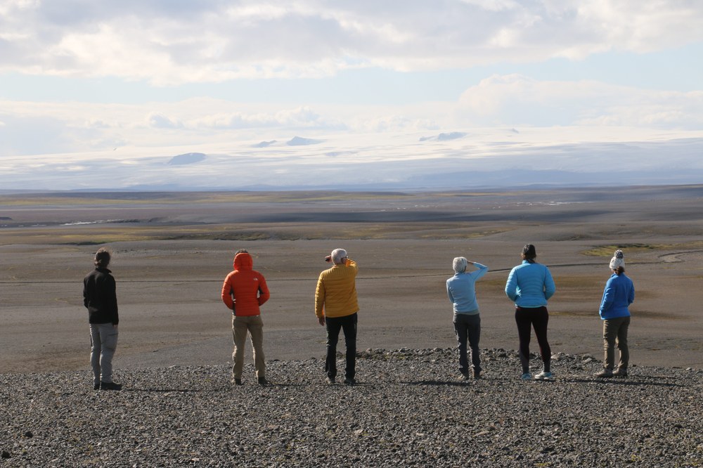
The Sprengisandur highland plateau
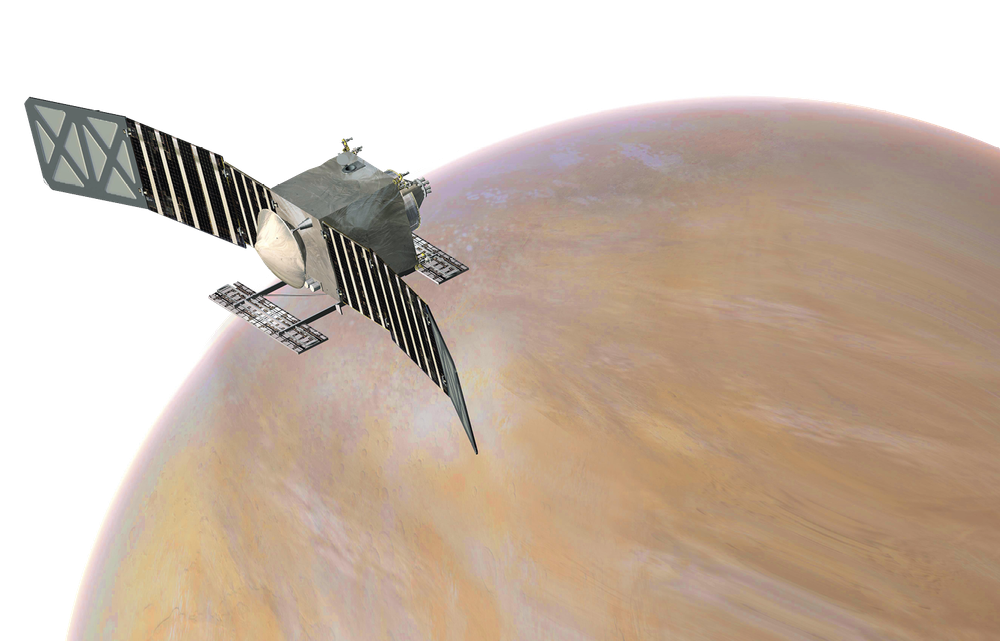
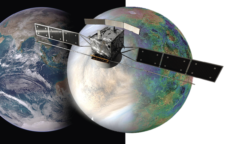
The NASA VERITAS mission is being prepared in Iceland.
The VERITAS mission will study Venus for three and a half years.
Credit:
NASA/JPL-Caltech
DLR is involved, scientifically and experimentally, in ESA's EnVision and NASA's VERITAS missions. For both missions, the DLR Institute of Planetary Research (scientific lead) and the DLR Institute of Optical Sensor Systems (lead instrument developer) are jointly developing a spectrometer for near-infrared wavelengths, including the VEMulator used during the expedition. These will map the mineralogical composition of rocks on the surface of Venus for the first time, using their thermal radiation. The multispectral Venus Emissivity Mapper (VEM) is being developed for this purpose. Ideally, the VEM data will be combined with mapping data from a high-resolution radar instrument so that precise topographical information can be acquired in addition to the mineralogical data. The DLR Microwaves and Radar Institute took part in the Iceland campaign with its F-SAR radar system on board a Dornier 228 from the DLR Flight Experiments facility. The Institute is also contributing algorithms to the VERITAS radar experiment.
Hidden from view
Within this dense atmosphere of carbon dioxide, thick clouds of sulphuric acid prevent telescopes and cameras from observing its surface in visible light. However, radar signals from orbiting spacecraft can get through Venus' atmosphere and reflect off its surface, revealing the roughness and even the topography of the landscape.
Venus has not experienced plate tectonics, at least in its recent past. On Earth, plate tectonics are caused by the overturning of huge, only partially molten rock formations in the planet's mantle, leading to volcanism. This allows the heat generated in the interior by the radioactive decay of elements to be dissipated in a 'controlled' manner. Under the crust of Venus, however, the heat builds up like a pressure cooker without a valve until the 'cauldron' explodes and erupts in the form of a global volcanic catastrophe.
Little is known about the types of volcanism involved when this happens or the composition of the lavas and minerals from which the solidified rock forms. Images and measurements from the Soviet-era Venera spacecraft suggest that the volcanic rock is basalt, which is found on all Earth-like planets. Of particular interest, however, are the minerals in the rocks, which could answer the question of whether water was actually present on Venus in earlier times and influenced its development.
Venus is back in fashion
The NASA VERITAS mission
The mission to Venus is due to start in the next decade.
Credit:
NASA/JAXA/ISAS/DARTS/VR2planets/Damia Bouic
Three new missions will be sent to Venus at the beginning of the next decade. ESA, in partnership with NASA, has selected EnVision. This mission will analyse Venus from its core to its upper atmosphere, as well as the interactions between the various 'levels'. The aim is to gain a better understanding of the planet's formation, evolution, activity and weather patterns. EnVision will also investigate whether Venus once supported water for long periods, and perhaps even had the conditions necessary for life.
NASA is planning two Venus missions – the Venus Emissivity, Radio Science, InSAR, Topography And Spectroscopy (VERITAS) orbiter, which will complement EnVision in its experimental instrumentation, and the Deep Atmosphere Venus Investigation of Noble gases, Chemistry and Imaging (DAVINCI) mission, which consists of an orbiter and a lander. It is scheduled for launch in 2029, with a landing in 2031.
Water on Venus?
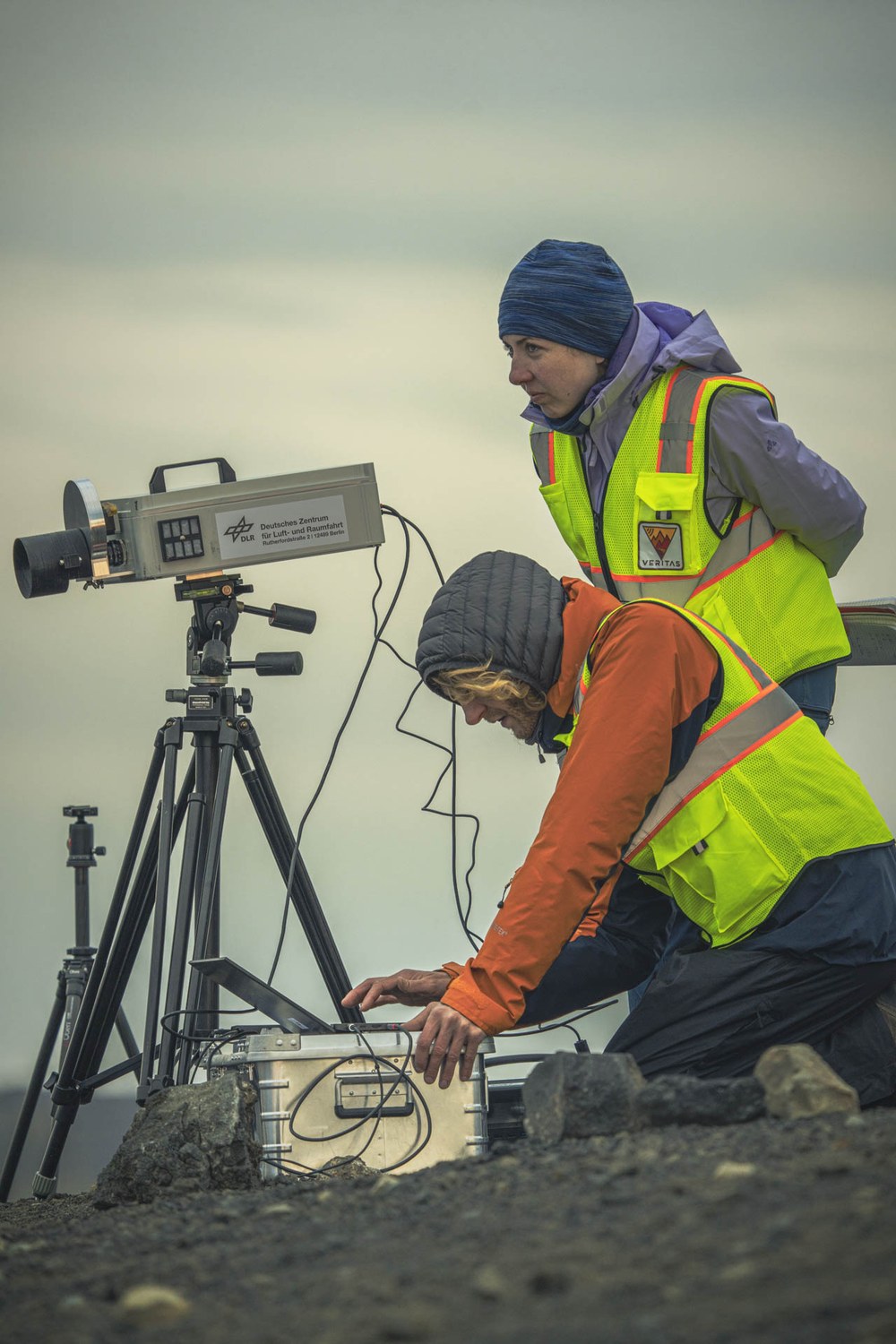
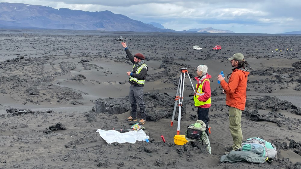
Measurements with the VEMulator
Solmaz Adeli and Stephen Garland set up the Venus Emissivity Mapper Emulator infrared camera for multispectral imaging.
Venus researchers are now pretty convinced that water was present on the surface of the planet for long periods in its early history. This poses the question – could Venus once have harboured life? It is not yet possible to say if this can be answered with the new missions; the first step is to gain a better understanding of the planet. New, improved technologies will be used in the planned Venus missions from ESA and NASA – but it needs to be tested first. This is where Iceland comes in as a 'little Venus', because the latest lava flows have not yet weathered and, most importantly, there is no vegetation yet.
The Icelandic field campaign saw nearly 20 VERITAS scientists from the USA, Italy and Germany target two main volcanic areas. The first is the almost 100-square-kilometre solidified lava flow from the 2014 Holuhraun eruption in central Iceland, near the famous Askja caldera, and the second is the still active eruption of Litli Hrútur on the Reykjanes Peninsula on the south coast. It also included some lava flows from nearby volcanoes that erupted in 2021 and 2022.
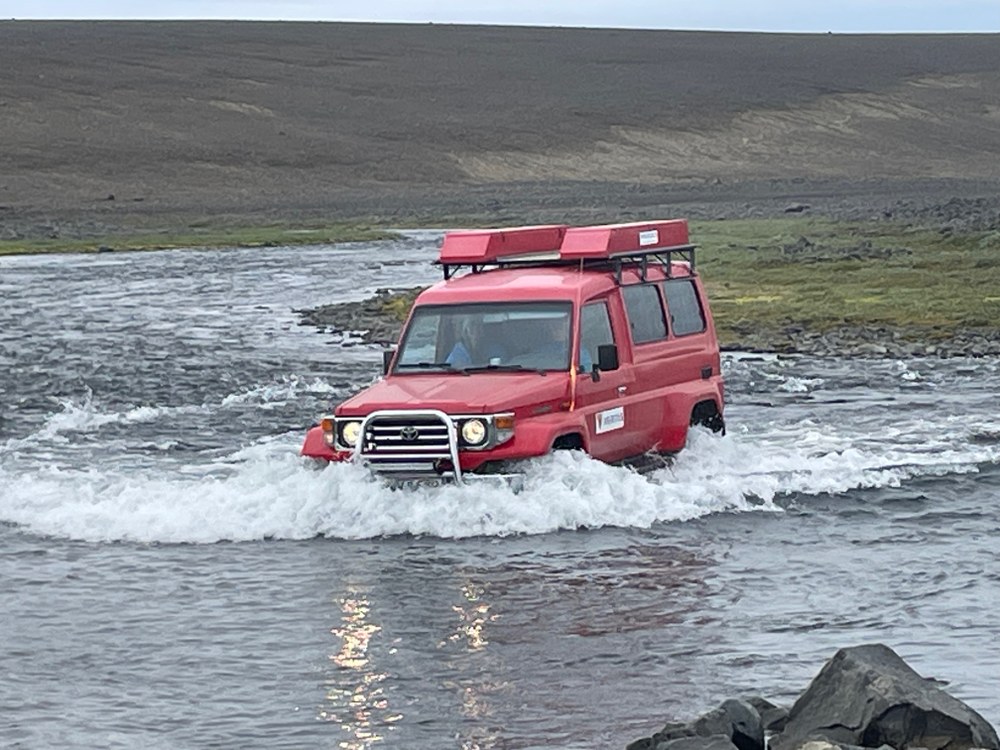
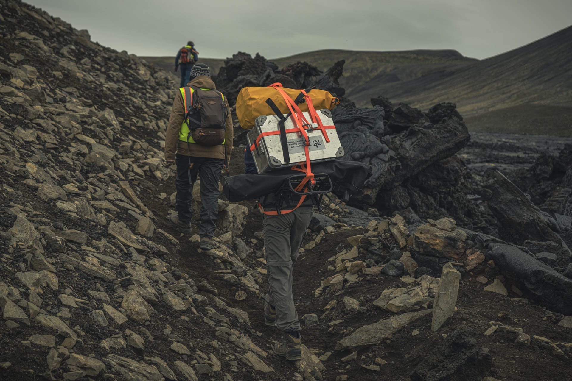
Bumpy journey
Only large off-road vehicles are allowed to drive into the interior. Fortunately, the rivers only carried a small amount water in August 2023.
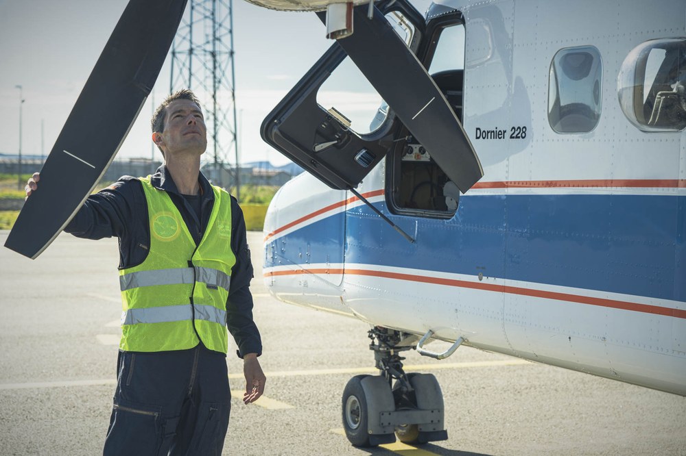
DLR was represented on the ground by a five-member team and by its Dornier 228-212 research aircraft with crew from Oberpfaffenhofen. A unique F-SAR radar system was installed on the aircraft and used to obtain high-resolution data from an altitude of approximately 6000 metres above the lava flows. These are similar to those that will be obtained during the VERITAS and EnVision missions as the spacecraft orbit Venus. This technology allows high-resolution radar 'images' to be acquired in all weather conditions and even at night, which will be invaluable for mapping the surface of Venus.
While the Dornier 228-212 aircraft carried out precise radar measurements of the Holuhraun and Litli-Hrútur lava flows along defined routes, the crew on the ground simultaneously conducted laser measurements of the flows and the sandy areas next to them. The data sets will later be compared and harmonised.
Not an easy path
Heavily laden, the route takes the four science teams over hill and (volcanic) dale.
While radar focuses on the topography, structure and roughness of the lava flows, spectroscopy deals with the composition of the volcanic rock. This is done by measuring the emissions from hot or cooled lava. DLR used a Venus Emissivity Mapper Emulator(VEMulator) in Iceland for this purpose, which measures in six filtered wavelengths, modelled on the 'spectral windows' of the venusian atmosphere. The 'ground segment' of the field campaign sometimes had to cope with harsh working conditions, as some of the lava flows consist of rock with razorsharp edges. Aerial support came in the form of drones, which acquired millimetre-accurate images from an altitude of just a few metres. The DLR volcano team collected 60 kilograms of samples at the VEMulator measurement points, which are now being analysed at the Planetary Spectroscopy Laboratory in Berlin. The results will be used to finalise the design and calibration of the experiments that DLR has developed for NASA's VERITAS and ESA's EnVision missions, intended to map the global distribution of minerals on Earth's somewhat overheated neighbour.
A scientist at the DLR Institute of Planetary Research, Solmaz Adeli leads the team that spectroscopically analysed Iceland's volcanic surfaces during the campaign.
How did you feel during the campaign?
On the one hand, it was exhausting. On the other, I wanted to make as many measurements as possible. It was wonderful to spend time in this extraordinary landscape, but I was also looking forward to analysing the data on my computer.
What was the biggest challenge?
The weather! It was very unpredictable. When it rains, the instruments don't work and when it’s very cold and windy, it's difficult for us humans to work. But overall, we coped well.
What comes next?
We are now taking care of the data analysis. This involves looking at the spectral measurements and analysing the samples taken from Iceland in our Planetary Spectroscopy Laboratory. The final step is to link this data to Venus.
Three questions for Daniel Gesswein
Daniel Gesswein
During the Iceland campaign,he operated the F-SAR radar system.
A researcher working at the DLR Microwaves and Radar Institute, Daniel Geßwein was responsible for operating the F-SAR radar system on board the Do 228-212.
What is such a mission like?
The flight team, of which I was a member, flew over the island every day for two weeks. We usually met at Keflavik Airport between 07:00 and 08:00, where we completed final flight preparations. A mission over the Holuhraun area lasted approximately eight hours in total. We would arrive back at about 17:00, followed by a debriefing. These were very busy and intense days.
What exactly did you do during the flight?
I controlled the F-SAR radar system. This meant that I sat at the front of the aircraft cabin and operated the control computer, where I can adjust all the settings for the radar measurements. The data collected can then be processed by my colleagues on the ground.
And how does it feel to sit in the plane?
It's a reward for all the work, of course, both in terms of hardware development and certification. It takes a lot of time and energy. I am particularly pleased when I look at the images of the analysed data and see that we have been able to take the research one step further.

