Maritime research
DLR's maritime research focuses on the oceans, lakes and rivers and draws on expertise from all areas: findings from aeronautics, space, energy, transport and security come together.
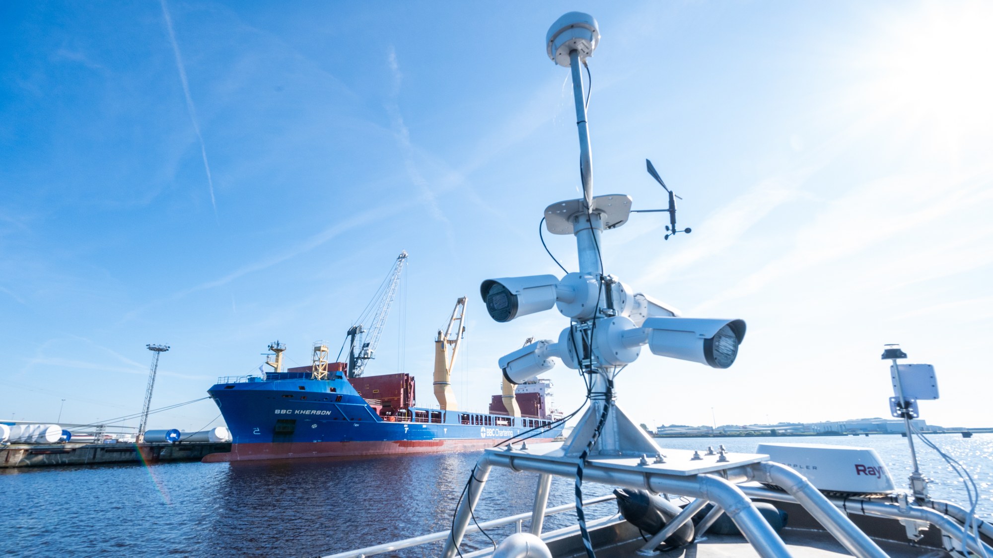
Reduced waiting times, more reliable arrival times and safer routes: assistance systems will enhance the safety, efficiency and comfort of shipping in the future. They will play a crucial role in diverting freight from congested roads to waterways. The idea of autonomous driving in the water will require the development, testing and certification of new technologies. It will also entail a transformative shift in the relationship between humans and machines. Social acceptance, altered working conditions and the clarification of legal issues all play a pivotal role in this paradigm shift. DLR is actively conducting research in all of these critical areas.
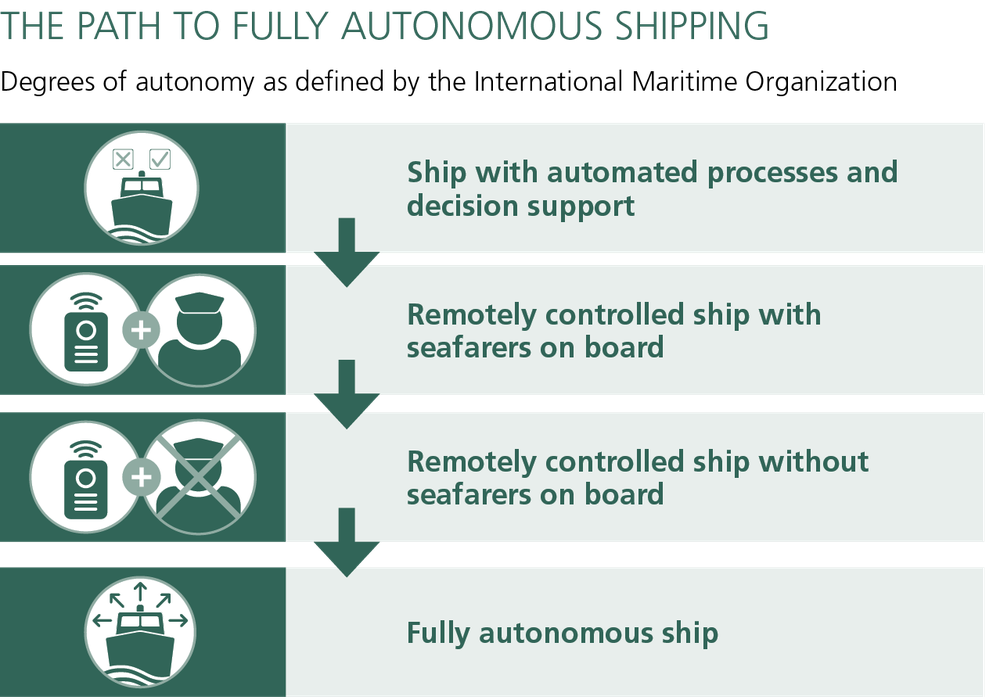
Experts categorise ships as automated, remote-controlled and fully autonomous. In the fully autonomous category, a ship's control system is able to make decisions and take actions independently. Determining the appropriate degree of automation for a specific ship hinges on its intended mission. Short-haul ferries are already undergoing testing with full autonomy. However, if autonomous or semi-autonomous ships are to be deployed in a qualified and legally secure manner, the technical equipment must meet very stringent reliability requirements. The navigation instruments must be able to function reliably under extreme weather conditions such as ice, fog, storms, spray and swell so that they can take over the tasks of the ship's command on board. Furthermore, all control instruments must be shielded from external hacking. Therefore, it is necessary to set international safety standards in satellite communication and to establish a legal framework. DLR is operating several test fields and research boats to investigate these topics for both inland and maritime shipping.
Road freight transport has nearly doubled in the past 30 years, leading to increased congestion and emissions along transport routes. Currently, only around seven percent of goods in Germany are transported via inland waterways. "Shifting some of the transport to rivers and canals is a crucial contribution, not only to alleviating road congestion but also to making transport more environmentally friendly by using new technologies," says Thoralf Noack, Coordinator for Maritime Research at DLR.
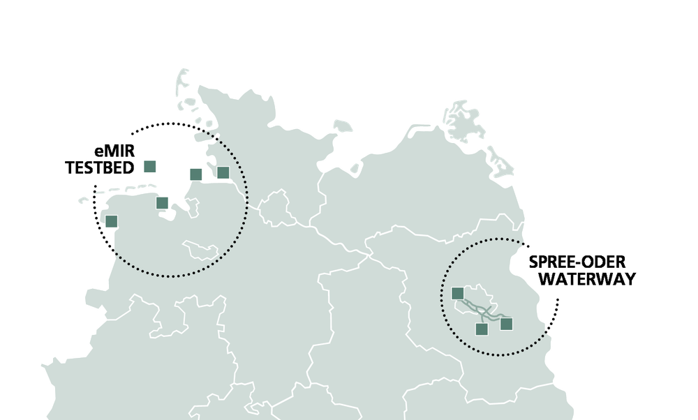
However, climate change is also presenting new challenges for inland navigation. In 2022, for instance, water levels on the Upper and Middle Rhine were so low at times that in some areas, transport on the river came to a standstill. While deepening waterways remains a key option, it will require new technical expertise. "One possibility involves innovations in the field of new transport systems, such as smaller, autonomous, shallow-draft vessels, which are currently being developed for use on the Spree-Oder Waterway by DLR in collaboration with industry, small and medium-sized enterprises, other research institutions and authorities," adds Noack.
A digital test field for automated and autonomous inland navigation is currently under construction on the Spree-Oder Waterway in Germany. In contrast to shipping on the high seas, the reception of satellite data for navigation in built-up areas can be unreliable, particularly around bridges or locks. However, reliable positioning is all the more important in these areas in order to safeguard structures from collisions and prevent traffic disruptions. The solution lies in the intelligent integration of satellite navigation with other sensors installed both on the ship and on land, such as in ports or on locks. These sensors include cameras, lasers or radar sensors that measure environmental data with centimetre precision.
DLR, in collaboration with research institutions, industry partners and authorities, successfully demonstrated the effectiveness of this technology. They autonomously navigated the MS Victor Hugo, an 82-metre-long and 10-metre-wide passenger ship, into the lock near Strasbourg in August 2022.
The positioning system relies on global navigation satellite systems like GPS and Galileo to determine its position. Nonetheless, achieving the necessary precision for a vessel to safely enter a lock with centimetre accuracy requires additional correction data. This data will be made available via VDES (VHF Data Exchange System). VDES, the successor to AIS (Automatic Identification System), is a radio system designed to enhance the safety and management of shipping traffic through the exchange of navigation and other ship data. In contrast to AIS, VDES boasts a higher bandwidth, facilitating more interference-free data transmission between ships, base stations and traffic centres. The development of VDES has greatly benefited from the profound expertise of scientists at the DLR Institute of Communications and Navigation, who are actively involved in its ongoing international standardisation process.
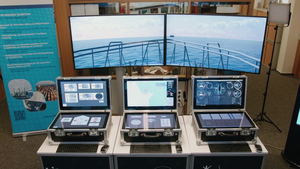
To test the reliability and effectiveness of automated systems at sea, DLR operates the e-Maritime Integrated Reference Platform (eMIR) testbed together with authorities and industry. Here, highly automated assistance systems are researched and developed, for example for collision avoidance. The testbed comprises two modules: a simulator and a real-world test environment at sea. The virtual infrastructure includes AI-based environmental, traffic and ship simulators. With their help, the risks and the efficiency of innovative maritime systems can be assessed while the product is being developed. The physical testbed – an area of sea from Brunsbüttel past Cuxhaven and Wilhelmshaven to Heligoland equipped with instrumentation for this purpose – allows maritime systems to then be assessed under real-world conditions.
A complete ship's bridge, installed in a seagoing container, can be set up at the harbour or loaded on board a ship. Axel Hahn, Director of the DLR Institute of Systems Engineering for Future Mobility, underlines the benefits of the testbed: "eMIR is a fascinating large-scale facility. We can use it to collect data on maritime traffic and provide a research platform to advance the development of highly automated systems."
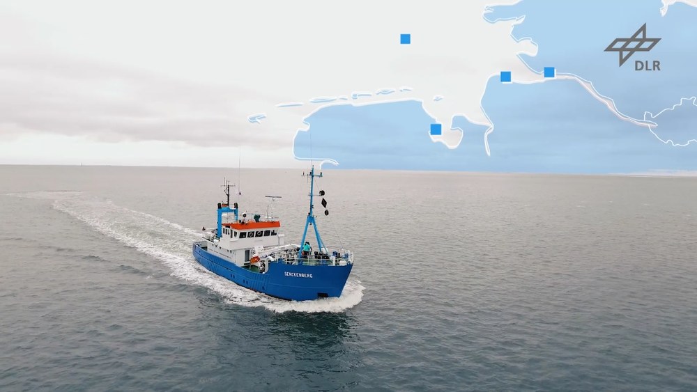
Video: Maritimes Testfeld eMIR (e-Maritime Integrated Reference Platform)
Your consent to the storage of data ('cookies') is required for the playback of this video on Youtube.com. You can view and change your current data storage settings at any time under privacy.
DLR, OFFIS – Institut für Informatik
Andreas Burmann
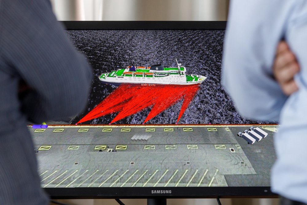
Berthing manoeuvres often cause damage to port infrastructure and ships. To reduce these damages in the future, DLR has developed the 'XXL parking assistance' system SmartKai for large seagoing vessels. The system will be available during the beginning of 2024 via the DLR spin-off Navanion GmbH. The system works with laser, radar and environmental sensors integrated into the quay wall. These determine the speed of a ship and its distance to the quay wall with centimetre precision. This data is transmitted to the ship bridge with a delay of less than a second through a SmartKai box installed in the harbour. On the bridge, the information is displayed on a nautical chart, accessible on any mobile device. Pilots and bridge personnel can use this real-time information to respond promptly and navigate accordingly. Additionally, the system captures nautical environmental data, for example currents, wind and tidal conditions. SmartKai proves especially valuable in handling manoeuvres that pose challenges due to nearby port infrastructure such as power berths, locks and passages.
Further information: navanion.de
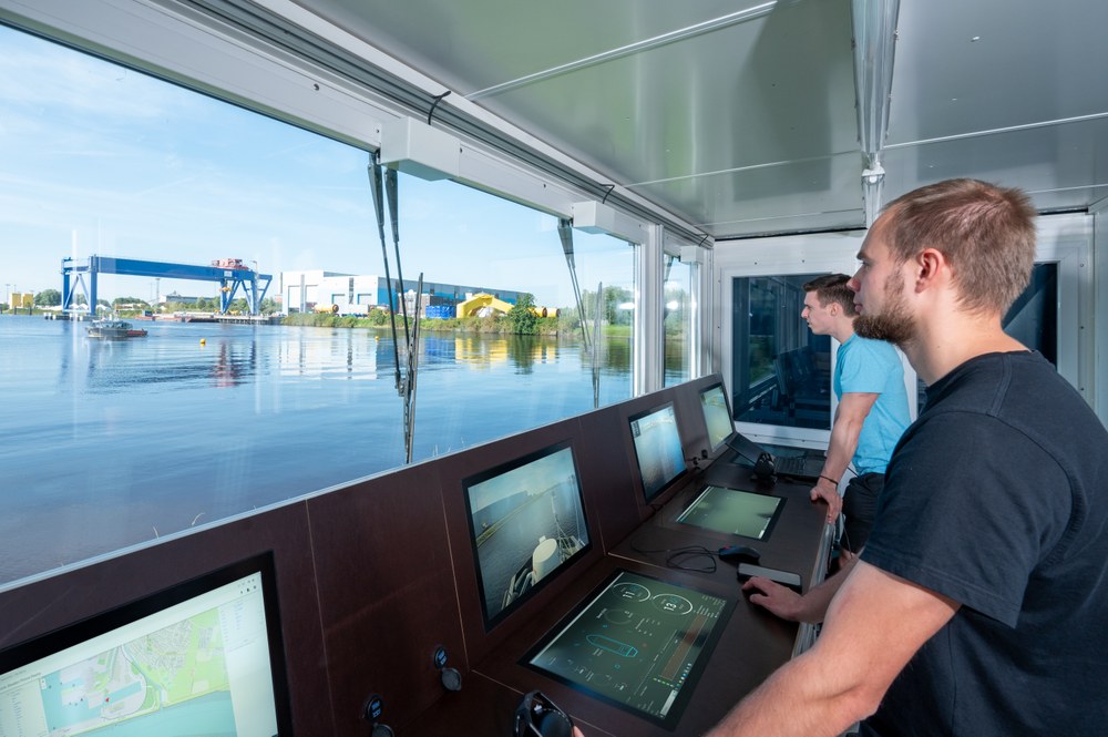
The ports of Emden, Cuxhaven and Wilhelmshaven are a fundamental part of eMIR. New technologies for port traffic can be researched here. Ship manoeuvres such as berthing and casting off are digitalised and automated with the help of the collected data. Additionally, logistical processes for port operations such as cargo handling are being investigated. In Emden, researchers are currently testing an operational concept for an autonomous dredger tasked with removing silt from the harbour. The research vessel Sally is equipped with sensors and cameras to monitor the surroundings, allowing detection of moving ships or measuring the distance to the quay wall. Sally is also equipped with various assistance systems including collision avoidance sensors, autopilots and object recognition systems. The portable eMIR container will facilitate remote control of Sally, pushing the boundaries of this system and assessing its future approval for use in dredging vessels.
For autonomous vehicles to navigate effectively, they must be able to recognise their surroundings and nearby objects with the utmost precision. Systems and processes employing artificial intelligence (AI) prove well-suited for this purpose. Their programs demand a high level of trustworthiness to ensure they are not prone to errors. Like humans, AI must undergo training to recognise and navigate around obstacles such as ships, buoys, floating containers, people or marine animals. In optical camera-based systems, AI is trained using images of ships from various perspectives. However, there are challenges posed by changing environmental conditions, such as water droplets on the camera lens, which can hinder the accurate identification of objects. Certifying these AI systems presents its own set of challenges, too. To address this, DLR operates a ship bridge simulator at the Federal Maritime and Hydrographic Agency (BSH). Collaboratively, DLR and the BSH have developed a comprehensive test catalogue for this simulator, encompassing thousands of scenarios that the AI must swiftly recognise.
The Large Modifiable Underwater Mothership (MUM) will have the capability to cover distances of up to 1500 nautical miles (2700 kilometres) without a crew, using its fuel cell propulsion system. Measuring approximately 50 metres in length, it can be equipped with a diverse range of systems resembling a construction kit, such as batteries, sensors, transport containers and smaller underwater robots, earning it the moniker 'Mothership'. A laser-based camera system developed by DLR uses artificial intelligence for object recognition, ensuring MUM's safe and autonomous navigation around obstacles.
MUM's primary applications are pipeline maintenance and the detection and removal of munitions discarded during the Second World War. "The advantage lies in its ability to autonomously conduct repairs to critical infrastructure such as gas pipelines, throughout the year, even underwater in adverse weather conditions like storms and waves," explains Carl Wrede, Deputy Director of the DLR Institute for the Protection of Maritime Infrastructures. The strategy involves the large mothership positioning itself as close as possible to a site, where it will deploy a smaller submarine to carry out autonomous work using a gripper arm.

thyssenkrupp Marine Systems GmbH
Upon completion of the research phase, MUM is supposed to be developed into a marketable product. DLR has undertaken a survey to gauge social acceptance and explore potential application scenarios. The research team conducted interviews with key stakeholders, including captains, shipbuilders, shipyards, scientific institutions and ship pilots.
Simultaneously, efforts are underway to establish a comprehensive legal framework. The legal landscape on the high seas transcends national boundaries. Different regulations govern navigation depending on the type of vessel – whether it is a motor vessel, sailing boat or fishing boat – even within German territorial waters. Social acceptance, legal considerations and the reliability of AI constitute crucial parameters that influence the technical design of the ship. MUM's initial testing will take place in a maritime testbed in the Baltic Sea, at an average depth of 70 metres.
However, before achieving autonomous navigation across the world's oceans, the International Maritime Organization (IMO) and individual states must collaboratively devise a clear legal framework for the global operation of autonomous ships. Wrede recognises the potential in this context, stating, "DLR is unique in that it is able to drive technological development with legal development, and our engineers and lawyers work closely together. Legal considerations and the requirements for the technology are considered from the very beginning of the technology development process. This is our approach to safely implementing autonomous shipping."
An article by Jana Hoidis from the DLRmagazine 174
