
EmissionslandKarte
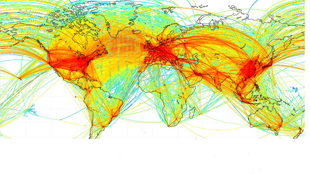

In project EmissionsLandKarte (ELK) high-resolved 3D aviation emission inventories of worldwide passenger and cargo air traffic are modeled for year 2019.
Duration: 1.January.2022 - 31.December.2024
Within the 3-years impulse project EmissionsLandKarte (ELK) DLR is funding the establishment and improvement of expertise in the modelling of gaseous and particle emissions and noise pollution for traffic and energy production on global, national and local scope. In ELK project 25 DLR institutes and the Hereon in Geesthacht collaborate interdisciplinarily in order to create high-quality datasets for the assessment of both environmental and climate impact of traffic and air quality with the goal to be prepared for the modelling of novel technology scenarios.
Traffic volumes for worldwide land transport, aviation and shipping are quantified spatially and temporally for year 2019 and high-resolution emission inventory datasets are modelled for the three traffic sectors and beyond that for the energy demand for traffic. Traffic volumes and emission distributions will be regarded on subsector level and will be disaggregated for both passenger and cargo transport, and deep-sea and inland navigation respectively. Beyond that, a methodology to model emissions in industrial and agricultural sector will be developed. On national scope, noise pollution induced by road and railway traffic, at airports and due to wind turbines are modelled and visualised. Besides, for the Hamburg metropolitan area, emissions and noise pollution are modelled in detail on micro scale. Via the geographic information system ELKIS exemplary datasets from emissions and noise modelling will be visualised and finally all available datasets will be provided to the scientific community for research purposes.