Tracking interactions in Earth's atmosphere


- The European-Japanese environmental satellite EarthCARE was launched on 29 May 2024 at 00:20 CEST (15:20 local time).
- The German Space Agency at DLR has a significant role in the mission, which will focus on research into aerosol-cloud interactions and their impact on climate dynamics.
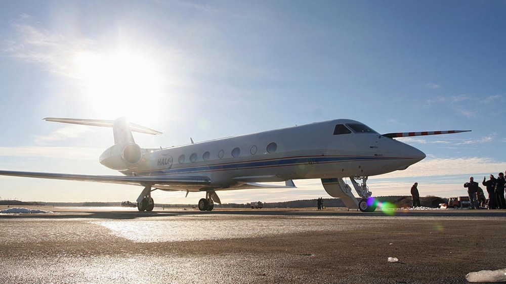
- The German HALO research aircraft will conduct one of the most extensive validation campaigns, equipped with an EarthCARE-like payload from German research institutes and universities.
- Focus: Spaceflight, atmosphere, climate change
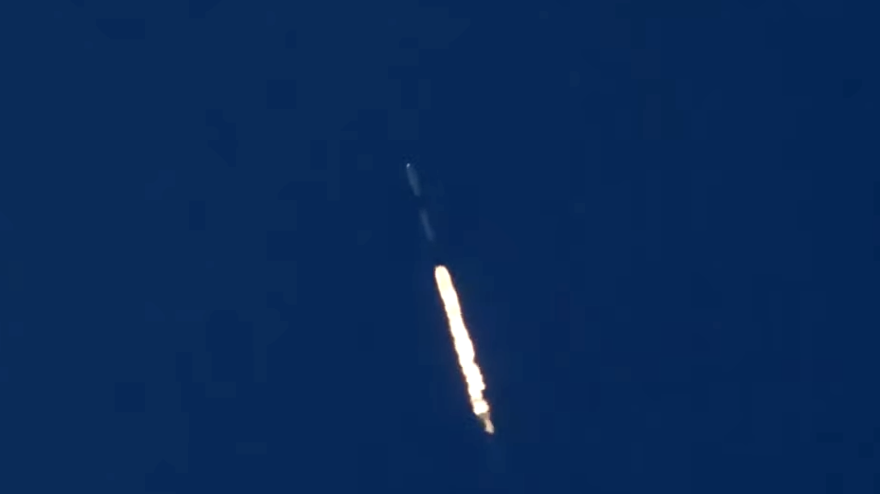
On 29 May 2024 at 00:20 CEST (15:20 local time), the Earth observation satellite EarthCARE lifted off from Vandenberg, California, on board a SpaceX Falcon 9 rocket. The European-Japanese satellite, also known as the 'white dragon' due to its appearance, successfully made its first contact at 1:14 a.m. CEST, confirming its readiness for its mission in space.
Over the next six months, during the commissioning phase, the High Altitude and Long Range (HALO) research aircraft of the German Aerospace Centre (Deutsches Zentrum für Luft- und Raumfahrt; DLR) will carry out a joint campaign under the leadership of the DLR Institute of Atmospheric Physics and the Max Planck Institute for Meteorology to validate the satellite data in detail. German researchers will also be analysing the data products and their quality in depth as part of the 'GIVE' project funded by the German Space Agency at DLR.
The German Space Agency at DLR has a substantial role in the Earth Cloud Aerosol and Radiation Explorer (EarthCARE) mission – as part of ESA's FutureEO Earth observation programme, with Germany serving as the programme lead since its inception and contributing several hundred million euros to date. In addition, the German National Space Programme is allocating several million euros to facilitate the use of EarthCARE data by German researchers during the operational phase. A project office will be established to support work by German research institutions and universities, marking one of the most significant contributions to the validation process in Europe.
Tracking interactions in Earth's atmosphere
Whether facing drought and heat in southern Europe or coping with heavy precipitation events in Germany, solar radiation is the decisive factor influencing climate events and weather dynamics on Earth, as it drives atmospheric circulation. However, this radiation is distributed very differently in the atmosphere, interacting with clouds, aerosols – comprising solid and liquid particles – and trace gases. To enhance the accuracy of predictions in the near future, a comprehensive global understanding of aerosol and cloud parameters, which are currently not easy to determine, is important. Deciphering their interactions within the atmosphere is crucial. This and the measurement of radiation density will allow the radiation budget of the planet to be determined much more precisely than is the case today. The European Space Agency (ESA) and the Japanese Aerospace Exploration Agency (JAXA) therefore launched their largest and most complex Earth Explorer Earth observation mission to date on 28 May 2024 (local time).
"The European-Japanese Earth observation mission EarthCARE will significantly advance our understanding of climate and weather phenomena. The fact that the largest and most complex Earth Explorer satellite in ESA's Earth observation programme was built in Germany and that German companies and scientific institutions can also contribute other important components to this mission shows the leading position that Germany holds in international Earth observation," emphasised Walther Pelzer, DLR Executive Board Member and Director General of the German Space Agency at DLR, during the live launch event, held at ESA's European Space Operations Centre in Darmstadt.
The EarthCARE satellite, which is 2.5 metres high, 17.2 metres across (including its solar arrays) and weighs approximately 2200 kilograms, was launched into its target orbit at an altitude of 393 kilometres on board a Falcon 9 rocket from the US space company SpaceX.
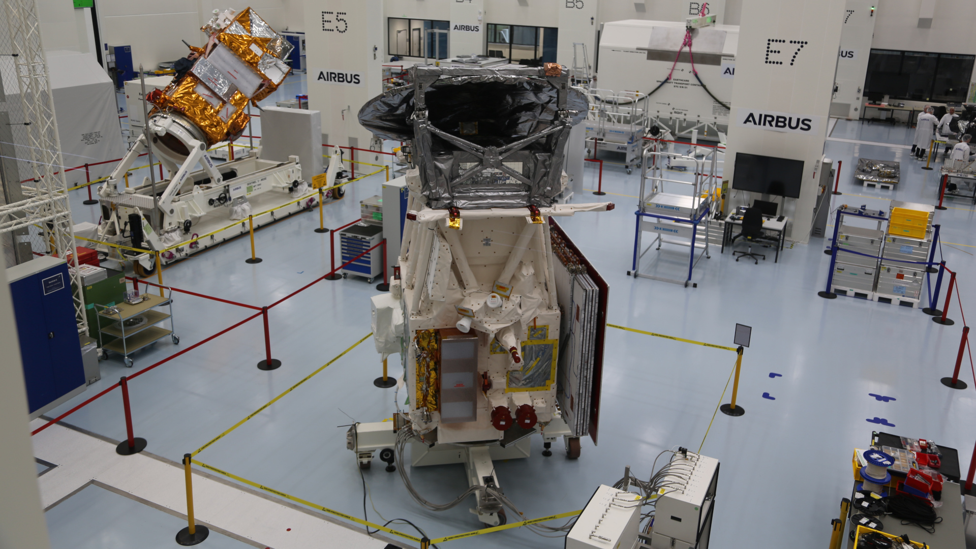
Four instruments provide a unique overview of the processes in Earth's atmosphere
EarthCARE houses four complementary instruments. By emitting light pulses from a laser and analysing the reflected signals, the atmospheric lidar ATLID, in which the German company Tesat from Backnang is also involved, derives a vertical profile of aerosols and clouds in Earth's atmosphere, including their properties such as height, density and aerosol type. The unprecedented accuracy of this information will significantly improve predictions from climate models and deepen researcher's understanding of the role of aerosols and clouds in Earth's energy balance. With the Cloud Profiling Radar (CPR) provided by JAXA, EarthCARE can observe the 'inner world' of clouds and provide detailed insights into their vertical structure and velocity, particle size distribution and water content, for example to track the formation and dispersion of clouds. While the atmospheric lidar and cloud radar create profiles of the atmosphere in a rather narrow 'curtain' directly below the satellite, EarthCARE's Multi-Spectral Imager (MSI) makes measurements over a much larger field of view. The instrument records high-resolution images in several spectral bands of the visible and infrared light spectrum. This will allow scientists to distinguish between different types of clouds, aerosols and Earth's surface as well as obtain additional information on the optical properties of clouds and aerosols in order to learn more about their composition and distribution. By combining the lidar, radar and multispectral data, three-dimensional information on clouds and aerosols will become available. The fourth instrument on board is the Broad-Band Radiometer (BBR), which measures the reflected radiation in the atmosphere in three directions. "This makes it possible to determine the amount of reflected solar radiation and thermal radiation emitted by Earth. These measurements will be combined with the radiation calculated from the combined observations of the other instruments and thus significantly improve our current understanding of the interaction between aerosols, clouds and the energy balance of our planet," explains Albrecht von Bargen, who is responsible for the EarthCARE mission at the German Space Agency at DLR.
Validation campaign will be conducted using the German HALO research aircraft
Together, these four high-performance instruments will offer unprecedented insights into the 'inner workings' of Earth's atmosphere. "But EarthCARE can only be effective if the instruments are calibrated correctly. To achieve this, the measurement results obtained in space must be repeatedly compared with other measurement data from the air and from the ground. We are doing this in a three-part validation campaign, for which we have equipped the HALO research aircraft with four instruments that are comparable to those of EarthCARE," explains Silke Groß, who is leading these campaigns at the DLR Institute of Atmospheric Physics. The measurement flights, coordinated by the Institute of Atmospheric Physics and the Max Planck Institute for Meteorology together with the Leipzig Institute for Meteorology and the Universities of Hamburg, Cologne and Munich, will begin from Cape Verde in August 2024. There, the validation will be supported by ground measurements conducted by the Leibniz Institute for Tropospheric Research (TROPOS). In September, HALO will continue on to Barbados, where the Max Planck Institute for Meteorology will accompany the measurement flights with ground measurements. HALO will then return to DLR in Oberpfaffenhofen, where extensive flights over Europe, the extratropical North Atlantic and over the Alps to the Mediterranean will be conducted during the autumn.
The scientists are pursuing different goals with the three flight destinations. "Over Cape Verde, we have a complex situation of different aerosols and clouds, from low to high cloud cover and can study the interaction of these suspended particles particularly well. With the flights around Barbados, we expect a different cloud and aerosol structure. And with the flights from Oberpfaffenhofen, we are investigating aerosols and clouds on flights from the extratropics, over the Alps to the Mediterranean region, which once again differ significantly from those of the other flight destinations. This will allow us to cover as wide a spectrum as possible," explains Groß. On many of these flights, HALO will fly directly under the EarthCARE satellite so that the measurements from the satellite, the research aircraft and the ground stations are exactly comparable. Ludwig-Maximilians-Universität München (LMU), the Universities of Cologne, Leipzig and Hamburg, the DLR Institute of Atmospheric Physics and the Max Planck Institute for Meteorology are involved in the flight campaigns. The validation flights will be coordinated with validation activities carried out by the German Research Foundation (Deutsche Forschungsgemeinschaft; DFG), including TROPOS, Freie Universität Berlin (FU Berlin), Forschungszentrum Jülich and the German Weather Service (Deutsche Wetterdienst; DWD).
Algorithms from Germany to mine 'data gold'
Together, the four instruments provide information for a total of 40 different data products – for example on cloud formation and classification, the composition of the aerosol layer, the radiation budget of the atmosphere, but also on rain and snow properties such as the exact droplet and flake sizes. Approximately half of the geophysical parameters from the data products are derived directly from the measurements of a single one of the four instruments. For the other half, these data products are used in advanced algorithms to derive synergistic geophysical parameters. The development of these computing processes was awarded by ESA to TROPOS and FU Berlin, among others, with significant shares, and is therefore also taking place in Germany. "Algorithm development has been an integral part of Earth observation for many years. It makes it possible to provide calibrated information from raw data and, in turn, to derive geophysical parameters from this with the help of computational rules based on physical relationships. The EarthCARE mission would be inconceivable without algorithms. They help scientists to extract the optimum amount of information from the actual measurements, such as the algorithms provided by TROPOS for calculating the cloud top and aerosol parameters from ATLID measurement data. In future, as with other Earth observation missions, we can expect AI-based approaches – evaluated strictly on the basis of geophysics, of course – to be pursued in order to carry out further in-depth analyses," explains Albrecht von Bargen. In order to further explain and make this wealth of data and its use accessible to all interested scientists and a wider circle in Germany, a project office has been set up at LMU, which the German Space Agency at DLR is supporting with funds from the National Space Programme.